Ecuador Mountain Biking: Avenue of the Volcanos, Part Three - Mama Rumi and Southern Cordillera
Introduction and your Ecuadorian word for the day "Alchapullas" - a native flowering tree
Compared to its other neighbours such as Peru and Bolivia, Ecuador is not as well known for mountain biking. Our outsider’s viewpoint is that this could be due to a variety of reasons, lack of a critical mass of home-grown bikers; or the fact that the Galapagos is Ecuador’s main attraction. There certainly is no lack of trails and certainly no lack of diversity in terrain and culture. Ecuador is a fascinating country in and of itself and the Ecuadorians are fantastic people and very welcoming to tourists. Our visit here showed us the possibilities and no doubt more people will come for the biking; it's just too good to be under the radar for this long. This is especially so when there are people like Mateo of Ride Ecuador who can provide very professional turnkey bike guiding services.
A note on the weather, Ecuador is bisected by the Equator so the days are consistently around 12 hours long. The weather is fairly uniform other than a marked rainy and dry season. There are cooler temperatures in the rainy season (Oct/Nov in the Highlands; April to July in the Orient). Our tour was right between the start of the dry and rainy seasons and we were fortunate. During our visit rain was always forecasted but rarely came. When it fell it did not last long. What we found was that the country is so mountainous that weather forecasts were basically useless except for the wildest of guesses. We usually expected afternoon to evening fog due to the Nieblina (fog creeping up from valley floor towards the highlands) but we could always expect mornings to generally be better weather.
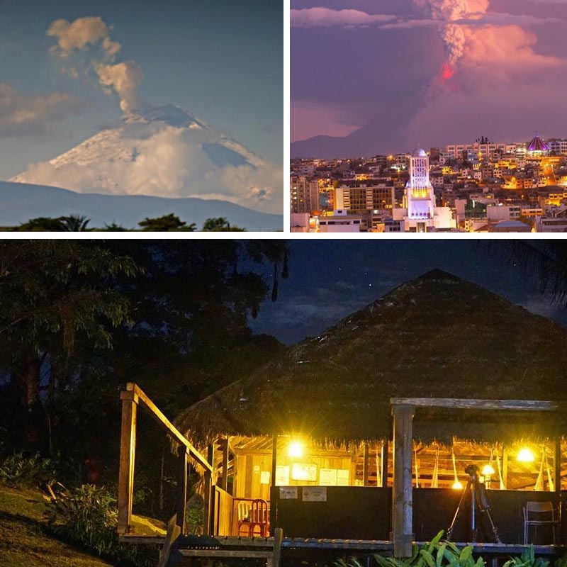
![Ecuador Mountain Biking Avenue of the Volcanos Part Three - Mama Rumi and Southern Cordillera]() Top left: Cotopaxi erupting (the National Park surrounding the volcano has re-opened and there is now limited access. Top right: Tungurahua erupts (picture from RutaViva; Bottom. A jungle lodge in the Cuyabeno reserve
Top left: Cotopaxi erupting (the National Park surrounding the volcano has re-opened and there is now limited access. Top right: Tungurahua erupts (picture from RutaViva; Bottom. A jungle lodge in the Cuyabeno reserve
Mama Rumi
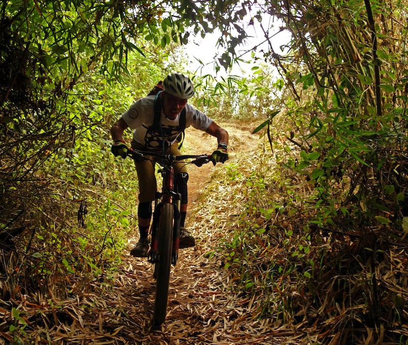
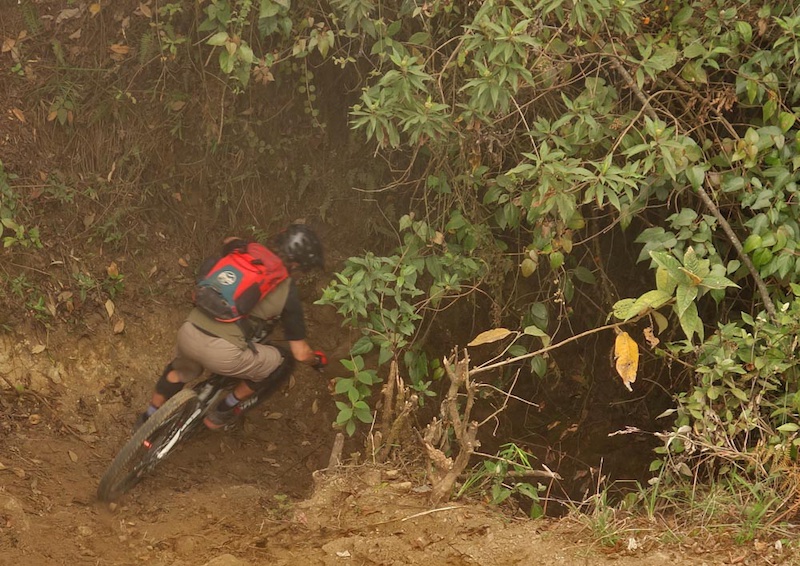
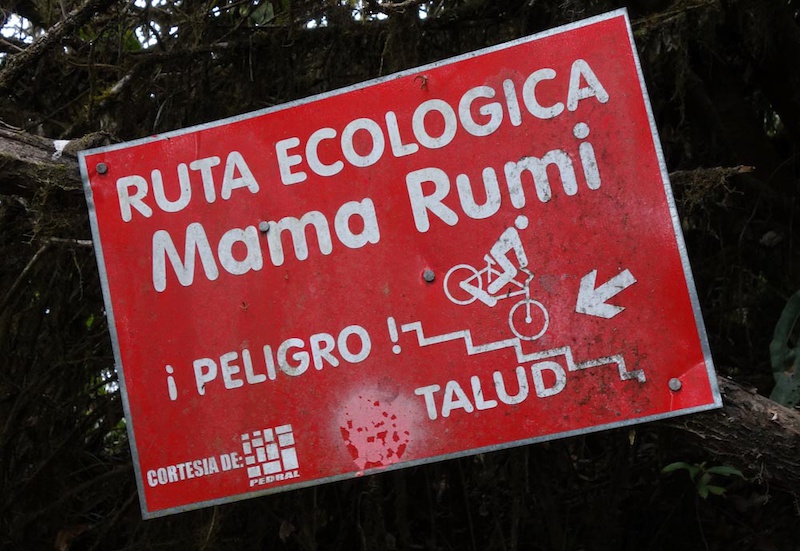
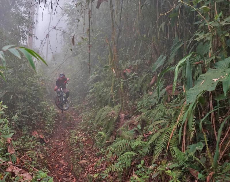
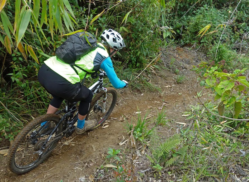
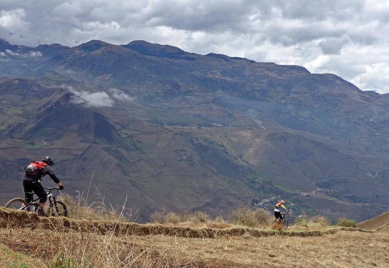
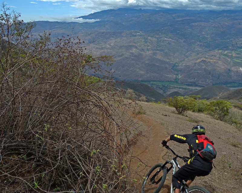
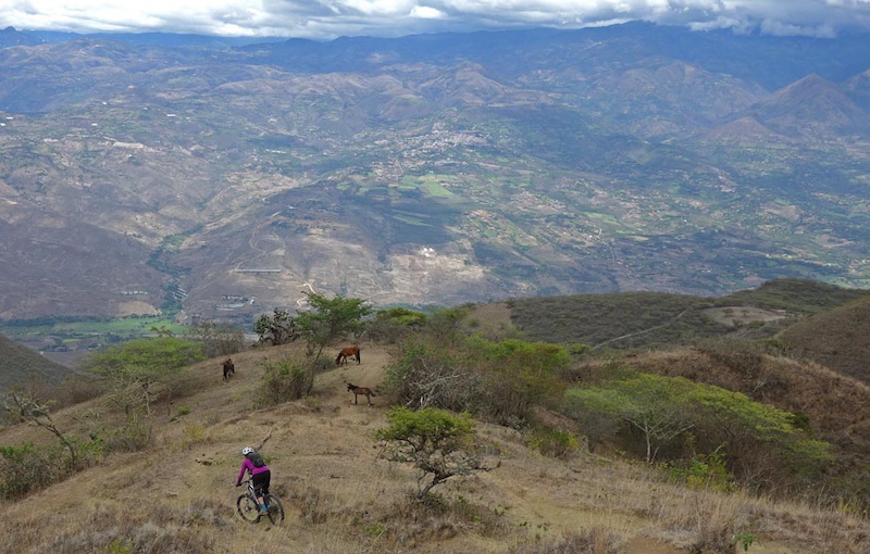
Our next ride is an Ecuadorian classic and perhaps one of the most famous trails in the country. Mama Rumi (Mother Rock in Quecha) is a centuries-old Inca trail descending from 3023m above San Miguel de Bolivar in Ecuador to 1130m to Telimbela. Its 12km length and 1920m descent was lost for many years as the jungle took it back until Mauricio Gaibor’s grandfather re-discovered it in the mid-20th century. Now used primarily for downhill mountain biking, Mauricio’s granddad used it as smuggling route for alcohol. Brewers would distill in the lowlands in Telimbela and hike it all the way to more populated highlands starting at 9pm in the evening and finishing in the wee hours of the morning to evade authorities.
Mauricio Gaibor, friends and local volunteers re-opened the trail after countless hours of work fixing holes and clearing back dense cloud forest jungle. Mauricio now holds the Downhill Mama Rumi race here annually attracting 284 participants in the 2015 edition. Over 600 people come to San Miguel and Telimbela over the race weekend and over 150 riders (international and Ecuadorians) come to the region over the year. Particularly for 102 person Telimbela, that is a huge tourism economic boost and has resulted in real quality of life changes. Only this year due in large part to the races’ media attention, the government is installing water pipes giving all the people in the valley clean water for the first time in their lives. Not only is mountain biking serious business, but it can change lives for the better.
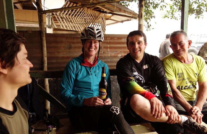
You can support Mauricio; the trail builder/worker, the community and the trail by going to local businesses. Mauricio’s Panchito Comida Rapida food truck is at San Miguel’s main square Friday and Sat evenings and at regional festivals. You can also try his locally brewed liquor – Lagrima del Inca. Thanks to Mauricio, Mateo of Ride Ecuador for educating us and to mountain biking - not just serious business but also making life better for everyone. Viva Ecuador! Viva Mama Rumi!
![Mama Rumi Mother Rock in Quecha is a centuries old Inca trail descending from 3023m above San Miguel de Bolivar in Ecuador to 1130m to Telimbela over 12kms. It was rediscovered by Mauricio Gaibor s grandfather. Mauricio now runs the Downhill Mama Rumi race on it]() Dropping in on Mama Rumi in the fog
Dropping in on Mama Rumi in the fog
![Mama Rumi Mother Rock in Quecha is a centuries old Inca trail descending from 3023m above San Miguel de Bolivar in Ecuador to 1130m to Telimbela over 12kms. It was rediscovered by Mauricio Gaibor s grandfather. Mauricio now runs the Downhill Mama Rumi race on it]() Classic Inca trail
Classic Inca trail
![Mama Rumi Mother Rock in Quecha is a centuries old Inca trail descending from 3023m above San Miguel de Bolivar in Ecuador to 1130m to Telimbela over 12kms. It was rediscovered by Mauricio Gaibor s grandfather. Mauricio now runs the Downhill Mama Rumi race on it]() Culoncos and rocks abound
Culoncos and rocks abound
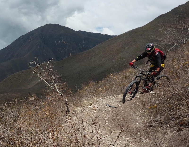
![Mama Rumi Mother Rock in Quecha is a centuries old Inca trail descending from 3023m above San Miguel de Bolivar in Ecuador to 1130m to Telimbela over 12kms. It was rediscovered by Mauricio Gaibor s grandfather. Mauricio now runs the Downhill Mama Rumi race on it]() Yes. It is dangerous and technical. Spice it up with some moist slickness deposited by the fog
Yes. It is dangerous and technical. Spice it up with some moist slickness deposited by the fog
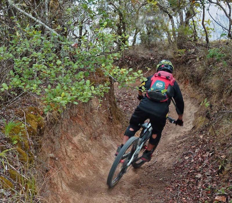
![Mama Rumi Mother Rock in Quecha is a centuries old Inca trail descending from 3023m above San Miguel de Bolivar in Ecuador to 1130m to Telimbela over 12kms. It was rediscovered by Mauricio Gaibor s grandfather. Mauricio now runs the Downhill Mama Rumi race on it]() Classic jungle downhill descent. Hundreds of hours go into cleaning up the jungle undergrowth that is always trying to take back the trail. Hand cleared by Mauricio and volunteers with machetes
Classic jungle downhill descent. Hundreds of hours go into cleaning up the jungle undergrowth that is always trying to take back the trail. Hand cleared by Mauricio and volunteers with machetes
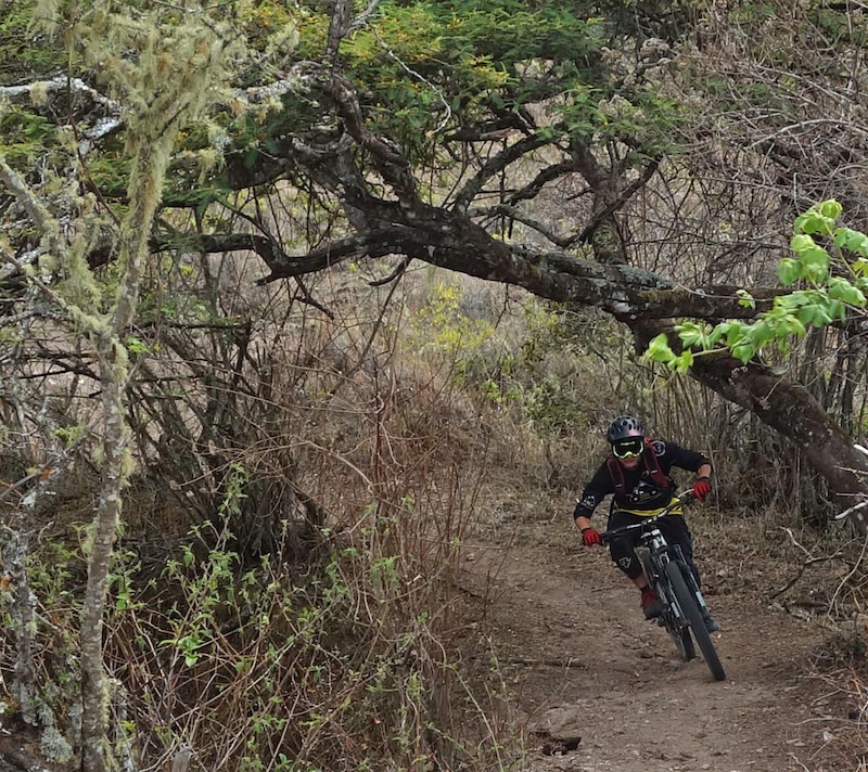
![Mama Rumi Mother Rock in Quecha is a centuries old Inca trail descending from 3023m above San Miguel de Bolivar in Ecuador to 1130m to Telimbela over 12kms. It was rediscovered by Mauricio Gaibor s grandfather. Mauricio now runs the Downhill Mama Rumi race on it]() Classic jungle singletrack
Classic jungle singletrack
![Mama Rumi Mother Rock in Quecha is a centuries old Inca trail descending from 3023m above San Miguel de Bolivar in Ecuador to 1130m to Telimbela over 12kms. It was rediscovered by Mauricio Gaibor s grandfather. Mauricio now runs the Downhill Mama Rumi race on it]() Some bridges to clear barbed wire set up for farm boundaries
Some bridges to clear barbed wire set up for farm boundaries
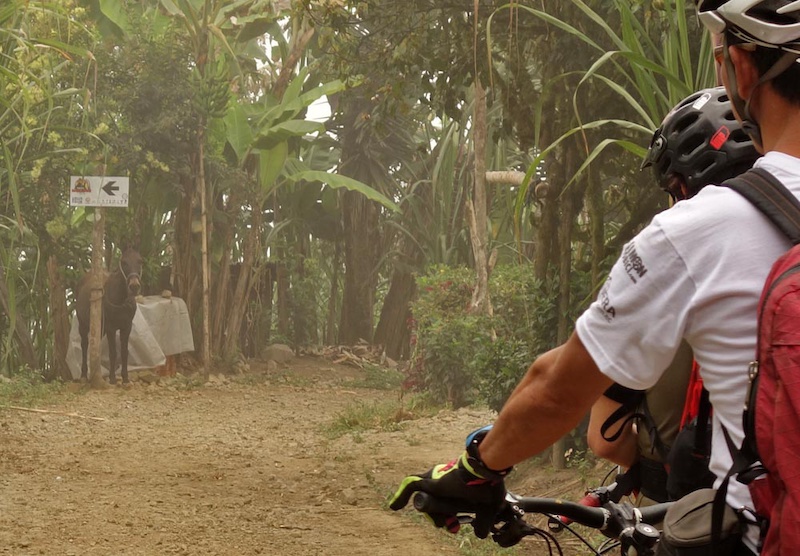
![Mama Rumi Mother Rock in Quecha is a centuries old Inca trail descending from 3023m above San Miguel de Bolivar in Ecuador to 1130m to Telimbela over 12kms. It was rediscovered by Mauricio Gaibor s grandfather. Mauricio now runs the Downhill Mama Rumi race on it]() A local burro guards the entry to the lower downhill
A local burro guards the entry to the lower downhill
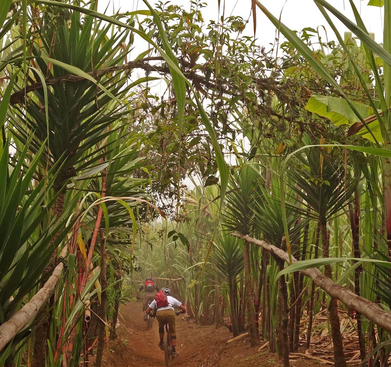
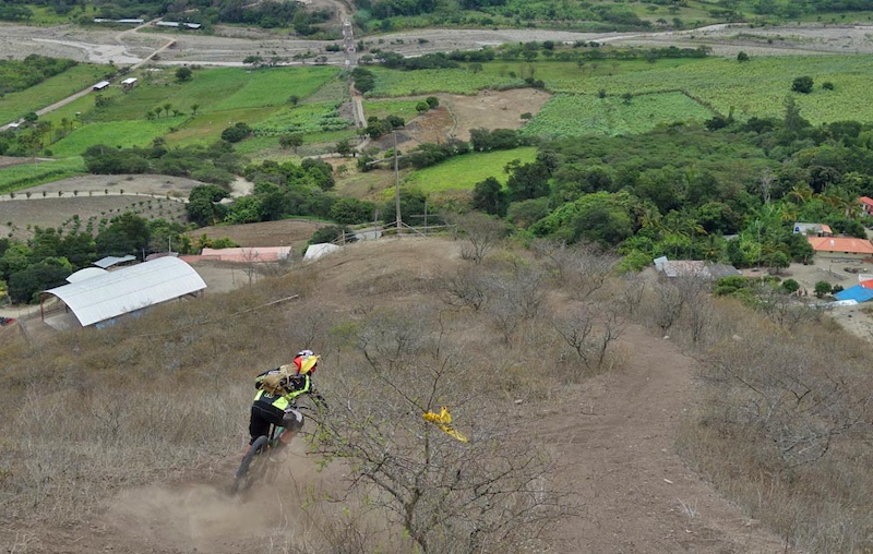
![Mama Rumi Mother Rock in Quecha is a centuries old Inca trail descending from 3023m above San Miguel de Bolivar in Ecuador to 1130m to Telimbela over 12kms. It was rediscovered by Mauricio Gaibor s grandfather. Mauricio now runs the Downhill Mama Rumi race on it]() Through the caña de azucar plantation
Through the caña de azucar plantation
![Mama Rumi Mother Rock in Quecha is a centuries old Inca trail descending from 3023m above San Miguel de Bolivar in Ecuador to 1130m to Telimbela over 12kms. It was rediscovered by Mauricio Gaibor s grandfather. Mauricio now runs the Downhill Mama Rumi race on it]() At the trail bottom, a little roadside stand at Telimbela sells beer and other refreshments and welcomes bikers. Rain starts just as we end our ride and we take shelter
At the trail bottom, a little roadside stand at Telimbela sells beer and other refreshments and welcomes bikers. Rain starts just as we end our ride and we take shelter
![Mama Rumi Mother Rock in Quecha is a centuries old Inca trail descending from 3023m above San Miguel de Bolivar in Ecuador to 1130m to Telimbela over 12kms. It was rediscovered by Mauricio Gaibor s grandfather. Mauricio now runs the Downhill Mama Rumi race on it]() Mauricio's food truck serves amazing meals in San Miguel's town centre
Mauricio's food truck serves amazing meals in San Miguel's town centre
Our trailforks ridelog is here
Camino Del Rey
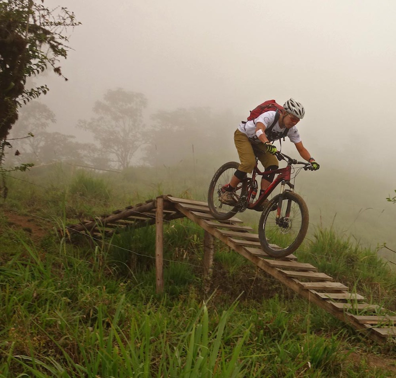
Our next ride is a half day quickie that is perfect for when you have a long day to travel. Camino del Rey (Road of the Kings) is another rediscovered Inca trail, in the mountains above San Jose del Chimbo close to the Mama Rumi area. This was a perfect half day short 7.6km ride ending in the lower valleys, Starting at 3228m elevation the trail ends at 2217m at San Pablo and was another trading and transport route used by Incas; then rediscovered and cleared by hand and machete by its Castillon Marcelo Vargas. Marcelo is yet another dedicated local who doesn’t even mountain bike but welcomes bike traffic on the trail. Marcelo also rides his horses and hikes on this trail so please don’t run him over!
On Camino del Rey, there are plenty of culunco (big ground ruts formed by the passage of years of feet and jungle rains). Culuncos are something that will be familiar to South American trail users and add dramatically to the technical nature of the singletrack. In this case, Camino Del Rey’s culuncos were awesome natural berms proving not only that the Incans ride bikes downhill, I suspect they liked dual slalom. One other word of caution, the soil type in this area is of the nature that if it's wet it becomes death-slippery. Be warned!
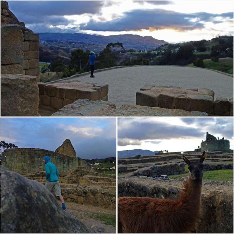
Following our ride, we drove through Cañar and Chimborazo province to overnight close to Ingapirca, the site of some well-preserved Incan ruins.
![Ingapirca Incan Ruins and the Camino Del Rey trail]() Marcelo by the trail head sign. He does a lot of work on this trail and is its Castillon.
Marcelo by the trail head sign. He does a lot of work on this trail and is its Castillon.
![Ingapirca Incan Ruins and the Camino Del Rey trail]() More culuncos.
More culuncos.
![Ingapirca Incan Ruins and the Camino Del Rey trail]() Serious natural berms going on in this section.
Serious natural berms going on in this section.
![Ingapirca Incan Ruins and the Camino Del Rey trail]() The trail is quite the brake burner.
The trail is quite the brake burner.
![Ingapirca Incan Ruins and the Camino Del Rey trail]() Our end of day visit to the Ingapirca Incan ruins.
Our end of day visit to the Ingapirca Incan ruins.
Our trailforks ridelog is here.
Cañari trails - I-Line
In Chimborazo and Cañar province, the Canari people were fierce fighters resisting the Incans for a great length of time. Their network of trails and roads above the Panamerican towns of Chunchi, Guasanto and Alausi gives some hint of their determination and fortitude. On our ride our guide, Andres 'Soto' Sotomayor is a DH racer and local in Cuenca who has been exploring and pioneering routes in the area for years. Soto and Mateo are friends (Ecuador’s bike community is small, tight and everyone knows everyone and helps everyone else out) and share knowledge. Soto is also a somewhat competent rider having raced on the World DH circuit in the early 2000s. Soto has invested lots of time in building relationships with the communities, ensuring that bikers respect local trails and traditions and the land. We were fortunate to have been among the first few riders to have done the 20km I-Line route.
The route started at 3613m at Pacchamama Bajo, crossed to Shusilcon and then descended to Nizag before ending at Pistishi at 1884m (terminus of the Nariz del Diablo trainride, descending a total of 1882m. What’s amazing is the link up of trails to minimize the amount of roads, maximze the amount of singletrack and yet achieve stupendous mind blowing views. This is among the most aesthetic lines that we’ve had the privilege of riding – ever.
Trail route descriptions have been left out on Soto's advice pending the ok of local communities for bikers to use the trails. For the present please contact Mateo of Ride Ecuador for route information.
![With Ride Ecuador we were one of the few riders to ride Andres Sotomayor s 20km I-Line route. The route started at 3613m at Pacchamama Bajo crossed to Shusilcon and then descended to Nizag before ending at Pistishi at 1884m descending a total of 1882m]() Starting high at Pacchamama Bajo.
Starting high at Pacchamama Bajo.
![With Ride Ecuador we were one of the few riders to ride Andres Sotomayor s 20km I-Line route. The route started at 3613m at Pacchamama Bajo crossed to Shusilcon and then descended to Nizag before ending at Pistishi at 1884m descending a total of 1882m]() The trail doesn't mess around. Right into head-sized rocks we roll.
The trail doesn't mess around. Right into head-sized rocks we roll.
![With Ride Ecuador we were one of the few riders to ride Andres Sotomayor s 20km I-Line route. The route started at 3613m at Pacchamama Bajo crossed to Shusilcon and then descended to Nizag before ending at Pistishi at 1884m descending a total of 1882m]() Soto showing downhill steez as the trail opens up.
Soto showing downhill steez as the trail opens up.
![With Ride Ecuador we were one of the few riders to ride Andres Sotomayor s 20km I-Line route. The route started at 3613m at Pacchamama Bajo crossed to Shusilcon and then descended to Nizag before ending at Pistishi at 1884m descending a total of 1882m]() The views from this ride are about as good as it gets. And there is no-one here.
The views from this ride are about as good as it gets. And there is no-one here.
![With Ride Ecuador we were one of the few riders to ride Andres Sotomayor s 20km I-Line route. The route started at 3613m at Pacchamama Bajo crossed to Shusilcon and then descended to Nizag before ending at Pistishi at 1884m descending a total of 1882m]() I-Line isn't one trail. It's actually a network of trails. Soto has pieced them together painstakingly and OK'ed riding them through lots of work with the villagers. Part of getting along is respecting the villager's livestock. Here we navigate the 'traffic' of Shusilcon.
I-Line isn't one trail. It's actually a network of trails. Soto has pieced them together painstakingly and OK'ed riding them through lots of work with the villagers. Part of getting along is respecting the villager's livestock. Here we navigate the 'traffic' of Shusilcon.
![With Ride Ecuador we were one of the few riders to ride Andres Sotomayor s 20km I-Line route. The route started at 3613m at Pacchamama Bajo crossed to Shusilcon and then descended to Nizag before ending at Pistishi at 1884m descending a total of 1882m]() More freaking spectacular scenery.
More freaking spectacular scenery.
![With Ride Ecuador we were one of the few riders to ride Andres Sotomayor s 20km I-Line route. The route started at 3613m at Pacchamama Bajo crossed to Shusilcon and then descended to Nizag before ending at Pistishi at 1884m descending a total of 1882m]() Views and singletrack that goes on forever.
Views and singletrack that goes on forever.
![With Ride Ecuador we were one of the few riders to ride Andres Sotomayor s 20km I-Line route. The route started at 3613m at Pacchamama Bajo crossed to Shusilcon and then descended to Nizag before ending at Pistishi at 1884m descending a total of 1882m]() Could not resist another view shot.
Could not resist another view shot.
![With Ride Ecuador we were one of the few riders to ride Andres Sotomayor s 20km I-Line route. The route started at 3613m at Pacchamama Bajo crossed to Shusilcon and then descended to Nizag before ending at Pistishi at 1884m descending a total of 1882m]() We're at the halfway mark. The trail drops to the Panamerican.
We're at the halfway mark. The trail drops to the Panamerican.
![With Ride Ecuador we were one of the few riders to ride Andres Sotomayor s 20km I-Line route. The route started at 3613m at Pacchamama Bajo crossed to Shusilcon and then descended to Nizag before ending at Pistishi at 1884m descending a total of 1882m]() A short hike-a-bike with views of the town of Alausi far far below.
A short hike-a-bike with views of the town of Alausi far far below.
![With Ride Ecuador we were one of the few riders to ride Andres Sotomayor s 20km I-Line route. The route started at 3613m at Pacchamama Bajo crossed to Shusilcon and then descended to Nizag before ending at Pistishi at 1884m descending a total of 1882m]() Soto dropping onto the faster section of trails. Basically, they are rollers on Incan doubletrack. A very long pumptrack if you will. The view below is to the Nariz del Diablo feature and a very famous railway station. Famous for being steep.
Soto dropping onto the faster section of trails. Basically, they are rollers on Incan doubletrack. A very long pumptrack if you will. The view below is to the Nariz del Diablo feature and a very famous railway station. Famous for being steep.
![With Ride Ecuador we were one of the few riders to ride Andres Sotomayor s 20km I-Line route. The route started at 3613m at Pacchamama Bajo crossed to Shusilcon and then descended to Nizag before ending at Pistishi at 1884m descending a total of 1882m]() More views but this time towards Chunchi.
More views but this time towards Chunchi.
![With Ride Ecuador we were one of the few riders to ride Andres Sotomayor s 20km I-Line route. The route started at 3613m at Pacchamama Bajo crossed to Shusilcon and then descended to Nizag before ending at Pistishi at 1884m descending a total of 1882m]() Through the town of Nizag close to the Panamerican Highway and we practise cow slalom.
Through the town of Nizag close to the Panamerican Highway and we practise cow slalom.
![With Ride Ecuador we were one of the few riders to ride Andres Sotomayor s 20km I-Line route. The route started at 3613m at Pacchamama Bajo crossed to Shusilcon and then descended to Nizag before ending at Pistishi at 1884m descending a total of 1882m]() Finally at the railway station terminus of Pistishi
Finally at the railway station terminus of Pistishi
La Paz Downhill
We met Andres 'Soto' Sotomayor when he showed us around the I-Line link up of Canari trails. He has also been very active in the Cuenca area riding bikes downhill on the La Paz downhill trail for fifteen years. Through that time, he’s tirelessly worked with the community and gained their trust so much so that the locals have helped with the La Paz race which is now in its 10th year. Starting from the caserio/mountain village of Portetillos the track descends 1700+ m to the small village of Sulupali Grande in the Yunguilla.
Although we were on lighter all-mountain type bikes one never passes up the opportunity and privilege of riding a trail with the trail builder. Especially a trail like this where someone has put heart and soul into the route, the land, the track and its character. This proved to be a fun, technical, fast track. Something that a downhill mountain biker would route and build. Although most sections were fine on the lighter bikes there was the odd section demanding travel and aggressive tires. Govern your speed accordingly and don’t get too entranced by views – you’ll need to concentrate in many spots!
A word on this track - It's steep, loose and fast. More importantly, access has been won by careful and polite cooperation with local communities. Respect the fences. Don't chase cows. Don't trespass and respect people's land. A higher elevation of track has already been lost due to some rider's poor etiquette - it would be a shame to lose more. For more information on how to get to this track contact Mateo via Ride Ecuador or Soto via the La Paz downhill site.
![The La Paz downhill starts from the caserio mountain village of Portetillos. The track descends 1700 m to the small village of Sulupali in the Yunguilla valley.]() Soto adores the local kids and they adore him. Trailbuilder's passion.
Soto adores the local kids and they adore him. Trailbuilder's passion.
![The La Paz downhill starts from the caserio mountain village of Portetillos. The track descends 1700 m to the small village of Sulupali in the Yunguilla valley.]() As usual Ecuadorian rides start with outstanding views.
As usual Ecuadorian rides start with outstanding views.
![The La Paz downhill starts from the caserio mountain village of Portetillos. The track descends 1700 m to the small village of Sulupali in the Yunguilla valley.]() Fast.
Fast.
![The La Paz downhill starts from the caserio mountain village of Portetillos. The track descends 1700 m to the small village of Sulupali in the Yunguilla valley.]() and loose.
and loose.
![The La Paz downhill starts from the caserio mountain village of Portetillos. The track descends 1700 m to the small village of Sulupali in the Yunguilla valley.]() Some natural berms. Many man-made.
Some natural berms. Many man-made.
![The La Paz downhill starts from the caserio mountain village of Portetillos. The track descends 1700 m to the small village of Sulupali in the Yunguilla valley.]() Mateo railing.
Mateo railing.
![The La Paz downhill starts from the caserio mountain village of Portetillos. The track descends 1700 m to the small village of Sulupali in the Yunguilla valley.]() Trail and vegetation changes and becomes more desertlike as you drop elevation.
Trail and vegetation changes and becomes more desertlike as you drop elevation.
![The La Paz downhill starts from the caserio mountain village of Portetillos. The track descends 1700 m to the small village of Sulupali in the Yunguilla valley.]() Sharon dropping into the last fast zoom zoom section.
Sharon dropping into the last fast zoom zoom section.
![The La Paz downhill starts from the caserio mountain village of Portetillos. The track descends 1700 m to the small village of Sulupali in the Yunguilla valley.]() Mateo cornering into another loose turn.
Mateo cornering into another loose turn.
![The La Paz downhill starts from the caserio mountain village of Portetillos. The track descends 1700 m to the small village of Sulupali in the Yunguilla valley.]() The finishing steep straight.
The finishing steep straight.
![The La Paz downhill starts from the caserio mountain village of Portetillos. The track descends 1700 m to the small village of Sulupali in the Yunguilla valley.]() Soto on the signature finishline tabletop
Soto on the signature finishline tabletop
Where to Stay
San Miguel/San Jose del Chimbo
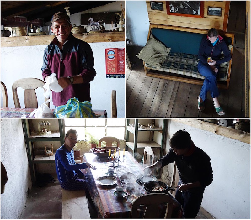
We stayed at the Casa Bella Vista, the homestead of Marcelo Vargas up on the hills above San Miguel. It has a grand view of the valley and has a western theme. It's rustic comfortable accommodations that was perfectly suited for biking. Of note, Marcelo.has opened trails around the area so by supporting him you also support local trail work. Accommodations at Bella Vista can be arranged by contacting Mateo of Ride Ecuador who has his guests stay there.
![Ingapirca Incan Ruins and the Camino Del Rey trail]() Bellavista's cosy interior and Marcelo's home.
Bellavista's cosy interior and Marcelo's home.
![Ingapirca Incan Ruins and the Camino Del Rey trail]() Bellavista means beautiful views and you can see why. On a clear day you can see Chimborazo
Bellavista means beautiful views and you can see why. On a clear day you can see Chimborazo
Ingapirca
We elected to stay close to the town of El Tambo on the Panamerican close to the Ingapirca Incan ruins at the Posada Ingapirca. This is an extensively renovated old homestead with great views, comfortable well-appointed rooms and good food.
![Ingapirca Incan Ruins and the Camino Del Rey trail]() You can see the Incan ruins right from the hotel
You can see the Incan ruins right from the hotel
 The hotel exterior and interior. Exceptionally comfortable
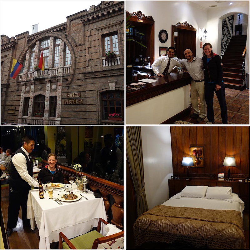
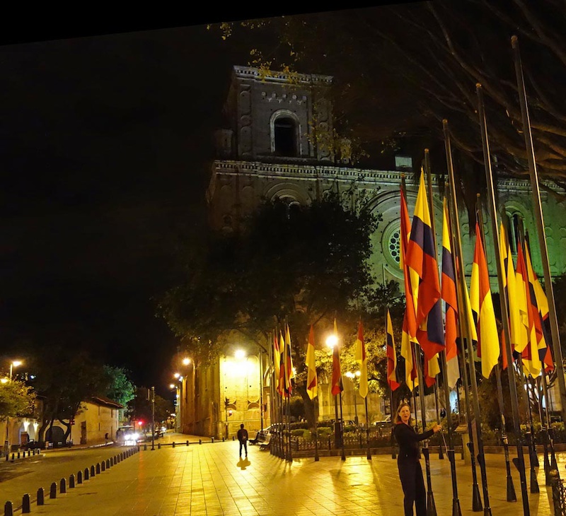
Cuenca
In Cuenca we stayed for two nights at the Hotel Victoria, a family-owned character luxurious hotel (owned by the same family which runs the Posada Ingapirca). We regretted not staying for longer. Hotel Victoria is in the heart of the old town and is right next to the river running through Cuenca. We had breakfast at the hotel and dinner. It’s a fantastic location being walk-to-everywhere with superior service, comfort and ambience.
![The La Paz downhill starts from the caserio mountain village of Portetillos. The track descends 1700 m to the small village of Sulupali in the Yunguilla valley.]() Hotel Victoria
Hotel Victoria
![The La Paz downhill starts from the caserio mountain village of Portetillos. The track descends 1700 m to the small village of Sulupali in the Yunguilla valley.]() Beautiful Cuenca
Beautiful Cuenca
Others parts
Part One - Quito and Baby Volcanoes.
Part Two - Chimborazo and Bigger Volcanoes.
More pictures, maps and details on Sharon and Lee's site are below:
Mama Rumi
Camino del Rey
Camino del Inca - the ILine
La Paz
MENTIONS: @leelau / @mateo5
Compared to its other neighbours such as Peru and Bolivia, Ecuador is not as well known for mountain biking. Our outsider’s viewpoint is that this could be due to a variety of reasons, lack of a critical mass of home-grown bikers; or the fact that the Galapagos is Ecuador’s main attraction. There certainly is no lack of trails and certainly no lack of diversity in terrain and culture. Ecuador is a fascinating country in and of itself and the Ecuadorians are fantastic people and very welcoming to tourists. Our visit here showed us the possibilities and no doubt more people will come for the biking; it's just too good to be under the radar for this long. This is especially so when there are people like Mateo of Ride Ecuador who can provide very professional turnkey bike guiding services.
A note on the weather, Ecuador is bisected by the Equator so the days are consistently around 12 hours long. The weather is fairly uniform other than a marked rainy and dry season. There are cooler temperatures in the rainy season (Oct/Nov in the Highlands; April to July in the Orient). Our tour was right between the start of the dry and rainy seasons and we were fortunate. During our visit rain was always forecasted but rarely came. When it fell it did not last long. What we found was that the country is so mountainous that weather forecasts were basically useless except for the wildest of guesses. We usually expected afternoon to evening fog due to the Nieblina (fog creeping up from valley floor towards the highlands) but we could always expect mornings to generally be better weather.
Mama Rumi

Our next ride is an Ecuadorian classic and perhaps one of the most famous trails in the country. Mama Rumi (Mother Rock in Quecha) is a centuries-old Inca trail descending from 3023m above San Miguel de Bolivar in Ecuador to 1130m to Telimbela. Its 12km length and 1920m descent was lost for many years as the jungle took it back until Mauricio Gaibor’s grandfather re-discovered it in the mid-20th century. Now used primarily for downhill mountain biking, Mauricio’s granddad used it as smuggling route for alcohol. Brewers would distill in the lowlands in Telimbela and hike it all the way to more populated highlands starting at 9pm in the evening and finishing in the wee hours of the morning to evade authorities.
Mauricio Gaibor, friends and local volunteers re-opened the trail after countless hours of work fixing holes and clearing back dense cloud forest jungle. Mauricio now holds the Downhill Mama Rumi race here annually attracting 284 participants in the 2015 edition. Over 600 people come to San Miguel and Telimbela over the race weekend and over 150 riders (international and Ecuadorians) come to the region over the year. Particularly for 102 person Telimbela, that is a huge tourism economic boost and has resulted in real quality of life changes. Only this year due in large part to the races’ media attention, the government is installing water pipes giving all the people in the valley clean water for the first time in their lives. Not only is mountain biking serious business, but it can change lives for the better.
You can support Mauricio; the trail builder/worker, the community and the trail by going to local businesses. Mauricio’s Panchito Comida Rapida food truck is at San Miguel’s main square Friday and Sat evenings and at regional festivals. You can also try his locally brewed liquor – Lagrima del Inca. Thanks to Mauricio, Mateo of Ride Ecuador for educating us and to mountain biking - not just serious business but also making life better for everyone. Viva Ecuador! Viva Mama Rumi!


Our trailforks ridelog is here
Camino Del Rey
Our next ride is a half day quickie that is perfect for when you have a long day to travel. Camino del Rey (Road of the Kings) is another rediscovered Inca trail, in the mountains above San Jose del Chimbo close to the Mama Rumi area. This was a perfect half day short 7.6km ride ending in the lower valleys, Starting at 3228m elevation the trail ends at 2217m at San Pablo and was another trading and transport route used by Incas; then rediscovered and cleared by hand and machete by its Castillon Marcelo Vargas. Marcelo is yet another dedicated local who doesn’t even mountain bike but welcomes bike traffic on the trail. Marcelo also rides his horses and hikes on this trail so please don’t run him over!
On Camino del Rey, there are plenty of culunco (big ground ruts formed by the passage of years of feet and jungle rains). Culuncos are something that will be familiar to South American trail users and add dramatically to the technical nature of the singletrack. In this case, Camino Del Rey’s culuncos were awesome natural berms proving not only that the Incans ride bikes downhill, I suspect they liked dual slalom. One other word of caution, the soil type in this area is of the nature that if it's wet it becomes death-slippery. Be warned!
Following our ride, we drove through Cañar and Chimborazo province to overnight close to Ingapirca, the site of some well-preserved Incan ruins.


Our trailforks ridelog is here.
Cañari trails - I-Line
In Chimborazo and Cañar province, the Canari people were fierce fighters resisting the Incans for a great length of time. Their network of trails and roads above the Panamerican towns of Chunchi, Guasanto and Alausi gives some hint of their determination and fortitude. On our ride our guide, Andres 'Soto' Sotomayor is a DH racer and local in Cuenca who has been exploring and pioneering routes in the area for years. Soto and Mateo are friends (Ecuador’s bike community is small, tight and everyone knows everyone and helps everyone else out) and share knowledge. Soto is also a somewhat competent rider having raced on the World DH circuit in the early 2000s. Soto has invested lots of time in building relationships with the communities, ensuring that bikers respect local trails and traditions and the land. We were fortunate to have been among the first few riders to have done the 20km I-Line route.
The route started at 3613m at Pacchamama Bajo, crossed to Shusilcon and then descended to Nizag before ending at Pistishi at 1884m (terminus of the Nariz del Diablo trainride, descending a total of 1882m. What’s amazing is the link up of trails to minimize the amount of roads, maximze the amount of singletrack and yet achieve stupendous mind blowing views. This is among the most aesthetic lines that we’ve had the privilege of riding – ever.
Trail route descriptions have been left out on Soto's advice pending the ok of local communities for bikers to use the trails. For the present please contact Mateo of Ride Ecuador for route information.


La Paz Downhill
We met Andres 'Soto' Sotomayor when he showed us around the I-Line link up of Canari trails. He has also been very active in the Cuenca area riding bikes downhill on the La Paz downhill trail for fifteen years. Through that time, he’s tirelessly worked with the community and gained their trust so much so that the locals have helped with the La Paz race which is now in its 10th year. Starting from the caserio/mountain village of Portetillos the track descends 1700+ m to the small village of Sulupali Grande in the Yunguilla.
Although we were on lighter all-mountain type bikes one never passes up the opportunity and privilege of riding a trail with the trail builder. Especially a trail like this where someone has put heart and soul into the route, the land, the track and its character. This proved to be a fun, technical, fast track. Something that a downhill mountain biker would route and build. Although most sections were fine on the lighter bikes there was the odd section demanding travel and aggressive tires. Govern your speed accordingly and don’t get too entranced by views – you’ll need to concentrate in many spots!
A word on this track - It's steep, loose and fast. More importantly, access has been won by careful and polite cooperation with local communities. Respect the fences. Don't chase cows. Don't trespass and respect people's land. A higher elevation of track has already been lost due to some rider's poor etiquette - it would be a shame to lose more. For more information on how to get to this track contact Mateo via Ride Ecuador or Soto via the La Paz downhill site.


Where to Stay
San Miguel/San Jose del Chimbo
We stayed at the Casa Bella Vista, the homestead of Marcelo Vargas up on the hills above San Miguel. It has a grand view of the valley and has a western theme. It's rustic comfortable accommodations that was perfectly suited for biking. Of note, Marcelo.has opened trails around the area so by supporting him you also support local trail work. Accommodations at Bella Vista can be arranged by contacting Mateo of Ride Ecuador who has his guests stay there.
Ingapirca
We elected to stay close to the town of El Tambo on the Panamerican close to the Ingapirca Incan ruins at the Posada Ingapirca. This is an extensively renovated old homestead with great views, comfortable well-appointed rooms and good food.
 The hotel exterior and interior. Exceptionally comfortable
Cuenca
In Cuenca we stayed for two nights at the Hotel Victoria, a family-owned character luxurious hotel (owned by the same family which runs the Posada Ingapirca). We regretted not staying for longer. Hotel Victoria is in the heart of the old town and is right next to the river running through Cuenca. We had breakfast at the hotel and dinner. It’s a fantastic location being walk-to-everywhere with superior service, comfort and ambience.
Others parts
Part One - Quito and Baby Volcanoes.
Part Two - Chimborazo and Bigger Volcanoes.
More pictures, maps and details on Sharon and Lee's site are below:
Mama Rumi
Camino del Rey
Camino del Inca - the ILine
La Paz
MENTIONS: @leelau / @mateo5
Author Info:

 Member since Oct 18, 2009
Must Read This Week
Sign Up for the Pinkbike Newsletter - All the Biggest, Most Interesting Stories in your Inbox
PB Newsletter Signup
Great trip report.