Taming Wild Mustangs - To The Edge Of Pain And Back

Time is not on our side. Looking North from Kagbeni, on the edge of the Upper Mustang, my eyes are met by a sea of dust-shrouded peaks. Somewhere on the other side of these 6000 metre leviathans sits Lo Manthang, an ancient walled city of Buddhist monks and the gateway to the Tibetan plateau. This “city” has a king and 300 inhabitants but no airport, and our chosen trail is the only way to reach it. It’s an undertaking will demand 10,000 meters of climbing at near 4000m elevation. It would be a reasonable challenge for any rider even without the time pressure of having only a ten-day permit to get there and back. Five days in, five days back, -it almost sounds like a race against the clock, but the real race is to ride this trail before it‘s swallowed up by bulldozers in the name of ‘progress’.
 |
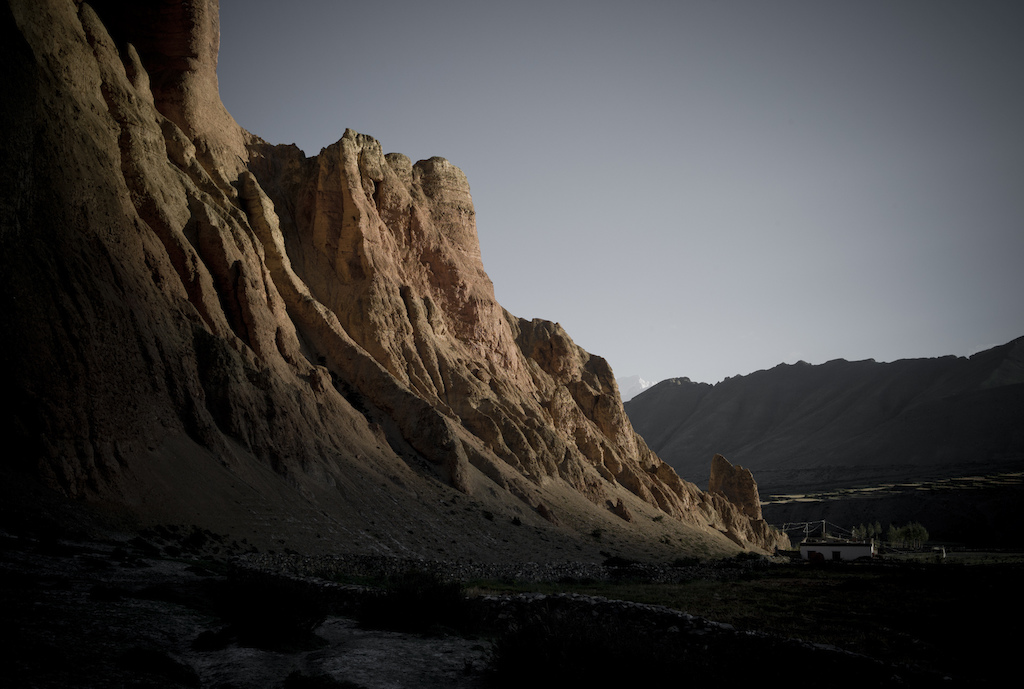
 There's only one word to describe Nepal -BIG There's only one word to describe Nepal -BIG |
Winding through the Nepalese ancient Kingdom of Upper Mustang -a land so rugged and windswept, so inhospitable and so mountainous that bikes are of no use here- this 120 Km long ancient trail has echoed with the clatter of feet and mules’ hooves for centuries. Yet, times are changing. The Chinese are pushing a jeep track south from Tibet, attempting to exorcise the mountain demons that play havoc with Chinese exports. And with the road will come change, some of it for the betterment of the locals, yet some for the detriment of an area that has geographically and politically remained isolated from the outside world. We’ve come to the area to try to ride the trail – or what’s left of it- before it disappears completely beneath the tedium of jeep track.
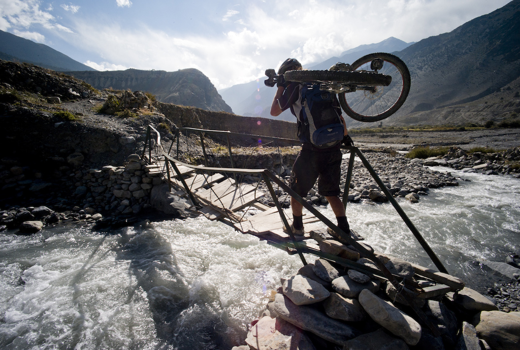 |
| Here even the little bridges can be a challenge. This one tilted 30 degrees to the side when you walked out on to it, something we only found out once Seb lost paper-sissors-stone to be first |
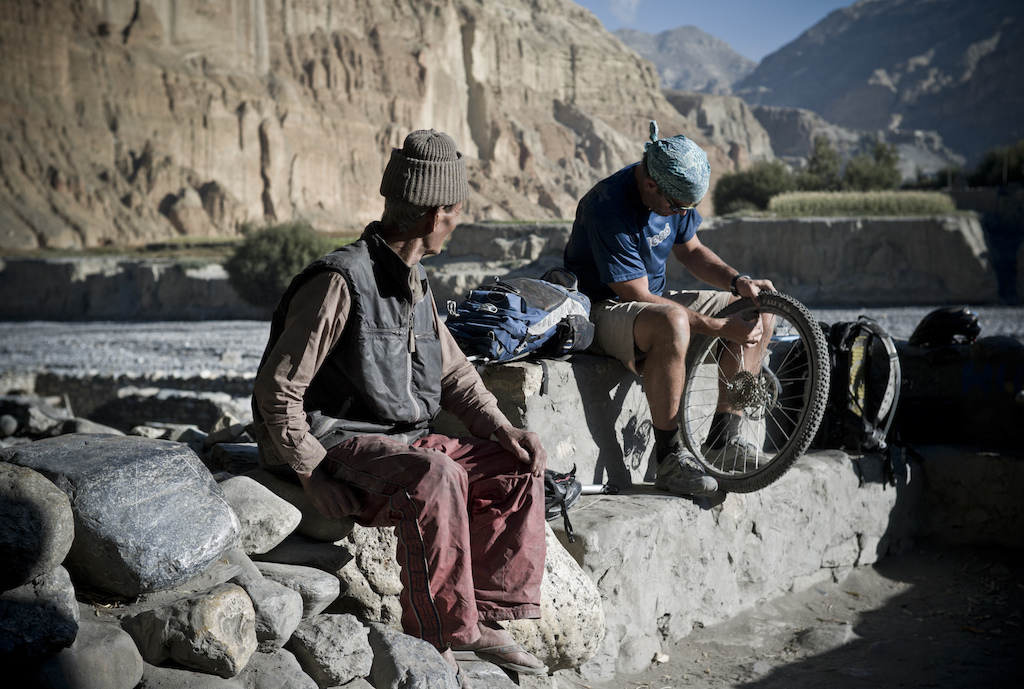
We start from the small village of Kagbeni, sitting on the downhill side of the popular Annapurna circuit trek. It’s a relatively easy -if scary- place to reach. You just have to trust one of the 20 seater early morning flights from Pokhara and an hour later you’re touching down in Jomsom, on a little runway surrounded by monster peaks. Try to come later and the strong, dust-laden wind that blows incessantly in the afternoon, will have you grounded. Or worse.
It’s this wind that paints the backdrop to our 10 day self guided ride to Lo Manthang and back. At times when the mercury rises towards 30C it’s cooling effect is appreciated. At others, when our energy levels are low and we still have distance to cover it is cursed. Either way, there is no escaping it. It tears at Buddhist prayer flags and rattles the thin window glass of our tea house accommodation. It throws grit in our eyes and tries to sweep us from swing bridges suspended high above angry boiling rivers. But it doesn’t stop us.
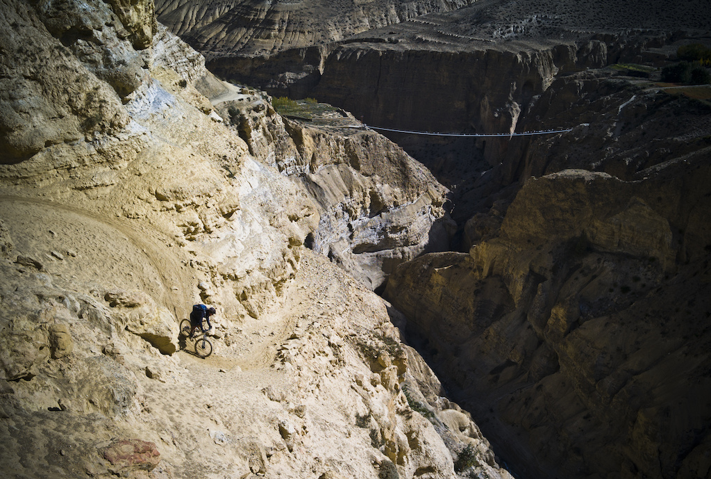 |
| Seb drops down one of the switchbacks on our return leg down the gorge, just one of the many descents that had us twitching. The trail rarely widened more than 1.5 metres for the entire 12 days of riding. |
Rumour has it that only one group of foreign mountain bikers has attempted the ride we’re setting out to do. -Italians apparently- and we hear of their progress from a couple of the tea houses we stop at. They passed through only a month earlier. Though the caress of mountain bike tyres has been rare, the trail we follow is centuries old. It forms an ancient trade route, allowing tea to be brought north from India to Tibet, in exchange for salt, dug from the Tibetan plateau, heading south.
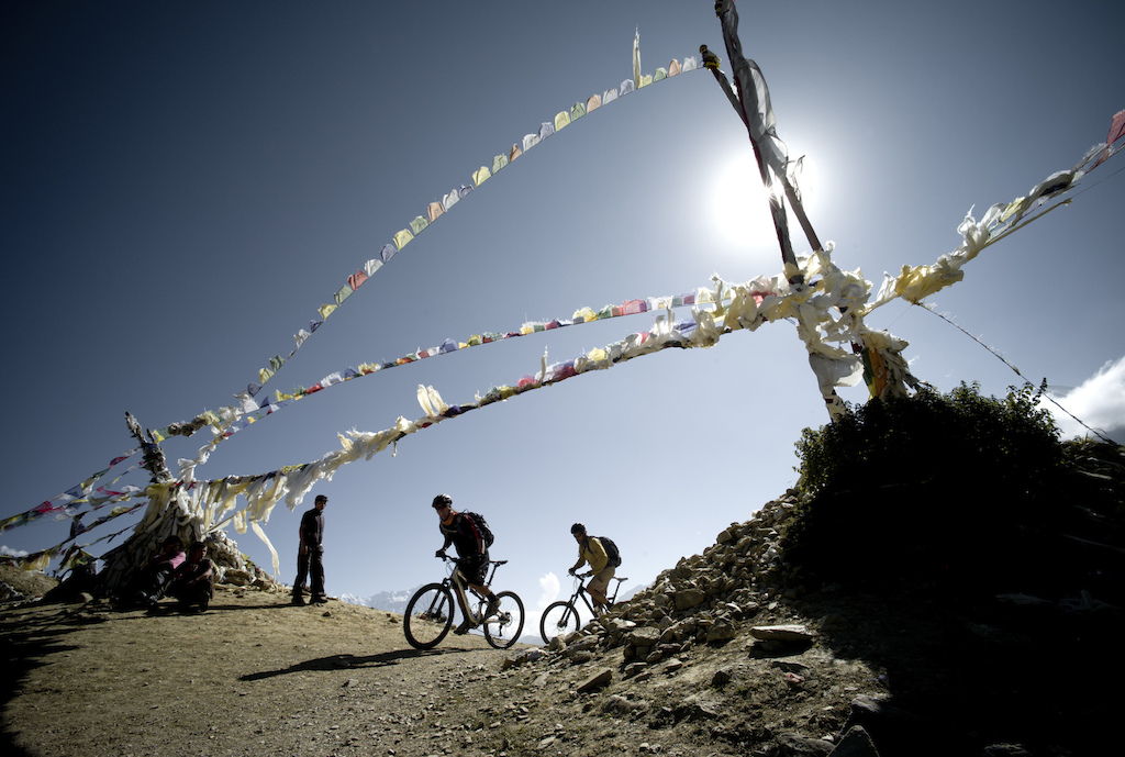 |
| Prayer flags line every high mountain pass. I am guessing people put them there to pray they don't have to climb it again. |
We roll out of Kagbeni early, check in with the authorities and get our passes stamped. The clock starts ticking. Debate is rife about why foreigner access to the Upper Mustang is restricted. Officially it’s to protect the ancient culture, customs and lifestyles of the Upper Mustang inhabitants. This doesn’t stop televisions make it through though. I hear from unofficial sources that it’s because when China moved in on Tibet, the region became a hideout for CIA operatives giving assistance to the Tibetan resistance. When the Chinese discovered this fact, they “leant” on Nepal and insisted that foreigners be banned from the Upper Mustang. The region only re-opened to foreign tourism in 1992. Whatever the reason, now $500 and some paperwork gets you an entry ticket.
 |
| "You never guess what I saw today, honey!" Bikes don't get seen much in the Upper Mustang. |
With Annapurna at our back we ride along the first few kilometres of rough jeep track that will, if the authorities are successful, eventually connect with the Tibetan end of the same road. The road’s reach hasn’t taken it far though and within two hours we pass decrepit, rusting yellow bulldozers sitting idle. Punished by the thin air at 3000m, we claw in just enough oxygen at to granny ring up climbs, suspended high above the braided Kali Gandaki River.
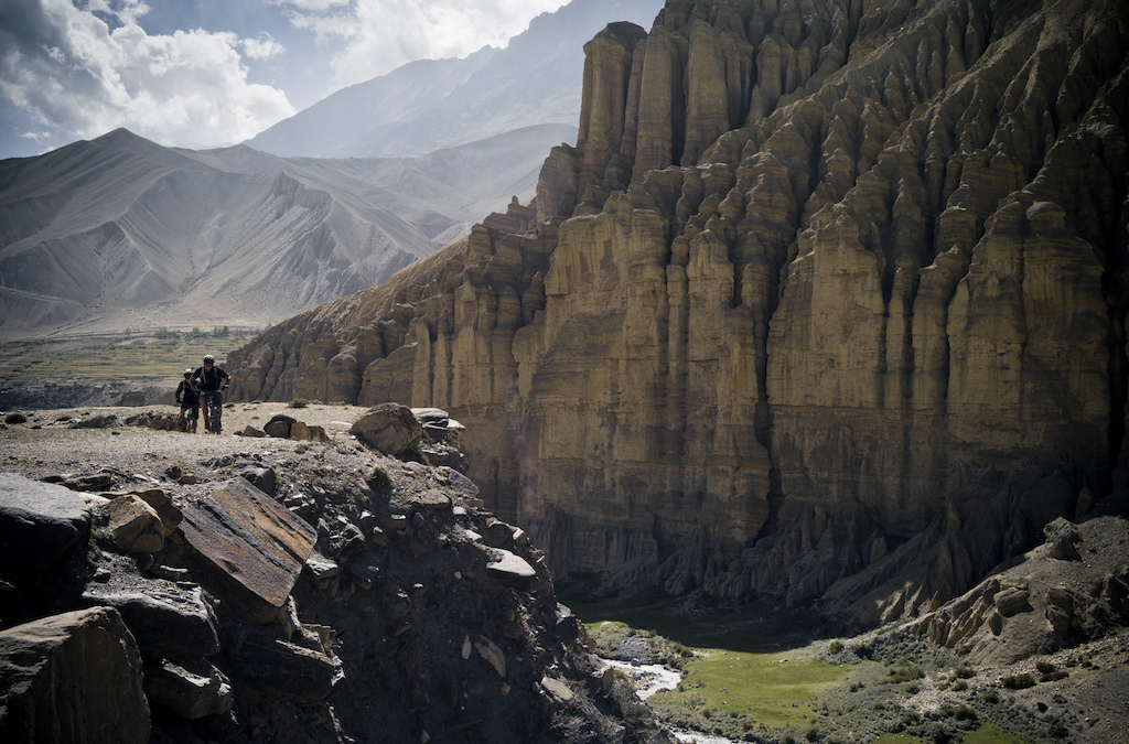
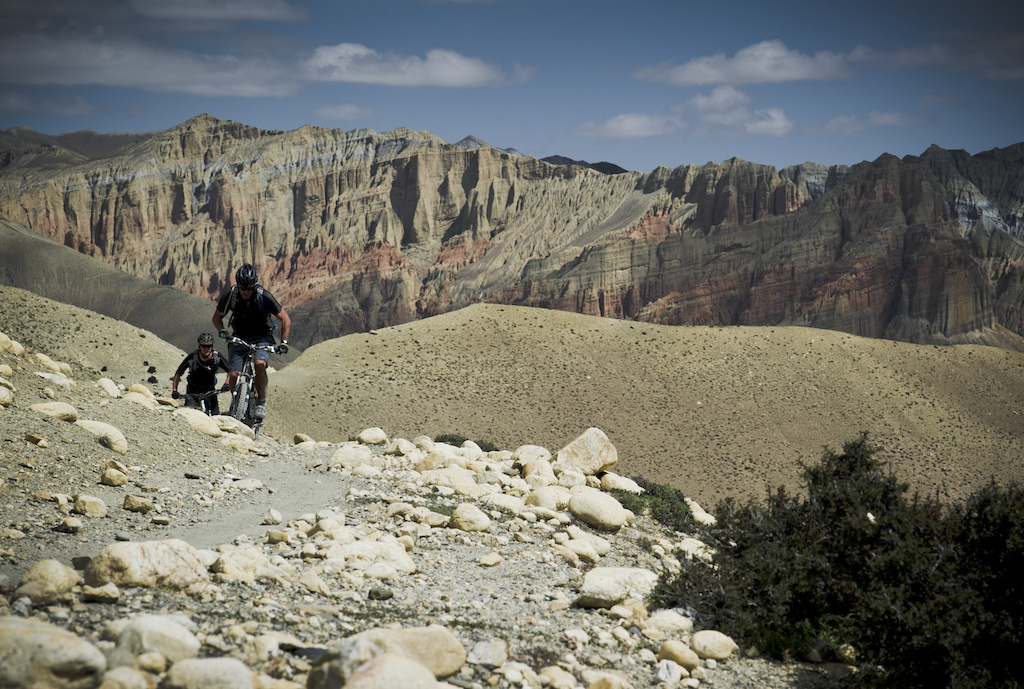
It’s October but the Asian sun is still fierce. Sitting in the rain shadow of the mighty 8000m Annapurnas, the Mustang region escapes the deluge that is the monsoon summer. The landscape around us is arid, dusty, a hundred shades of red and orange. The only trees we see are those that sip from irrigation canals, the umbilical cords of tiny villages that cling to survival in this hostile land. The landscape is harsh and unforgiving, but at the same time strikingly beautiful.
 |
| What goes down has to go up. |
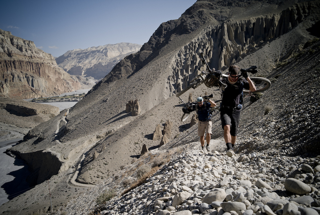
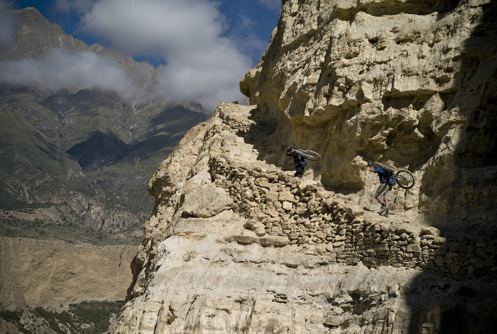
One benefit of the arid, treeless terrain is that we can see our trail from afar. We can plot its course across distant hillsides, match it on our basic map and figure what we have ahead of us. On the down side we also get to see the enormous climbs and the lofty passes that sit between us and our bed for the night. Such passes here are high and formidable. Still trying to acclimatise, the climbs are frustratingly slow. We’re soon accustomed to having bikes slung across our backs.
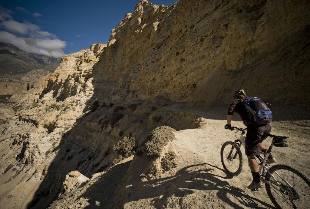 |
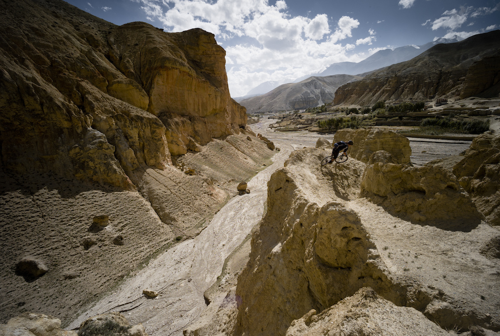
| Seb heads into the canyon. He'll not get far. |
Our first serious hike-a-bike comes on day two, almost straight out of the gate. Leaving the village of Chhusang we are carrying bikes within ten minutes. The map suggests the elevation gain to be 700 metres, and is marked with the words “steep climb”. It’s an understatement. What meets us is a spiralling, exposed ledge, punctuated with steps and way too steep to ride up. It clings to the vertical wall of a canyon and affords no room for error. We are only half an hour up it when we meet a train of mules coming the other way and are forced to retreat to a safe passing place. Although I don’t realise it at the time, this same trail will make an incredible descent on our return leg, one that leaves zero room for error.
To make it easier on ourselves for $10 per day we each have hired a porter to carry our overnight gear on the trip. It’s a luxury that allows us to ride the technical descents unencumbered by bulky packs. But as we grunt up the side of the Ghyakar Khola gorge, I take stock of our situation; we three mountain bikers hauling both day packs and 13 kilo bikes on our backs, and our three porters, each carrying a simple, 10Kg pack. The all smile broad toothy smiles. It’s the easiest job they have ever had.
 |
| Heading towards the next oasis -the next village and our only chance of food. |
With the road far from being finished yet, the trail is still the only connection between Lo Manthang and the rest of Nepal. Regular local foot traffic and the fact that the Nepalese like their chai means there is no shortage of tea houses to be found, each located at what would be the middle or end of a day’s walk. We use these for our sleeping and eating needs, although the cold showers when found, are less compelling.
Although the distances we set out to ride each day are not great, the altitude more than takes up the slack. We begin each day with a climb and descent, then repeat again before arriving, late afternoon at our planned accommodation. The climbs become slow, laboured tests of stamina, the descents a mix of fast and furious swooping turns and slow, technical staircases. Both are equally rewarding after the exertion to reach them.
 |
| The gorge just outside Chhusang, just before the arrival of the mule train. |
As we sit drinking tea and beer and eating curry in one tea house we discuss the idea of the road. We’re drawing a blank as to how the road builders will get around the steep, narrow Ghyakar Khola gorge we hiked up. When roads are built here they often don’t last long, with landslides and snow dragging them to ruin within a year. The Ghyakar gorge must represent less an ambition and more an unachievable dream for road builders.
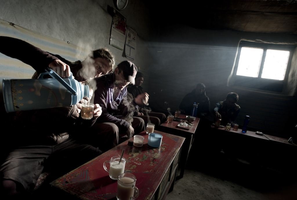 |
| Every day's end finished with this -a huge steaming Chinese flask of chai. And then beer. |
As we continue north on our trail, our ride becomes punctuated with trailside gompas (Buddhist temples) and swing bridge crossings. We crest two 4000m passes, each adorned with strings of prayer flags before unexpectedly meeting the end of the northern extension of the road just outside the village of Ghemi. The road builders have been busier than we expected, the road pushed further south from Tibet than we anticipated. For a moment as we look down at the ribbon of jeep track cut into the valley side below, we resign ourselves to the fact that perhaps we’re too late. And then we spot our salvation –the original trail darts off to our left, disappearing up and over a small pass. The bifurcation of trail shown on our map is a true representation, but while one trail has now been sacrificed to become jeep track, the other still exists in its original form. We turn left.
 |
| Where the trail never ends. another day another couple of thousand meters of climb and descent. |
Day three is universally hard work on such multi-day trips, and ours is no different. After the momentum of the initial trip excitement starts to wane, the fatigue begins to set in. We roll into the village of Dhakmar –no more than a cluster of mud brick houses set below red cliffs pockmarked with ancient caves- tired and hungry and in need of a good bed. There is one tea house and its perhaps the most basic we have come across. The window glass is cracked and the beds unleash a cloud of dust when touched. There is no shower, hot or cold. We slump, broken onto the dusty beds, pulling our sleeping bags over our tired, dust-caked bodies and individually ponder what we are trying to achieve. The single guest room that we occupy is silent. Every adventure trip has moments like this.
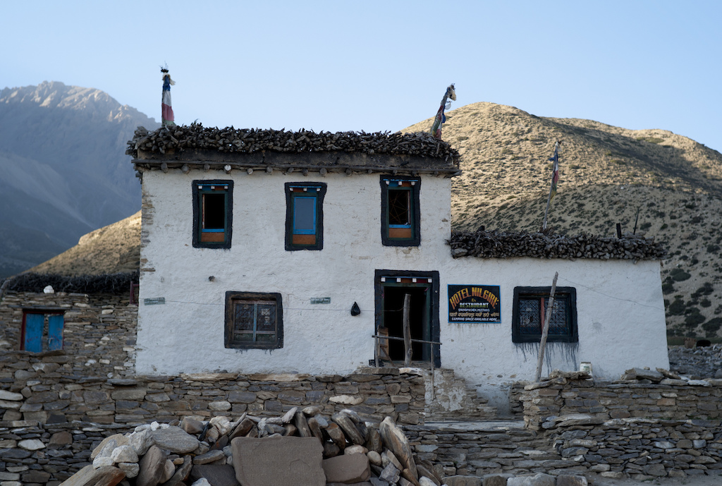 |
| Typical tea house accommodation -this village was just this and two other buildings, but there was no shortage of curry. And it even had beer. Result! |
As the mercury slides towards zero degrees, we seek warmth in the kitchen and watch as our host slaps chappati flat breads into shape and sets about cooking our dinner over a yak-dung fuelled stove. We are instantly handed steaming chai and I am entrusted to hold her baby. Speaking some English, our host explains the intricacies of life out here, in one of the most remote corners of the planet, living in a village reachable only on foot. That one night in Dhakmar becomes the most memorable and rewarding of our 3-week trip.
 |
| Our tea house in Dhakmar sitting below the red rock cliffs. |
Out of the door next morning we head straight into our first climb to the 3820m Mui La (pass). It’s the first of two we will face that day, a long ride that will see us arriving in Lo Manthang by nightfall. By the time we crest the second pass, the 4230m Marang La, and the highest of our ride, I am broken. The pass comes via a series of false summits each of which nearly breaks my spirit. I dig deep inside to find the mental stamina to push onwards and cresting the top, am hit by the sight of the vast Tibetan plateau to the north. Gone are the pointy Annapurnas of the Himalayas to be replaced by a landscape equally as unique and beautiful. And before its sweeping rise sits the red-walled city of Lo Manthang, our destination.
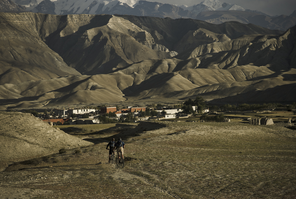 |
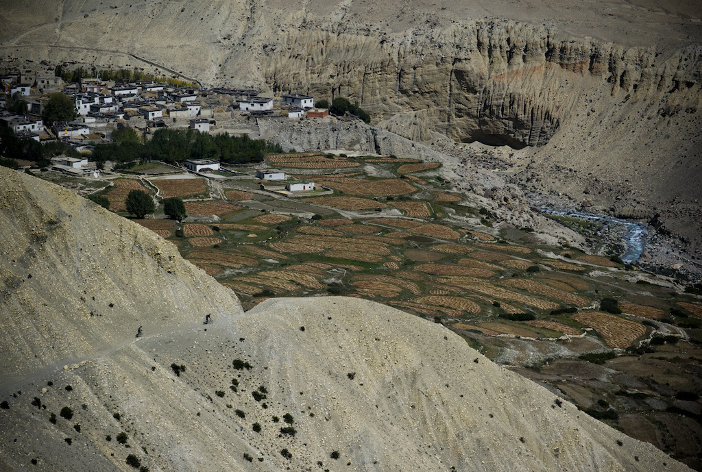
| Rob and Seb roll the last descent towards Lo Manthang. |
We sling legs over bikes again and re-energised by the sight of the 400m, 8 km descent laid out before us, we push off into the void once more.
Rolling into Lo Manthang is a unique experience for us all, and the locals alike. We hop drainage ditches and weave between wandering cows, watched by a hundred grimy faces of kids peering from behind doorways. We roll past Buddhist monks and women bent double under the weight of bundles of animal feed grass. We have been transported back in time and only the occasional Chinese motorbike brings us back to contemporary times.
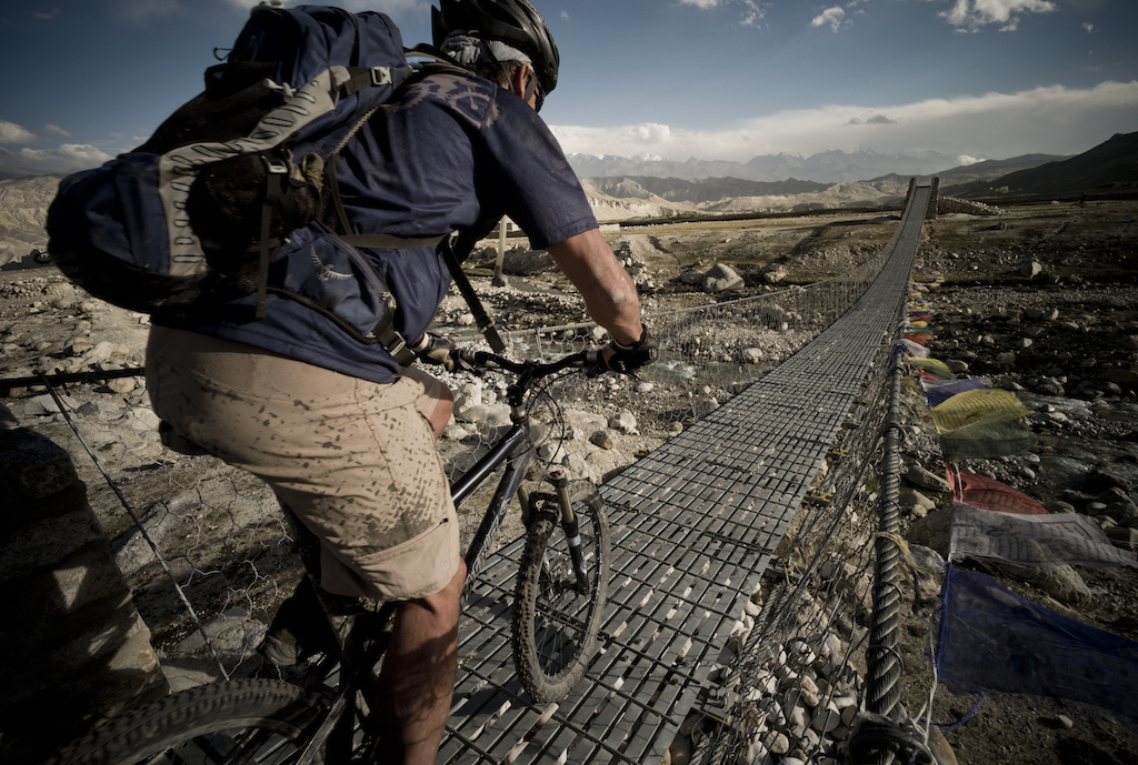 |
| Just keep pedalling -the best way to tackle the swingbridges in the wind. |
We have made it, we have reached our destination. We check into a tea house, down litres of chai and grin profusely at each other. We have ridden one of the world’s most unique and remote trails, and managed to dodge the evils of the road for most of the way. Tomorrow we will ride a loop further north towards the Tibetan border, just for the hell of it. We’ll explore caves that were inhabited a thousand years ago, and we’ll roll back to Lo Manthang destroyed again. And the day after we’ll start to retrace our way back to Kagbeni and beyond, beginning another 10,000 m of climbing and descending. And when we get back to Pokhara we’ll still be smiling from the rewards, the frustrations and challenges of riding bikes in such a place, on such a trail. And we’ll know that no road can ever deliver that.
 |
| Exploring caves north of Lo Manthang we found this wall ride to play on. Not somewhere to let it drift too much though. |
INFO: To enter the Upper Mustang you need a permit, costing £500 for 10 days. Usually this is obtained 3 weeks in advance by a trekking agency in Nepal (Kathmandu or Pokhara). Alternatively ride trails in the Lower Mustang around Kagbeni, for which no permit is needed. Kathmandu is big, noisy and doesn’t warrant a stay more than a couple of days. Fly on to the chilled town of Pokhara (1 hour, £50 o/w) or take a bus (7-9 hours, £5 o/w). Snow arrives in the Mustang after November, but the summer and autumn have warm (20-25 C) days and cooler nights (5 -10 C). Late October starts to drop below freezing at night, so take a sleeping bag to ward off the chill in the unheated tea house bedrooms.
Take essential spares (chain links, cables, spare rear mech and hanger) though you can find some spares in Pokhara at the MTB rental centres. Take sunscreen, headache tablets and a scarf to protect against the dust storms. A katadyn ceramic water filter is key to filling your hydration packs with clean drinking water each day,. There is no bottled water in the Upper Mustang. Maps of the region are available locally in Kathmandu of Pokhara. Trail food can be bought each day.
Contact: Tangi at www.nepalmountainbike.com
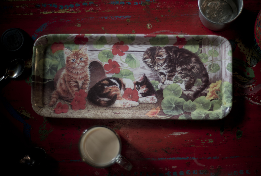 |
| You know the day will go well when you start it with tea served on a tray decorated with pics of kittens. |
Author Info:
Must Read This Week
Sign Up for the Pinkbike Newsletter - All the Biggest, Most Interesting Stories in your Inbox
PB Newsletter Signup
Feel free to read my thoughts on our non biking trip (which was a good thing because riding through 3ft of snow isn't really possible!). www.unclesomebody.com/blog/?m=201303 and www.unclesomebody.com/blog/?m=201304
I can't remember the number of times I thought about how much fun it would be to have a bike on some sections of trail. But I also remember my lungs burning as we hiked over passes above 4,000m!
There's nothing like the milky tea you get in Nepal... Seems like you guys were chugging it by the flask too!
The Annapurna circuit is developing so quickly...there was no road going to Kagbeni in 2004 and apparently a road is planned for people to drive around the entire circuit. I wonder what this area will look like in another 10 years time?
Rock paper scissors is the ultimate decision decider, isn't it?