Biking in Northern Canada: B.C.'s Northern Rockies & the Alaska Highway
This might be one of the longest biking-related stories that you'll read where you have to wade through so many non-biking pictures and text before you get to actual riding. That will be the case because this is a story about exploring a part of what is (in my humble opinion) one of the most beautiful wild regions in the world. Although you can do this by touring bike we wanted to see what Northern British Columbia had to offer for mountain-bikers.
The Inside Passage Ferry gets you halfway there
The first stage of our trip was the rather routine ferry ride from Vancouver to Vancouver Island then a drive up Island to Port Hardy. We then hopped on a BC Ferry to experience the Inside Passage. More information about this 15 hour cruise on one of BC's more famous and scenic waterways can be found here as well as in our more long-winded account of various points of interest on the voyage here. This first leg of our trip ended at Prince Rupert, about halfway up the province. Here we overnighted at the Eagle Bluff B & B - a convenient, comfortable and charming place to stay.
From here you could head east and check out the biking in the towns of Terrace, Smithers and Burns Lake (see the longest road trip story ever written on Pinkbike), but we wanted to get even farther north.
Cool (in a a cheeseball kind of way) Northern Rockies Tourism video
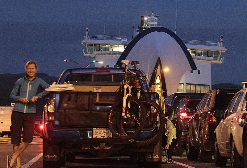
BC Ferries' Northern Expedition gets us on our way at Port Hardy
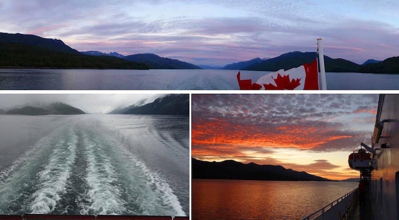
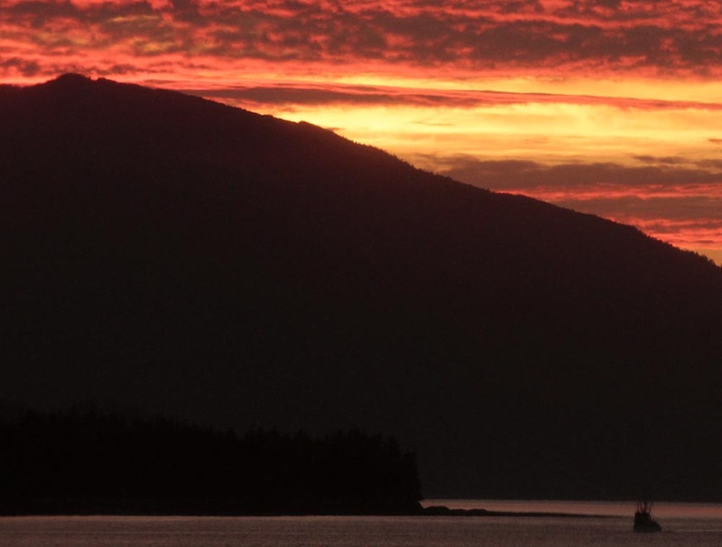
We started our road trip all the way from Vancouver to the North and back to Vancouver by taking the Inside Passage ferry from Northern Vancouver Island (Port Hardy) to Prince Rupert. We got lucky with some fantastic weather and light shows at sunset
The Grenville Channel
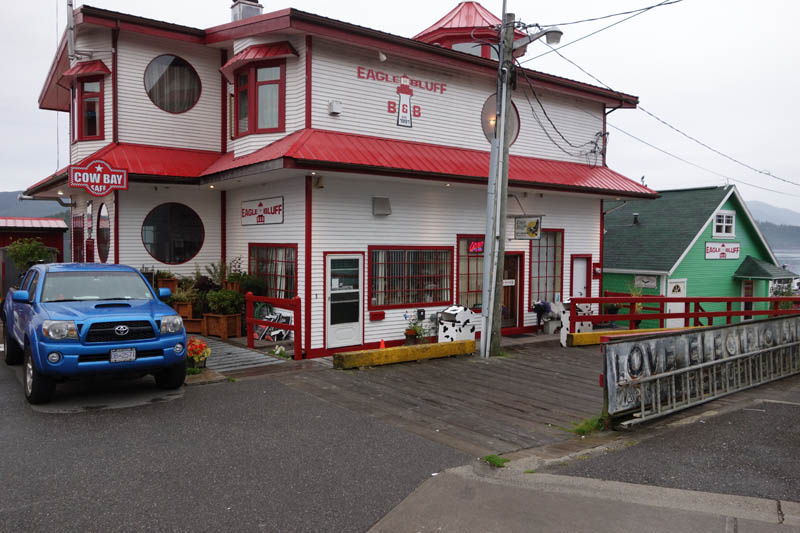
The Eagle Bluff B&B in historic Cow Bay, Prince Rupert. The ferry gets in late at night so you'll need a place to stay.
The Stewart Cassiar Highwaygets you the rest of the way to the North
When you get maps of BC at the AAA or CAA they end the maps at the latitude of Prince George. I like to think it's not because the cartographers are sloppy, but maybe it's because so few people live in such a vast area so maybe they thought no-one would notice. Those AAA/CAA maps actually cover half this vast province as Prince George is actually the centre of BC.
The Stewart Cassiar Highway winds its way through north-west part of the province; the two biggest towns of which are the megacities of Dease Lake (pop. 303) and Stewart (pop 500). Blink and you'll miss them. We've been to Stewart to ski but never further north.
After leaving Prince Rupert we headed North on Stewart-Cassiar which was built in the 1960′s to open mining south of the Alaska Highway in BC. Also known as Highway 37, it starts at Kitwanga/Hwy 16 and ends 725km later at the Alaska Highway. We took an alternate route off Hwy 16 via the Nisga’a Highway to visit the Nisga'a Memorial Lava Bed Park (very historic, well-presented and informative - don't miss it). This road parallels then joins the Stewart Cassiar just before the Meziadin Junction.
Gas is expensive along this route but you can buy it at various stops including Bell 2 Lodge, Iskut and Dease Lake, Good Hope Lake and the Junction with the Alaska Highway. As a cool way to break up the trip and to give ourselves more time to gawk at the incredible scenery we stayed at the Bell2 Lodge. Expect to see a ton of wildlife. Take your time to enjoy the views of Mt Edziza and dip your toe into the Stikine. There's a lot to see on the way but we had some biking to do.
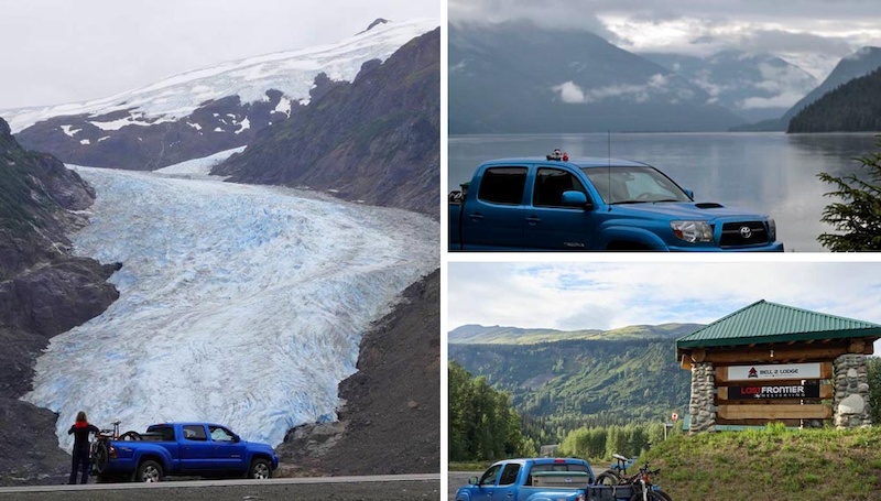
Our road trip continued as we drove the Stewart - Cassiar Highway from Kitwanga northwards. Bear Glacier in Stewart; the mighty Skeena river and the Bell2 Lodge in the middle of nowhere!
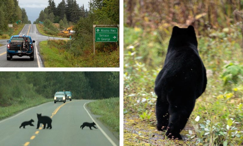
Lots of wildlife on the Stewart - Cassiar highway
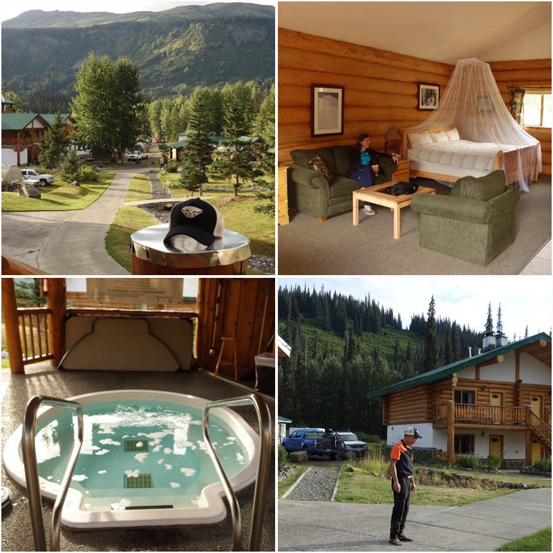
Bell2 Lodge is a touch of luxury in the middle of nowhere
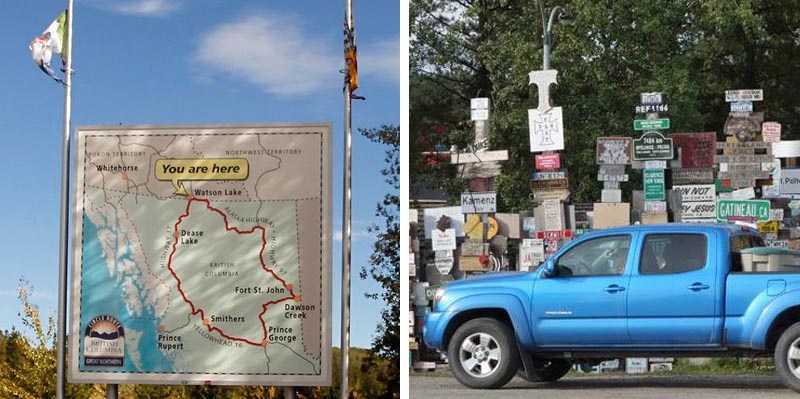
Taken at Watson Lake's signpost forest in the Yukon just before re-entering Northern BC
Northern BC: the Liard Hot Springs''
We actually continued further north ending up at the Yukon-North West Territories border about 1300km further north, but that's already been recounted in part 1 of our story. This is where we finally get to biking but first a bit of history about the Alaska Highway. This 1500 mile road was built in 1942, paid for by the Americans as a logistics and supply route in response to the Japanese bombing of Pearl Harbour to provide a northern driving route to Alaska.
The route between Fairbanks Alaska and Dawson Creek in BC was roughed in in 8 months by 16,000 men. Requiring upgrading ever since it is now mainly used by tourists, the highway is dotted with closed gas stations and a few vestiges of humanity. A cool picture archive of the Highway is here.
From Watson Lake you spend a short amount of time in the Yukon then quickly dive back into BC. You're still way up north so expect to see a ton of wildlife (bison, wolves, goats, and bears all over the place). A logical place to stay is Liard Hotsprings, where we camped. This is BC’s second largest hotspring and a hugely popular stop. At the end of a long boardwalk you will find change rooms, a nice deck and pretty much a hot tub pool. It's a wild gucci experience in the middle of nowhere and pretty much a must-do.
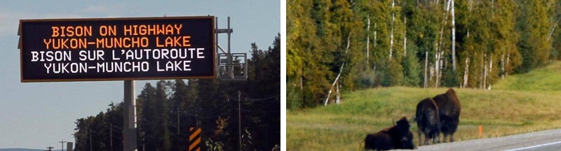
No shortage of wildlife on the Alaska Highway through Northern BC. We stopped at the Liard Hot Springs
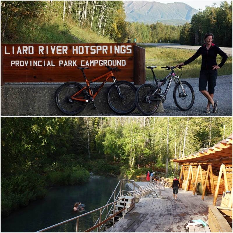
Liard Hot Springs; a popular stop on the Alaska Highway
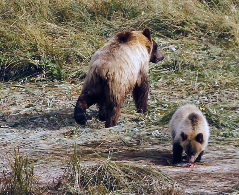
Had to sneak in obligatory grizzly mum and cub shot. This was actually taken in Haines Alaska on another leg of our journey
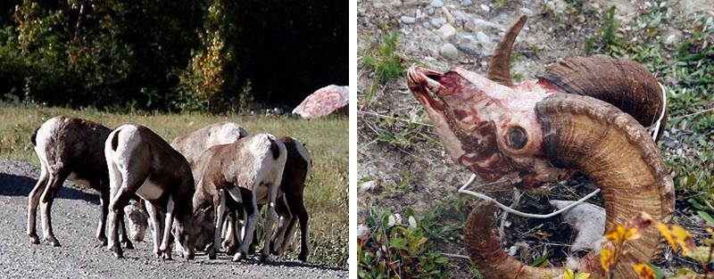
Lots of Alaska Highway wildlife and just as much hunting - goats and big-horn sheep
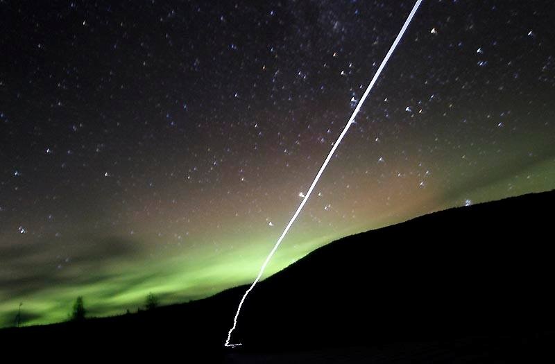
Liard Hot Springs aurora
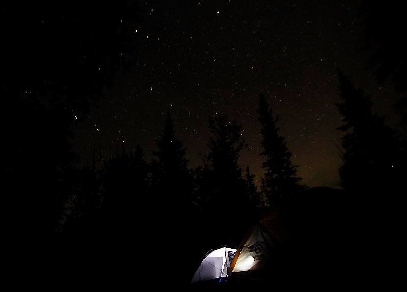
Liard camp
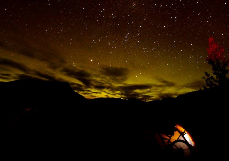
Racing River camp
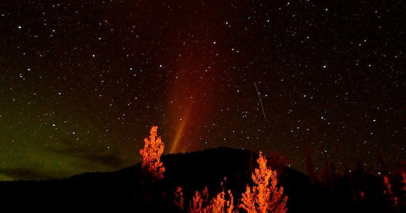
Racing River aurora
Northern BC: finally the biking
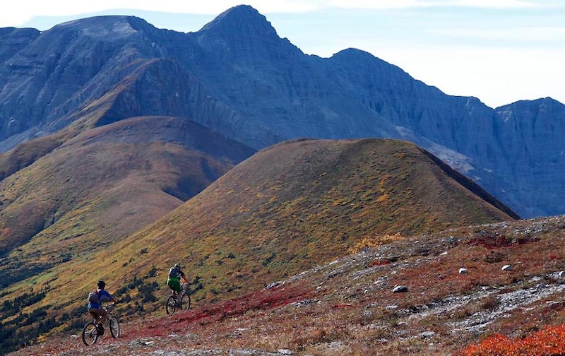
Nonda Ridge
Our destination today was Nonda Ridge, near Fold Mountain in the Northern Rockies approximately 2 hours drive east of the Liard Hot Springs . The closest town is Toad River (at pop 40 the second biggest town in the area), so get your supplies there. At Nonda Ridge we were directly east of Muncho Lake since the Highway bends east past Muncho Lake. Nonda Ridge is more typically associated with motorized access. We found microwave tower roads to give fantastic alpine ridgeline access with treeline at 1600m!
There's no trail here in the traditional sense. Instead we biked a series of ridgelines as an out and back with amazing views of the Northern Rockies on all sides. Truly this is a heck of a place to lose a moose. Since it's an out and back you can go as long or as short as you want; and explore for as long as you'd like.


This land goes on forever
Flower Springs
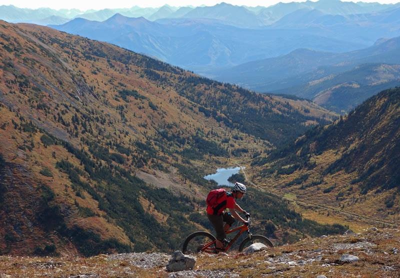
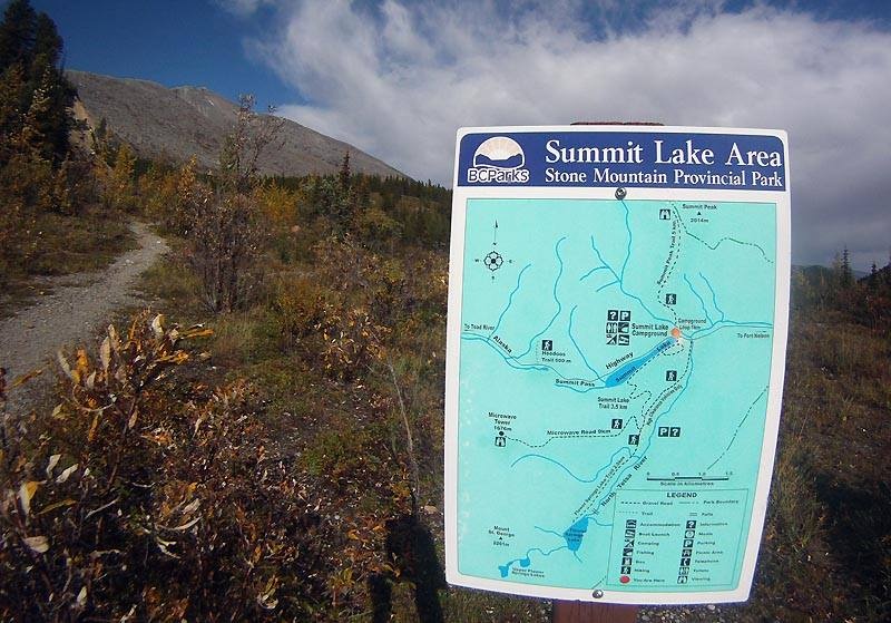
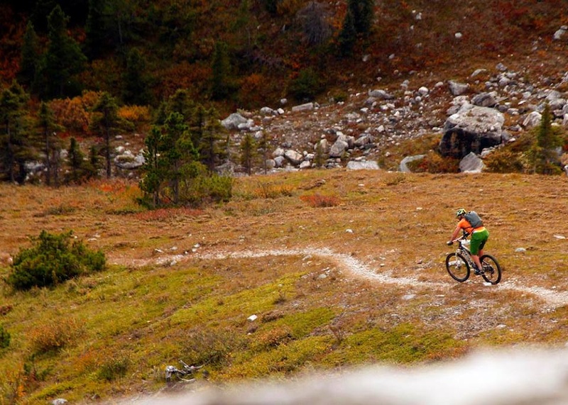
About 3 hours drive east of Nonda Ridge and the metropolis of Toad River Stone Mountain Provincial Park is pretty much the Eastern edge of the Northern Rockies along the Alaska Highway. The park itself is just 140 km west of Fort Nelson, (pop 3900), the largest town in the Northern Rockies. There are 5 trails here, two are rideable and were ridden; Flower Springs and Summit Peak trail (trailhead directions here).
Both trails are out and backs. Flower Springs was actually in full fall colour glory and made for a fantastic technical ride. The approach is on the microwave tower access road and is easy. The remainder of the trail is on technical rock up and down singletrack; difficult to ride on the gentle uphill grade heading to the lake but easy to pedal through on the way back. Flower Springs as a trail itself only gains 230m over approximately 10km so the grade isn't an issue. Even if you detour to Summit Lake's trail and trek back to the parking lot (the lakeshore trail is hike-a-bike) the ride should only take the morning.
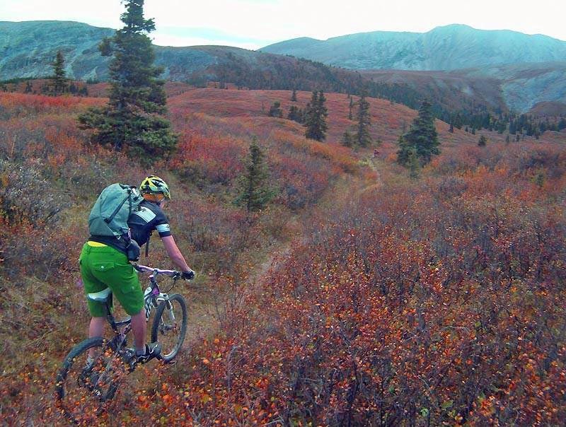


Muskeg and tundra in full fall colours
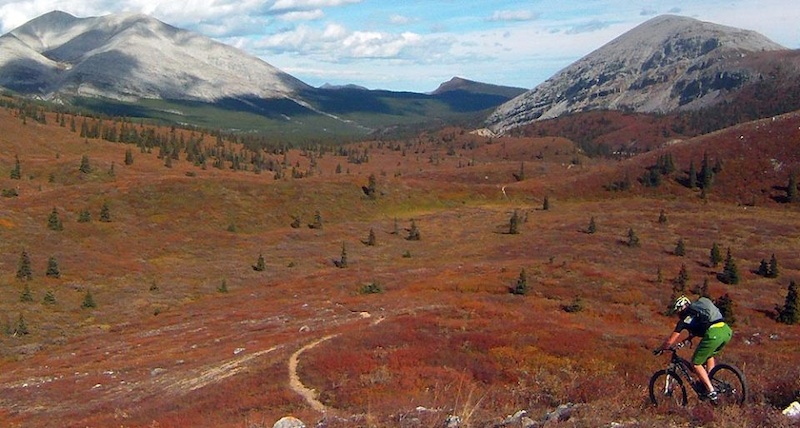
Summit Peak
As is true of interior mountain ranges, afternoon thundershowers are all the rage and the mountains of the Northern Rockies where Stone Mountain Provincial Park is located is no exception. The last bit of our ride from Flower Springs to Summit Peak was spent in a torrential downpour. Then the sun came out and within a half hour it was blisteringly hot and time for us to ride/push up to Summit Peak.
This is another out and back trail. There is a spot where you will crest treeline and it won't take long to get there (our starting point is 1300m and treeline is just at 1450m). After you hit treeline the trail steepens and you'll be dumping your bike to hike up to Summit Peak at 2014m. We elected to dump our bikes after about an hour and a bit of pushing and riding then chilled and took in expansive views. Then it's time for a fast flowing downhill back to the parking lot.


Picking up some passengers on our way back to the Southern Lights of Vancouver
Useful Links
- Tourism Rockies site
- Alaska Highway online guide
- BC Tourism's Fort Nelson site
- BC Ferries Inside Passage microsite
- Bell2Lodge
- Eagle Bluff B & B
42026 views
So much to see and so many places to go ride a bike. Lee, you're not making my life any easier by posting all these great destinations
Some excellent riding in both locations not too far from Prince Rupert 1.5hrs and 3 hrs respectively...
P.S. Check out Copper Mountain in Terrace
There is always the risk of big swells in the ocean. If you are on a boat and its getting rocky, the middle of the boat is the most stable.
Ive been caught in swells. Got sick as a dog.