Photo Story: Horseflies and Heatstroke on Silvercup Ridge

I'll be honest, I had my hopes up that I was going to be able to travel this year. I've never ridden my bike anywhere other than BC and Alberta (and a couple of days in Utah). Just to be clear, I'm not complaining about that but after watching Where the Trails ends repeatedly and drooling over trips that people like Dan Milner have done sometimes I feel like I need to go somewhere. Obviously, that's not happening anytime soon. So in lieu of flying across the world, I decided to check some things off my local "places to ride" list. That's what brought us to Silvercup ridge.
Silvercup ridge is a 40ish kilometer route (details are sparse online) that follows along a ridgeline in the middle of nowhere about 2 hours south of Revelstoke and 2 hours north of Nelson. It sits across the valley from a small operation you may have heard of named Retallack (that's on my "to ride" list as well if anybody wants to send me enough money to go there, thanks in advance). With it being the Thursday before the long weekend and me in a hurry to figure out what to do I asked my good buddy Paul to join me on a two-day ride over this ridge and back to the car. It should only be 60ish kilometers in total including an easy road jaunt so two days would be plenty of time... He was in and the sort of planning that consisted of mostly just winging it and hoping for the best started.

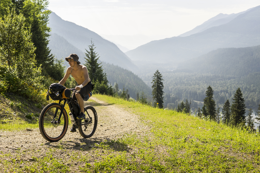
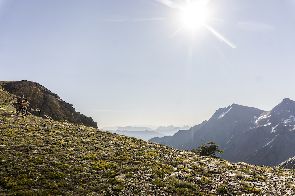
No complaints about the views on the way to the trailhead.
The forecast called for low to mid 30's and clear skies. Normally when it gets to those temperatures I switch over to whitewater kayaking until I deem it reasonable to ride uphill again. This was an exception though seen as how it was a long weekend. We then loaded up the bikes and headed north until the highway turned to dirt and arrived at Gerrard. Gerrard is a ghost town (I didn't see any ghosts or towns though) at the south end of Trout Lake. Home to the aptly named Gerrard trout, a species of rainbow that get very, very big. We parked here and then started to peddle up our first climb.

Shirts on didn't last long since even though it was only 8:30 it was hot. Also, there's supposed to be caribou around here.
We kept telling ourselves the alpine wouldn't be as hot.


Mandatory "candid" "Oh, look over there" shot, definitely not just trying to look cooler than we are.
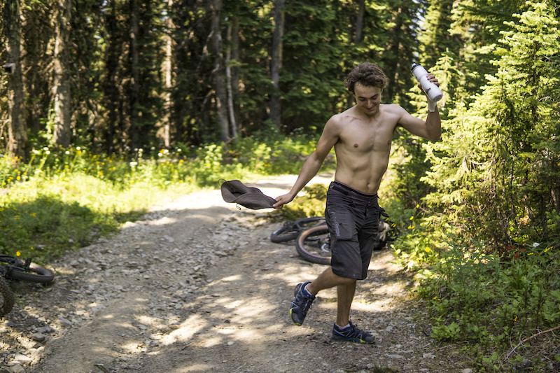
This climb was not to be underestimated. This would be, by far, the most elevation gain I have ever done in one single up. We started near the lake at a lowly 750m and started to peddle up the road to the first descent at an altitude of 2268. This road goes up, and only up, for 1518m. This plus the heat made for an interesting ride up. As a bonus too, once we got about a third of the way, the horseflies came, with a vengeance. I've never seen horseflies this big and in this number. When swatted it took force to squash them. and for everyone done in, two or three more would show. It got to the point that we even threw our shirts back on despite the temperature hitting the mid 30's now as we approached lunch. In fact, it was so bad we made the decision to set up the tent for lunch to give us a reprise from the constant bombardment. Even with the tent up these desperate mothers would dive bomb us and make an audible thump against the mesh of the tent.
0% Loaded
1/6
The Dance of the Horsefly
With lunch over and us having to leave the safety of the tent to carry on an ATV'er who had passed us on the way up stopped for a chat. We asked him how much farther we had until we broke into the alpine. He kindly informed us we were maybe under 1.5k away. He then told us to watch out since at the top of the road we were on, 1.5k away he had just spotted 3 grizzly bears. Not ideal, but we had the comfort of knowing that they ran away when they saw his loud and large ATV and we had one full can of expired bear spray.

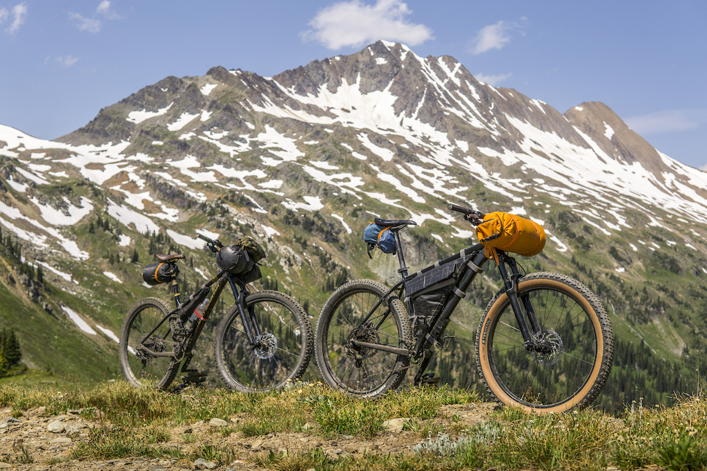
Topping out we were rewarded with quite a view...
...and our first downhill...
...and a chance to cool down.
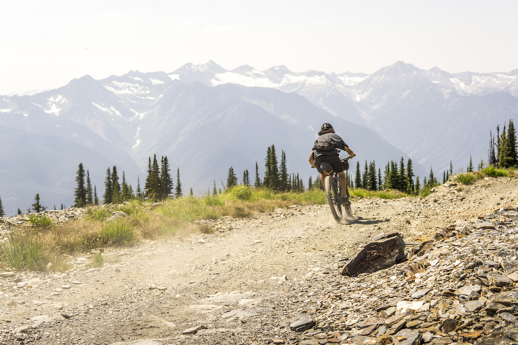
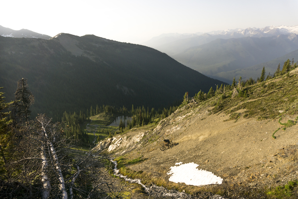
Now I know some of you are looking at the pictures of us riding down a gravel road and maybe thinking, lame. Normally I would be with you. I generally see gravel roads as something to put up with until I'm at the top of my fun singletrack. This road, on the other hand, is different. There are not many places you can ride a bike that I can think of where you look to the left and see glaciers, to the right and see glaciers. Plus we knew that coming up we might find some pristine alpine singletrack so that helped keep us going. By this point though we were feeling the heat. The alpine was not offering up any sort of break in temperature and this was taking its toll.
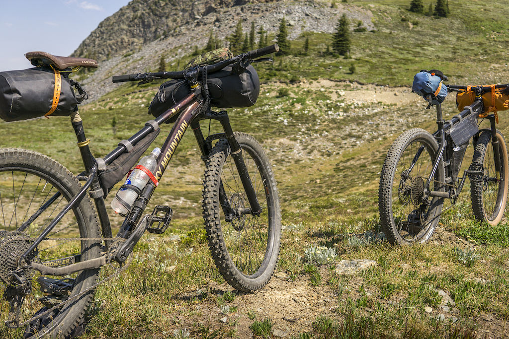
For those wondering the tool of choice for this trip was the Rocky Mountain Growler with Paul on last years plus version and me on this years updated aggressive fast 29er version.
We carried on pushing and occasionally riding up.

One unique thing about this area is that it's open to motorized vehicles in the summer. We were a little worried about having constant moto traffic but even though it was the long weekend all we saw was this group of rad trials riders. Also, I thought that with the motorized traffic there would be more signs of people but I didn't see even a speck of garbage the whole time.

Don't worry, the bottom bracket and hubs were already hurting after the last trip I took on this bike
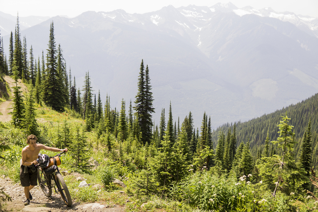
We were now 6 and a half hours in and things started to get interesting. The nice albeit steep doubletrack quickly turned into singletrack and then promptly vanished. I sort of had an idea that the trail disappeared for part of this route and we found out where. Luckily, or so we thought, the map we were following had a line showing where to go. As we followed it we hit a point where our bike packing trip turned into what we jokingly called "Bike Mountaineering". Below us was a no fall zone cliff and above us was the same. So we were forced to find another route. This had us pushing up the way we had just ridden down and then finally scrambling up a scree slope higher into the alpine to a ridgeline we thought we would be able to follow to our planned campsite.

This was taken moments before...

...the trail ended and the real adventure began

This part was fun on the way down but when we had to turn around not so much.
Once we gained the ridge things got very interesting. Our forecast for clear skies ended fast. The storm clouds started rolling in and we could hear the thunder coming from down the valley. We had to make an executive decision. The ridgeline would take us at least an hour and put us up above 2500m with no cover so the decision was obvious. We had to turn back and head for the lower ground where we would be safe. We dropped in on a gnarly scree line that took us quickly back down to a creek where we set up our tent just in time for the rain to start coming down. Seeing the lighting strike the nearby ridge gave us confidence that despite cutting our trip short, we made the right call. We later found out this storm caused a few fires in the area from lightning strikes.

Sorry for the potato phone photo but we weren't keen on sticking around up here for a photoshoot.
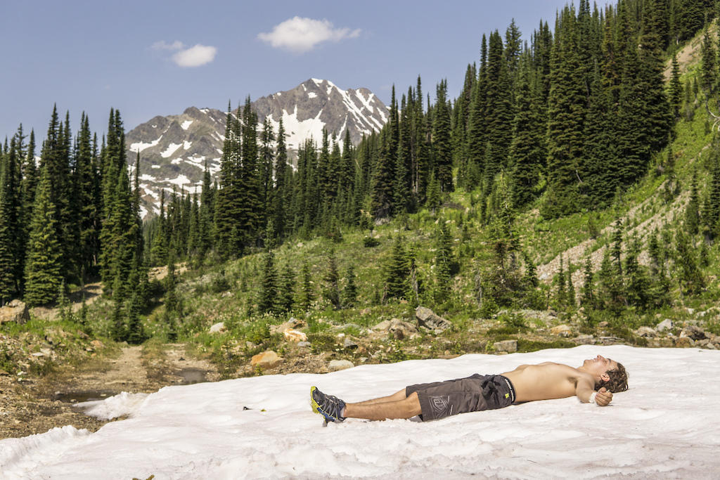
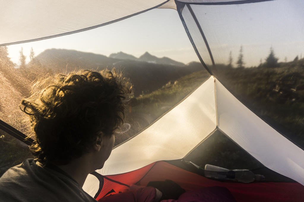
The next morning we woke up to a calm clear sky if you don't count clouds of mosquitoes. In a way though being forced to turn around was for the best. Not only because of lightning but because by that time we were both starting to feel a little bit of heatstroke and weariness from the constant sun on the way up to here. Also, we realized we may have underestimated the route. 40km doesn't sound like a lot but the difficulty of the terrain would have meant it would have been a real push for us to get it done in a reasonable time. We were a little disappointed in not being able to complete our goal but we also happened to be camped in an area surrounded by beautiful mountains and scree slopes. So in order to cheer ourselves up, we decided to dome some freeriding or screeriding.
Not a bad view to wake up to.

I've dreamt of riding stuff like this for a while. Thankfully this year's Growler turned out to be pretty much the perfect bike for it.

We didn't have to stray far from camp to shred.
After packing up camp we set out sights on one more goal. From our camp, we eyed up a nice little peak to summit and then ride down over 2000m back the way we came. Not the original plan but not a bad plan either. And even though we had to push the bikes uphill again, the views and the riding were well worth it.

The goal glowing in the morning light

The hike a bike would have been worth it even just for the view.

But the riding made it worth even more.

It's not often you get to go down stuff like this on a bike.
Or ride with views like this.
After our alpine fun riding, we hill bombed down the heinous dirt road we rode up just the day before. Our hopes and maybe overly ambitious plans to ride Silvercup in a couple of days were dashed but after seeing what we saw and doing what we did we still left feeling fulfilled. 360-degree views of towering mountains, glaciers, icefields and amazing riding made it worth the heatstroke, horseflies, mosquitos, hike-a-bikes and paranoia knowing we were a little high up there in a lightning storm. In the end, though it all worked out and we still got to do what we all love about this sport, exploring and having fun on our bikes.
Even when things aren't going your way, there's still good times to be had.
Thanks to Rocky Mountain for helping me get some sweet bikes to ride. If you want to see more photos of this trip and others you can find me here https://www.instagram.com/gravity_candy/?hl=en
Author Info:
 Member since Sep 14, 2015
Must Read This Week
How to Watch the 2024 Mountain Bike World Cup [Update: Staylive Offering Access in New Zealand, South Africa & More]
60351 views
60351 views
[UPDATED] Final Elite XC Results & Overall Standings from the Mairiporã XC World Cup 2024
41253 views
41253 views
Sign Up for the Pinkbike Newsletter - All the Biggest, Most Interesting Stories in your Inbox
PB Newsletter Signup
connect.garmin.com/modern/activity/2917145766
We did it north to south, but bike-packing I would do it the other direction. Beautiful country. Not too many moto-users.