Stories posted under Pinkbike Community blogs are not edited, vetted, or approved by the Pinkbike editorial team. These are stories from Pinkbike users.
If a blog post is offensive or violates the Terms of Services, please report the blog to Community moderators.
PNW Trail Elevation Chart - Seattle/I-90 Corridor
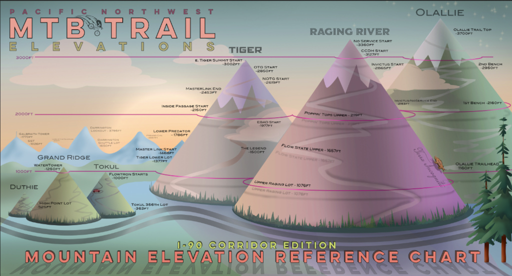
The idea here is that this graphic shows the elevation of some popular areas and trails along the I-90/Seattle Corridor. If you know the current snow-level, you can reference this handy chart to see if your favorite trail might be snow-free. Or maybe you just want to see the comparative elevations of these trail systems. Or perhaps you just want a picture to cover up a hole you smashed in the wall of your garage because you were so frustrated that you couldn’t go riding due to work/weather/Covid.
With the help of Emily Przybelinski, we were able to line up matching donations for the sale of each print. So far we've raised over $3000 for EMBA.
The prints can be purchased here - all profits go directly to EMBA: https://mtbprintshop.threadless.com/designs/pnw-i-90-elevation-map-print-emba-benefit/home/fine-art-print
I'm sharing this in hopes that it'll encourage folks in other regions to come up with novel ways of raising money for their local trail organizations.
-Scott Musgrove
www.scottmusgrove.com
Author Info:

 Member since Jan 21, 2019
Must Read This Week
Sign Up for the Pinkbike Newsletter - All the Biggest, Most Interesting Stories in your Inbox
PB Newsletter Signup
0 Comments
Login or Sign Up