
Video player is disabled while the embed window is open.
Copy and paste the HTML code below:
Color:
Size: X
|
| |
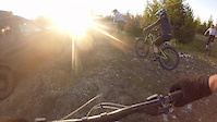
Bella Coola Mountain Biking
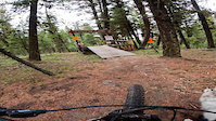
A full edit of a couple of trails I have found around Bella Coola thus far with my dog Hova. Big thanks to Wes, the trail builder for making such an awesome trail in this small comunity.

830
Views
4
Comments
3
Favs
Video info
- Date Posted
- Jul 17, 2012 at 23:53Jul 17, 2012
- Category
- XC
- Location
-
Bella Coola, British Columbia, Canada

The first trail comes off of the Medby rock lookout trail:
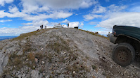
MEDBY ROCK LOOKOUT
Length: 2 km
Elevation gain: 500 m
Difficulty: moderate
How to get there: Cross the bridge over the Nusatsum River about 3.3 km. east of Saloompt Road on Highway 20 (22.8 km from Bella Coola). Drive 100m past the hairpin corner to a large parking area on the west side of the highway. The trailhead is the East Nusatsum Forest Service Road on the other side of the highway. A sign marks the start.
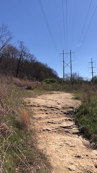
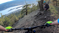
Description: This trail leads to the site of an old forest fire lookout so you can bet the view is panoramic. The trail starts along the main logging road for about 300 m then veers left onto a branch road. Follow this for another 300m to the top of the hill and across the flats. Then follow ribbons to the right as a smaller road eventually turns into a trail near a small creek. I cut out the rest of the directions cause here is where the bike trail starts. Instead up heading up along the creek you go right down along the creek. You'll cross a cool log bridge across the creek then its all fun to the bottom. Crosses the logging road futher down just above the Y, it was marked with ribbon and rocks before so keep an eye out for them. The trail ends right by the bridge on the highway a few hundred meters from the highway turn off.
The other trail is a little harder to find the top of but well worth it if you can find it. The google map bit are from this trail.
- Turn right at the Y on the logging road and follow the logging road up the steep logging road.
- It plateaus and you keep following it for a few kms.
- The trail does cross the road up here. Theres a Canadain flag on the uphill side and a carved wooden sign thing on the downhill.
- To get to the top of this section theres a little fairly grown over quad road on the lefthand side of the road you have to take and follow up for a about 2-3 kms. There are a few little bridges across some small creeks and arrows carved into some of them. Theres some ribbon at the top and the trail clearly headed down from there.
check this video www.pinkbike.com/video/277290 to get an idea of the trail.
Hope this helps!