Hurtin' for Vert 2012 - Part 4 of 4
Images by Dave Silver (unless otherwise noted)
Video by Wade Simmons
Words by Tyler Maine
Day Four: Chopaka
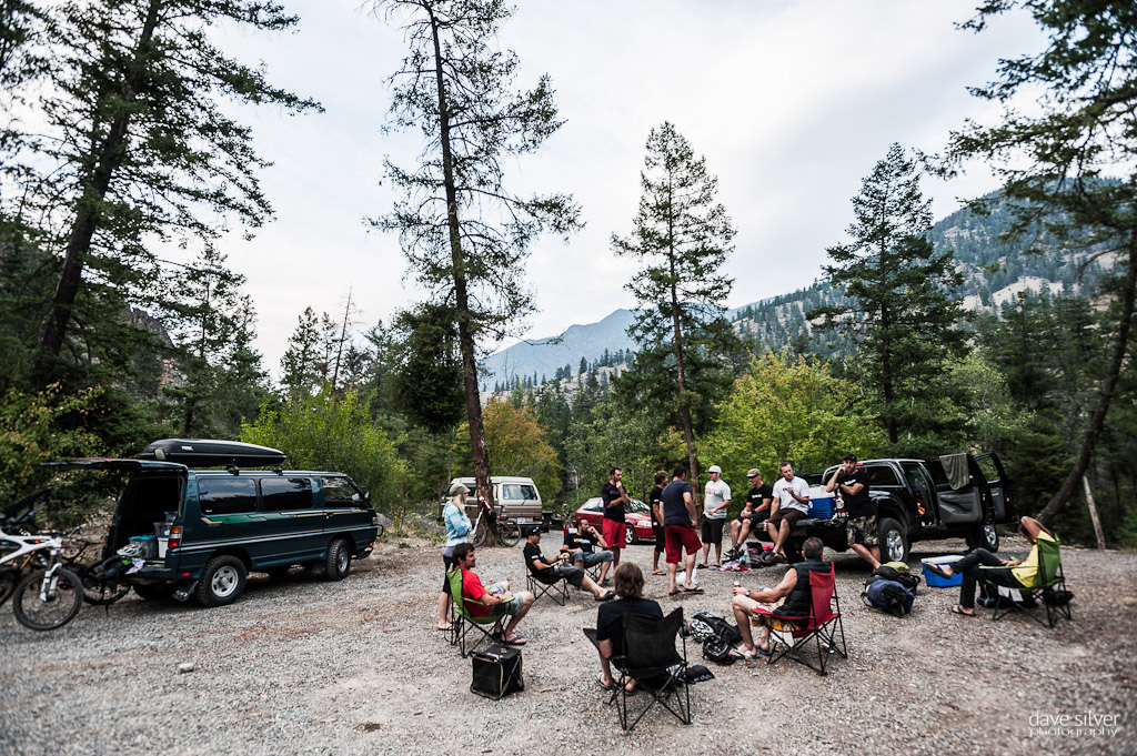
They say you save the best for last and that was our day four experience for sure. Huge climbs, vast alpine, bigger descents and hours in the saddle, all with Smoke at the lead and everyone else charging along. We were headed into Chopaka (aka Bigfoot ) territory and we'd need an escort through the Lower Similkameen Indian Band's lands to get to the trail head where we wanted to begin our ride. The Watchmen (those who oversee the territory ) met us in the morning and would spend close to two hours getting us up out of the valley near Keremeos and way back into the hills, and the first part of the journey was on the scariest road I've been on in years, maybe ever. If we'd had to back back down, all of us passengers would have unloaded bikes and ridden out, it was one of those "you had to be there scenarios," but trust me when I say, 'I was happy to get out of the van and start the ride for more reasons than riding alone'.
The area's beauty was amazing to say the least and it's been a while since I've felt that "away" from it all on a bike ride. Vastness for as far as you could see in any direction, a real outdoorsman kinda place. Prior to the ride, Smoke told us that he and two friends had done this traverse a few years prior and had only ever heard of two others making this trek, so he figured we were the third group on bikes to ever be in the area. There would be some hunting camps that we'd pass through as sheep season had opened the day before and this was their area. So much good adventure lay ahead.
The riding to hiking mix during the first part of our day was leaning pretty heavy to the hiking side with lots of times where you were shouldering your bike up the steeper sections. Our first taste of alpine riding may have been short, but the area was so rad and the cabin where we stopped to regroup offered the perfect place to shoot our Rider Profile shots.
From the cabin we'd remount (temporarily) our bikes and begin to make our way even higher through a notch in the alpine. The goal was to find Joe Lake and have lunch there in and amongst some hunting campsites that use the area as their base during hunting season. The last (and only other time) Smoke was up here they passed right by the lake by curling to the right of the notch as they crested, but Google Earth showed that they had just missed a lake and on this trip we'd seek it out.
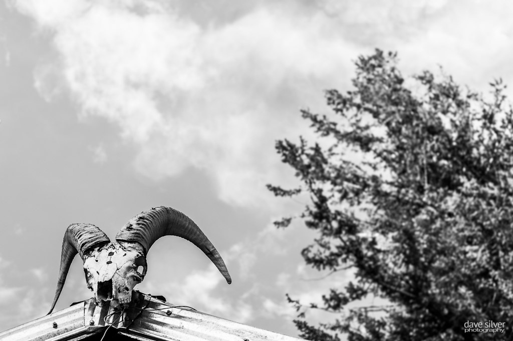
From Joe Lake we'd have to climb a bit and then begin the long traverse via game and hunting trails as we made our way to the Centennial Trail. This is where we'd experience some of the best riding of the whole trip as we pinned it through the alpine on our way to a lookout (Wilderness Research Project Cabins) on South Slope above Ewart Creek.
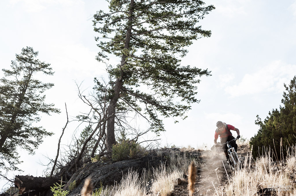
Day four was weighing heavy on our legs, but everyone couldn't help but be pumped on the trails, the friends and the amazing weather that was all in our favor on that final day. I kept my thin wool base layer on all day, but alternated with my jersey depending on the sun to cloud cover. Our bikes held up to the constant pounding they were taking on non mountain bike trails and it was really a treat to be on such advanced toys - really we are fortunate to be doing what we all do and being able to participate in this amazing sport. Day four was making us all appreciate the finer things a little bit more. My trip highlight came on this descent to the South Slope look out when Simmons was insistent upon having me lead him through the next section of trail as he wanted to Contour it. I was totally scared to have Wade behind me and filming none the less, but I gave it my all to keep the bike upright and moving forwards. Turns out that, that two minutes was the best wide-open riding I'd experience on the whole trip and Wade captured it all on his camera - thanks buddy!
Wade chasing Tyler through the open grasslands
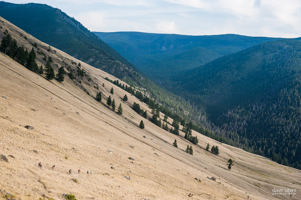
Not wanting to sit around for too long and have our bodies cool off, we made the last stop a quick one as we were still a long ways from the end of today's trail, but the ground would get covered fast as it was pretty much all downhill from here. Just over 750 meters of vertical in around four kilometers, kinda downhill and it was loose and littered with rocks, yes the South Slope was actually a pretty technical descent this late in the day, but it was the most scenic one with the golden light shining hard on it. From the tree line we'd descent to Ewart Creek and follow is all the way back to our campsite from the previous night and where all our vehicles were waiting. We were out there pretty much all day, covered 30 kilometers and descended over 7700 feet, you could say that the crew had earned a cold Pilsner back at camp.
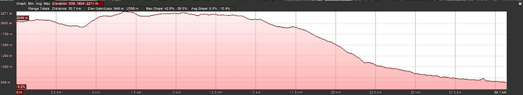
Chopaka - 30.7kilometers traveled, 3110 feet gained and 7736 feet lost
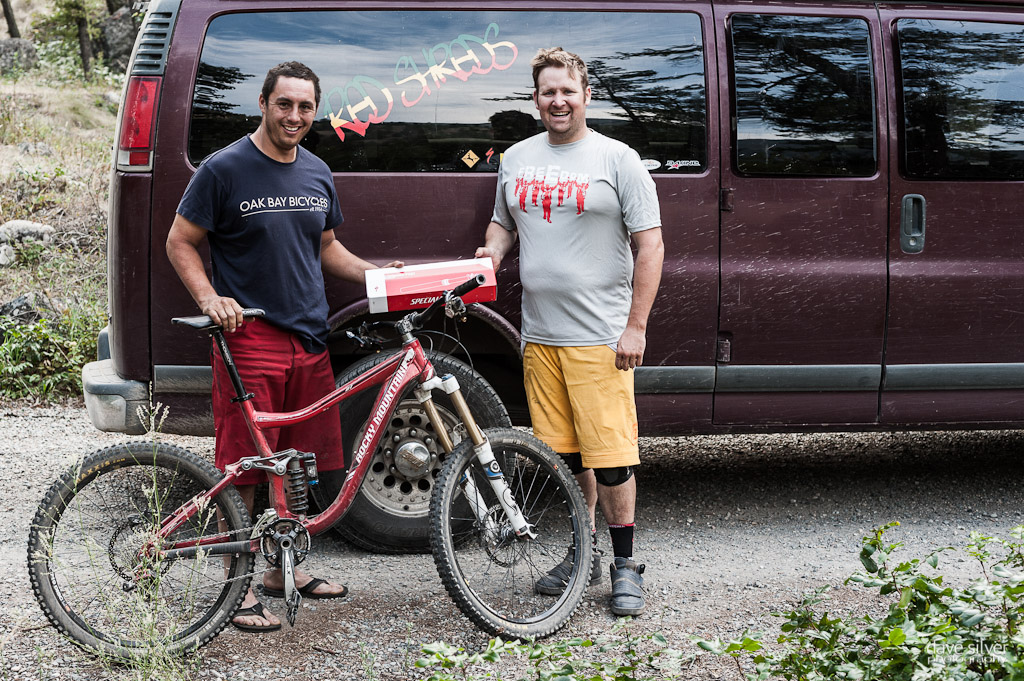
Trips like Pinkbike's Hurtin' for Vert can't happen without a great group of riders and an equally amazing support group like Specialized Bikes, Bush Pilot Biking, Rocky Mountain Bikes, Pilsner and Pinkbike.com. Thanks a ton for your support in making this year's adventure all time, we all appreciated it.
Extra thanks to our drivers today Kim and the Watchmen of the Lower Similkameen Indian Band.
Stay tuned for the official 2012 Hurtin' for Vert Video from Connor McLeod and a full stats round up, coming soon.
Video by Wade Simmons
Words by Tyler Maine
Day Four: Chopaka
They say you save the best for last and that was our day four experience for sure. Huge climbs, vast alpine, bigger descents and hours in the saddle, all with Smoke at the lead and everyone else charging along. We were headed into Chopaka (aka Bigfoot ) territory and we'd need an escort through the Lower Similkameen Indian Band's lands to get to the trail head where we wanted to begin our ride. The Watchmen (those who oversee the territory ) met us in the morning and would spend close to two hours getting us up out of the valley near Keremeos and way back into the hills, and the first part of the journey was on the scariest road I've been on in years, maybe ever. If we'd had to back back down, all of us passengers would have unloaded bikes and ridden out, it was one of those "you had to be there scenarios," but trust me when I say, 'I was happy to get out of the van and start the ride for more reasons than riding alone'.
The area's beauty was amazing to say the least and it's been a while since I've felt that "away" from it all on a bike ride. Vastness for as far as you could see in any direction, a real outdoorsman kinda place. Prior to the ride, Smoke told us that he and two friends had done this traverse a few years prior and had only ever heard of two others making this trek, so he figured we were the third group on bikes to ever be in the area. There would be some hunting camps that we'd pass through as sheep season had opened the day before and this was their area. So much good adventure lay ahead.
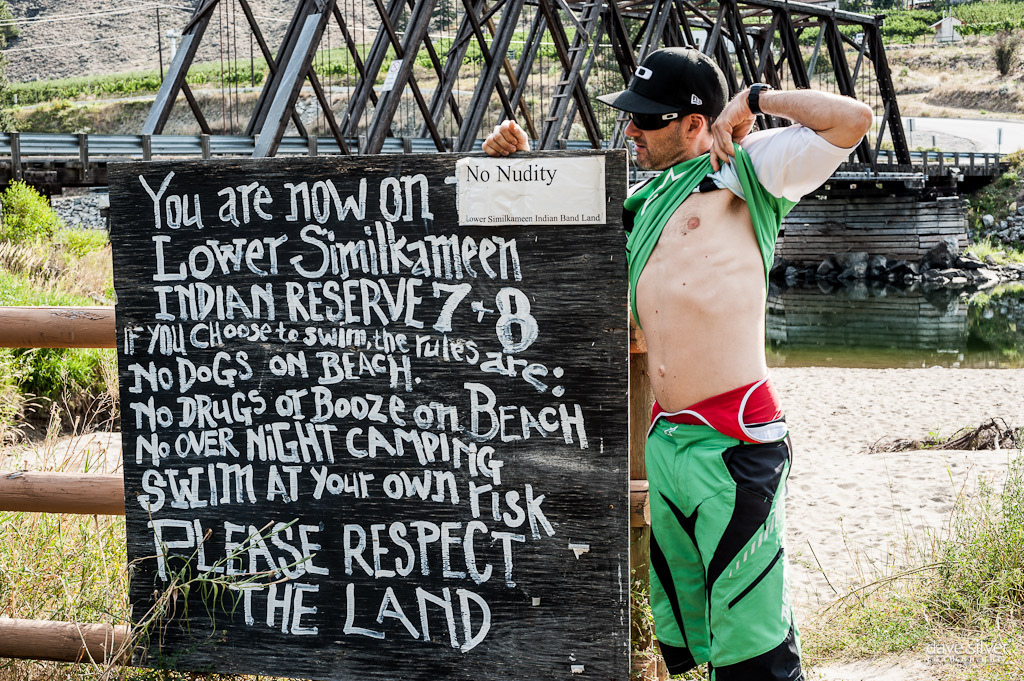 |
 He's built more like a hairless cat, so everyone turned a blind eye at this nudity. He's built more like a hairless cat, so everyone turned a blind eye at this nudity. |
 |
| We had arrangements to get an escort via the Watchmen across their territory - Lower Similkameen Indian Reserve seven and eight, so we didn't want to be late. This was a perfect time to take in the morning light and watch the riders from the Penticton Ironman ride by - if they only knew what they were missing out on. |
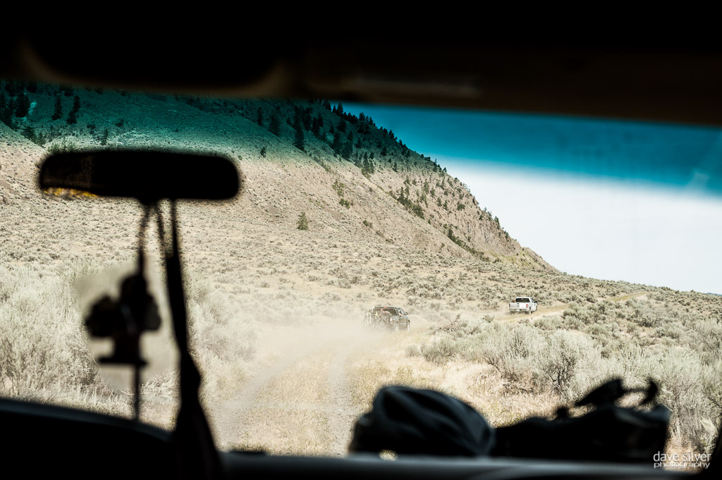 |
| The Watchmen would lead us for over 90 minutes up and back into their area. This was the scariest road as it climbed up the face of the mountains you see in the distance. |
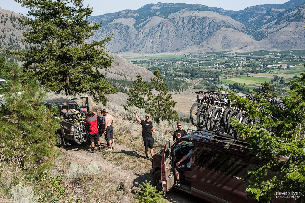 |
| Quick pee and breather break for everyone that was cramped up and scared inside a vehicle. |
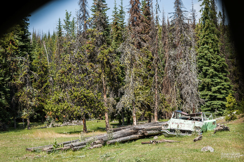 |
| That old car didn't fare too well back in the day, but it's new life as a target has worked out well for it. |
 |
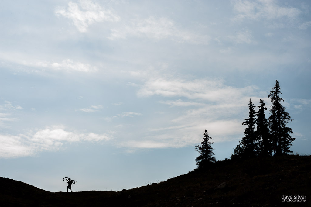
| From the drop-off point, it was a mellow climb into the Alpine, and then a fast descent before our laborious hike-a-bike up into the distant alpine area visible in this image. |
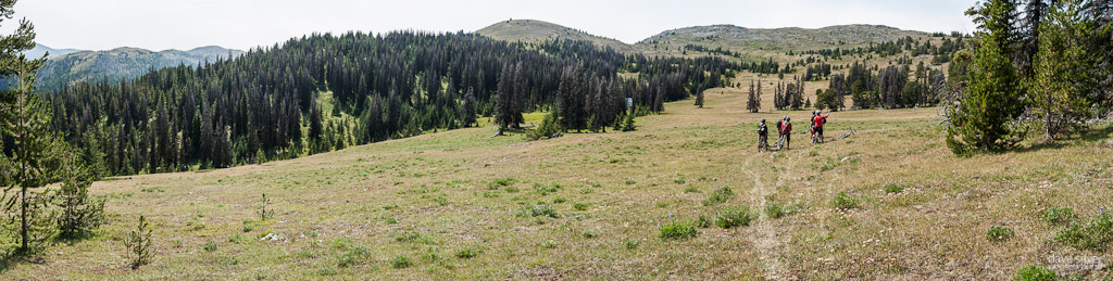 |
| As we hiked for about an hour, this was the view we were greeted with as we emerged from the woods - not too bad, hey? |
The riding to hiking mix during the first part of our day was leaning pretty heavy to the hiking side with lots of times where you were shouldering your bike up the steeper sections. Our first taste of alpine riding may have been short, but the area was so rad and the cabin where we stopped to regroup offered the perfect place to shoot our Rider Profile shots.
From the cabin we'd remount (temporarily) our bikes and begin to make our way even higher through a notch in the alpine. The goal was to find Joe Lake and have lunch there in and amongst some hunting campsites that use the area as their base during hunting season. The last (and only other time) Smoke was up here they passed right by the lake by curling to the right of the notch as they crested, but Google Earth showed that they had just missed a lake and on this trip we'd seek it out.
 |
| This is actually the second hike-a-bike, the first was up to the cabin in which we shot all of our portraits for the Rider's Article from a few days ago. The cabin stop was a chance to eat twizzlers and home made energy balls (thanks to Kurt's wife) and then it was all uphill again. |
 |
| Ahh a summit, one of a few we'd crest today. |
 |
| Woods gets to point it down through an open meadow on his way to the lunch stop and beauty lake break. |
 |
| This little hidden gem of a lake was a welcome find after two big hike-a-bike sections. -Photo by Smoke |
From Joe Lake we'd have to climb a bit and then begin the long traverse via game and hunting trails as we made our way to the Centennial Trail. This is where we'd experience some of the best riding of the whole trip as we pinned it through the alpine on our way to a lookout (Wilderness Research Project Cabins) on South Slope above Ewart Creek.
Day four was weighing heavy on our legs, but everyone couldn't help but be pumped on the trails, the friends and the amazing weather that was all in our favor on that final day. I kept my thin wool base layer on all day, but alternated with my jersey depending on the sun to cloud cover. Our bikes held up to the constant pounding they were taking on non mountain bike trails and it was really a treat to be on such advanced toys - really we are fortunate to be doing what we all do and being able to participate in this amazing sport. Day four was making us all appreciate the finer things a little bit more. My trip highlight came on this descent to the South Slope look out when Simmons was insistent upon having me lead him through the next section of trail as he wanted to Contour it. I was totally scared to have Wade behind me and filming none the less, but I gave it my all to keep the bike upright and moving forwards. Turns out that, that two minutes was the best wide-open riding I'd experience on the whole trip and Wade captured it all on his camera - thanks buddy!
 |
| We weren't the only ones up in the hills as it was opening weekend for Sheep Hunting season. Thankfully we saved some bright kits for the last day. This guy said we were a pretty ambitious crew to be up there on bikes. I think he's right. |
 |
| It may look really good, but this was pretty tough going as it was an animal trail and littered with rocks, thankfully the views kept you pulling forward. |
 |
| Quick stop to take in the views... |
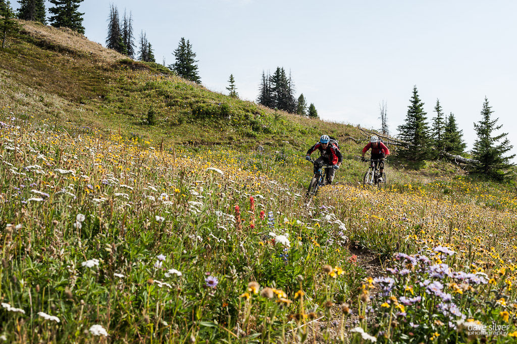 |
| And smell the flowers. |
 |
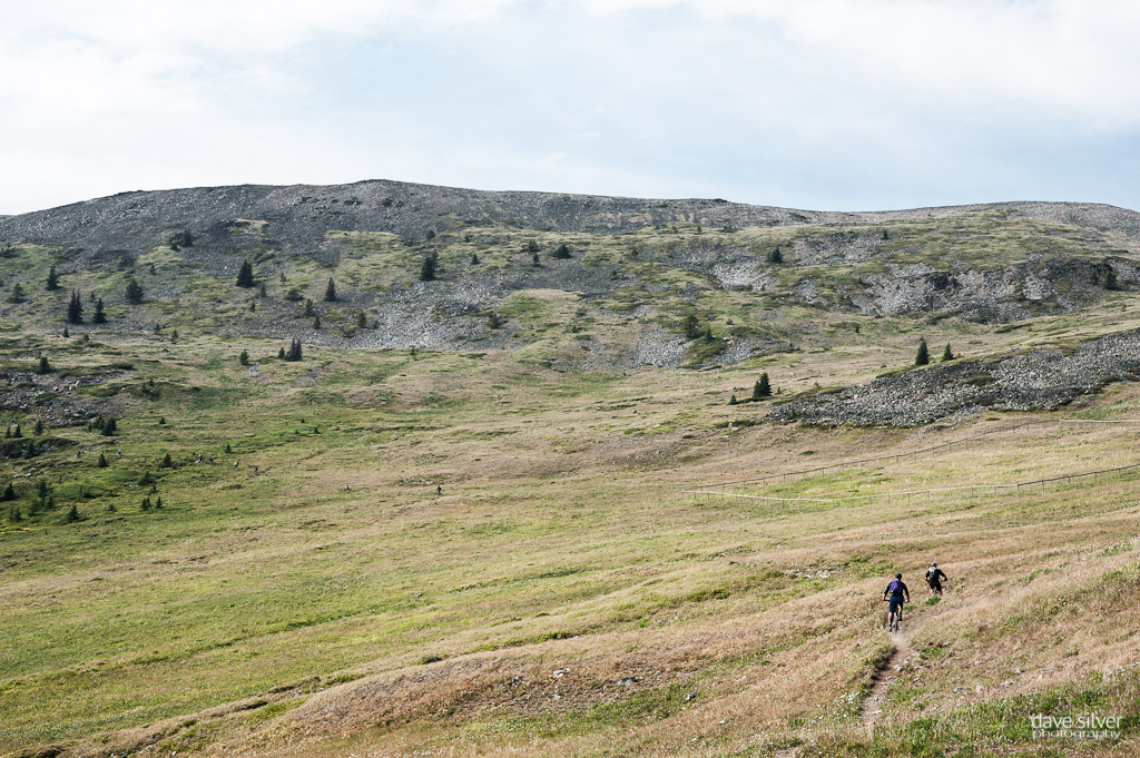
| The mountains and game trails seem to go on forever out there. We were about one to two miles north of the USA border through out much of our day. |
 |
| Oh and then it got good, really, really good! |

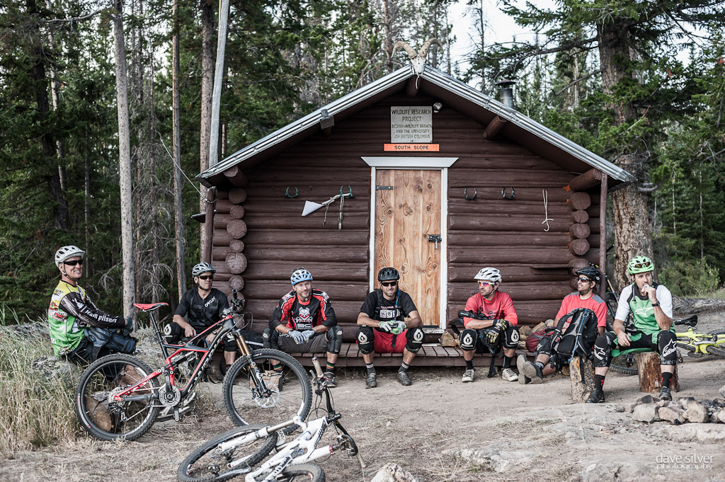 |
| After what was arguably the best sections of trail for the day, we were offered a nice place to take a moment and the surroundings at this Wildlife Research Project outpost station. |
 |
Not wanting to sit around for too long and have our bodies cool off, we made the last stop a quick one as we were still a long ways from the end of today's trail, but the ground would get covered fast as it was pretty much all downhill from here. Just over 750 meters of vertical in around four kilometers, kinda downhill and it was loose and littered with rocks, yes the South Slope was actually a pretty technical descent this late in the day, but it was the most scenic one with the golden light shining hard on it. From the tree line we'd descent to Ewart Creek and follow is all the way back to our campsite from the previous night and where all our vehicles were waiting. We were out there pretty much all day, covered 30 kilometers and descended over 7700 feet, you could say that the crew had earned a cold Pilsner back at camp.
 |
| No rest for the wicked though, and from where we were, the trail still keeps on going down - way down. |
 |
| This section was actually one of the hardest as we were all tired and it too was littered with baby head rocks through out. It went on for ten-plus minutes and the views continued to amaze us - wonder if this zone is skiable in the winter? |
 |
| Over 30 kilometers and several hours later we were back at our camp spot recounting the events of the past four days. So many good times out there Hurtin' for Vert. |
 |
| At the end of four days, we presented Brant with a Specialized Command Post for being the only one out there without an adjustable post - he had to earn it, but he was pumped to have one now too. |
 |
| Sweat and dust make even my white legs look darker. What a great trip and we're all already looking forward to our next big adventure with Hurtin' for Vert in the future. |
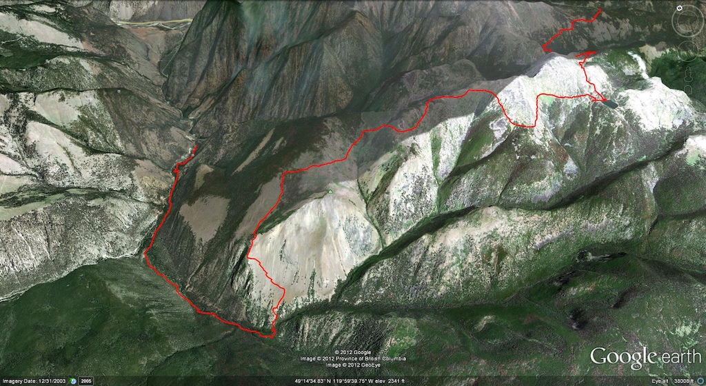 |
| Chopaka - Chopaka Road to Hunter Trails to Joe Lake to Centennial Trail / South Slope to Ewart Creek. |
 |
Trips like Pinkbike's Hurtin' for Vert can't happen without a great group of riders and an equally amazing support group like Specialized Bikes, Bush Pilot Biking, Rocky Mountain Bikes, Pilsner and Pinkbike.com. Thanks a ton for your support in making this year's adventure all time, we all appreciated it.
Extra thanks to our drivers today Kim and the Watchmen of the Lower Similkameen Indian Band.
Stay tuned for the official 2012 Hurtin' for Vert Video from Connor McLeod and a full stats round up, coming soon.
 |
Author Info:
 Member since Mar 27, 2001
Must Read This Week
Sign Up for the Pinkbike Newsletter - All the Biggest, Most Interesting Stories in your Inbox
PB Newsletter Signup
I think that when you look a bit closer at the roster, you'll find a bunch of guys that work for Rocky (Dre), ride professionally for Rocky (Simmons), or have ridden for Rocky in the past (Brant, Jonesie, me, etc), so that might also account for the high percentage. It's a self fulfilling prophecy, though. This style of riding is the overwhelming majority of the trails in BC, so it's hardly surprising that a local company would be designing a bike that performs well in that role.
Also, having ridden both the Slayer and the Ibis, I think if you found that much difference between the two that there was probably an issue with the tuning. There's definitely a few subtle differences between them, but they're both awfully good bikes. For most people the only differences they'd be able to feel would be a result of the parts spec, not the frame design.
As to the other: the HD was definitely spec'd better and lighter. Felt more nimble and quicker through the turns and better at climbing (technical and slog). Maybe I should have qualified my statement and said that the HD was superior for my local trails which are great, but don't approach BC trails for gnar.