Ecuador Mountain Biking: Avenue of the Volcanos, Part Two - Chimborazo and Bigger Volcanos
Introduction and your Ecuadorian word for the day - Carihuairazo; a snow capped 5000m volcano in the centre of Ecuador
Ecuador has an 8,000-year-old history with Europeans as a recent entrant. Its history is dominated largely by indigenous communities which goes a long way to explaining why Ecuadorian trails came to be. Incas came into the picture in the late 15th century swooping in from what is now Peru. The Incas conquered and then were conquered. Their operational method was to move conquered populations wholesale from one part of their empire to another; sometimes thousands of kilometers. This resulted in some native languages and cultures (Quechua most noticeably) being widespread over many geographies. Their large built-up transportation network of roads and trails also made it easy to move populations en masse. These roads and trails now can connect singletrack.
The difficulty can be in connecting the various disparate trail networks and making sense of the local communities who lay claim to and/or own the trails. With an area of 248,000km2 Ecuador is small compared to Canada at 9,985,000 km2 and comparable in size to the state of Oregon or the entire United Kingdom. The country is 714 km (444 mi) long and 658 km (409 mi) wide. Compounding its compact nature is the fact that a good chunk of the country is in the Amazon jungle basin; sparsely populated and difficult to navigate. Although Ecuador is small there is a lot going on in the land as even our first few days showed us. The high uplands of the Cordillera where we were biking is densely populated and the land extensively worked. You do need either a lot of research or a good chunk of local knowledge to make sense of how best to connect the trails together. Luckily we were with Mateo Cuesta of Ride Ecuador to help with this.
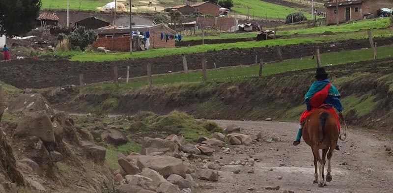
![Ecuador Mountain Biking Avenue of the Volcanos Part Two - Chimborazo and Bigger Volcanos]() Indigenous community in Canar Province in the highlands between Chunchi and Alausi on the Panamerican Highway
Indigenous community in Canar Province in the highlands between Chunchi and Alausi on the Panamerican Highway
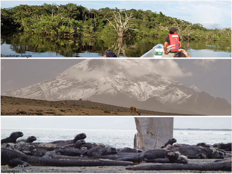
![Ecuador Mountain Biking Avenue of the Volcanos Part Two - Chimborazo and Bigger Volcanos]() From top to bottom: the Amazonian jungle in the Cuyabeno Reserve, Volcan Chimborazo, the Galapagos (our Amazon trip is recounted here)
From top to bottom: the Amazonian jungle in the Cuyabeno Reserve, Volcan Chimborazo, the Galapagos (our Amazon trip is recounted here)
In the first part of our trip we rode some of the more minor volcanoes. In the next part of our trip we were a bit more acclimatized to elevation and tackled higher and bigger objectives. It bears repeating that there are no less than 31 volcanoes over 3800m within a 100km radius of Quito. Many of these volcanos, including the well-known Cotopaxi and Tungurahua are active. These two were rumbling during our time here disgorging ash and displacing people. The highest peak in Ecuador is the dormant Volcano Chimborazo with its massively glaciated peak and summit block standing at 6,310m. Another mind-blowing factoid; the Equator runs through the glaciated Volcano Cayambe (5790m) so you can always bike, hike or ski on glaciers at the equator if that’s your fancy.
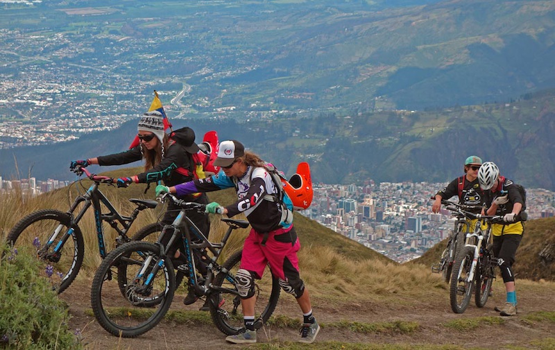
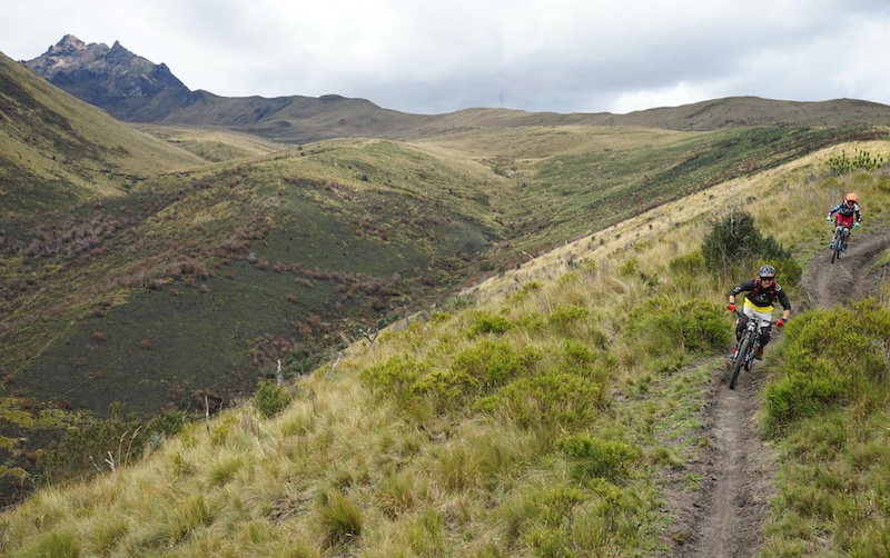
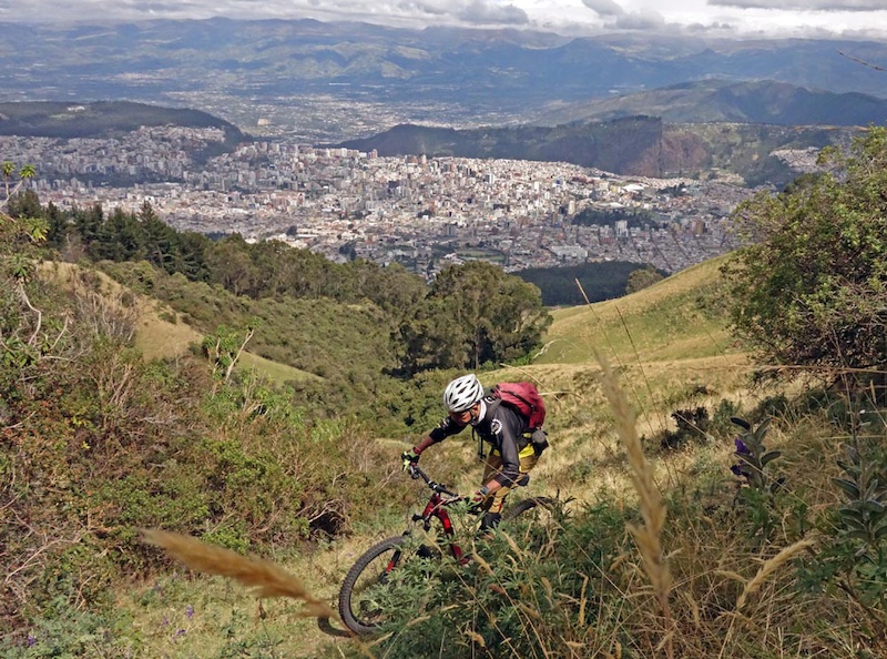
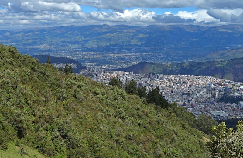
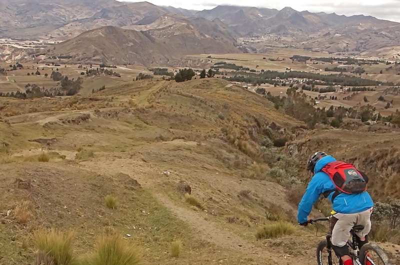
Rucu Pichincha - Quito's Twin Terrors
Today we’re off to one of the two Pichincha volcanos – signature mountains of Quito. Rucu Pichincha is the non-active twin to Guagua aka Baby (which is burping out smoke). Because we are soft and because we had many days of riding to do we used the Teleferico to get to 4000m. Then we climbed further to approx 4400m, 400m shy of the summit then rode down trails towards Quito. Despite the volcanic activity, tourism in Ecuador is still alive and well as is the mountain biking.
These two volcanos are popular acclimation climbs; used to prep for climbs for higher mountains. It’s a signature of Ride Ecuador’s preparation that we started with smaller mountains (recall that Ilalo was 'only' a little over 3000m) and then slowly but surely built up to higher elevations. Today we topped out at elevations that was oxygen-depriving for sea-level dwellers but were still able to pedal. We would have fared far worse if we had tried to ride this on our first day off the plane to Ecuador.
Of note, we chose to ride Rucu because one can get there easily from Quito and make it a more relaxed outing. You can ride Guagua but it entails a longish drive a fair bit west of the city of Quito and then up a jeep road to then hike/push bikes to the summit. Either ride is worthwhile and makes for incredible views.
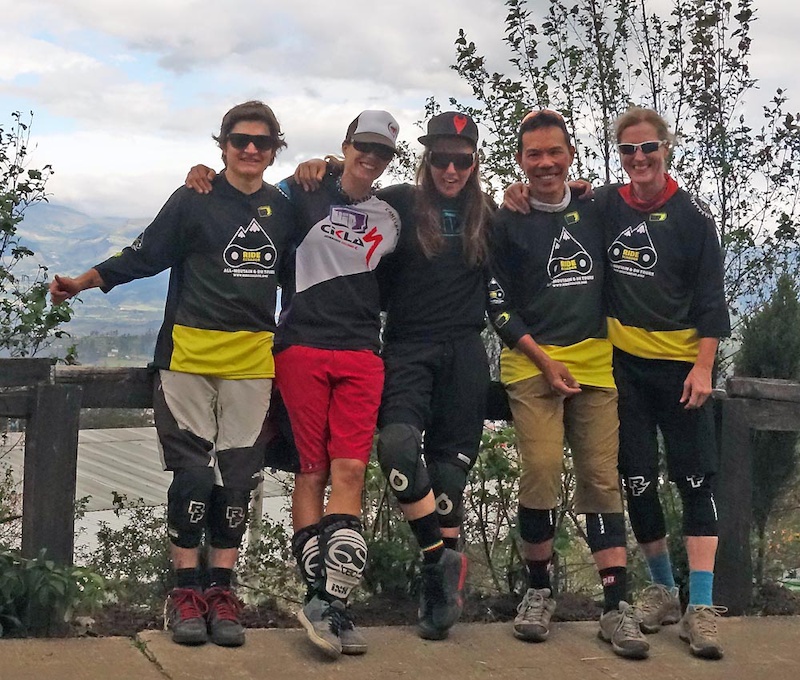
Today we rode with Suca and Julia who run the company WIP – they make customized bike clothing both for men and women. Their clothing is designed and made in Ecuador – rather a nice touch!
![Ecuador Mountain Biking Avenue of the Volcanos Part Two - Chimborazo and Bigger Volcanos]()
![Ecuador Mountain Biking Avenue of the Volcanos Part Two - Chimborazo and Bigger Volcanos]()
![Ecuador Mountain Biking Avenue of the Volcanos Part Two - Chimborazo and Bigger Volcanos]()
![Ecuador Mountain Biking Avenue of the Volcanos Part Two - Chimborazo and Bigger Volcanos]()
![Ecuador Mountain Biking Avenue of the Volcanos Part Two - Chimborazo and Bigger Volcanos]()
![Ecuador Mountain Biking Avenue of the Volcanos Part Two - Chimborazo and Bigger Volcanos]()
![Ecuador Mountain Biking Avenue of the Volcanos Part Two - Chimborazo and Bigger Volcanos]()
![Ecuador Mountain Biking Avenue of the Volcanos Part Two - Chimborazo and Bigger Volcanos]()
![Ecuador Mountain Biking Avenue of the Volcanos Part Two - Chimborazo and Bigger Volcanos]()
![Ecuador Mountain Biking Avenue of the Volcanos Part Two - Chimborazo and Bigger Volcanos]()
Our trailforks ridelog is here
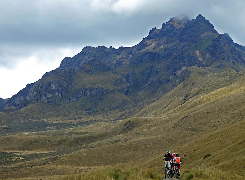
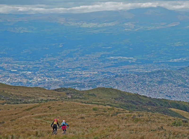
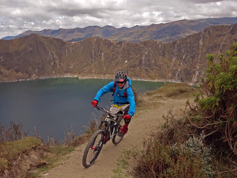
Volcan Quilotoa - Now we get High
Day five of our Ecuador mountain biking trip was supposed to be a rest day and had us further acclimatizing to altitude by sleeping at 3914m and then riding a short loop close to Volcan Quilotoa. Quilotoa is both the name of the water-filled caldera (old crater) of the now-extinct volcano and the small town closest to the volcano. You get there by way of a two-three hour drive southwest from Quito towards higher points in the Ecuadorian Andean cordillera passing some larger and many smaller towns. The area is deep in the heart of land inhabited mainly by indigenous people; tourism is a major contributor to their well-being and one can see that tourism dollars go a long way here.
The ride is part of the Quilotoa Loop, an exceptionally beautifully scenic and well-known hiking/biking loop towards the center of Ecuador. Sharon and Mateo went for a short ride sampling part of the loop while Lee recovered from drinking the Agua Ibarra.
The Quilotoa loop itself is in an area where you pay a small fee to enter the area where you can view the Caldera. The pay-for area is surrounded by the small indigenous name-saked community that has taken full advantage of its prime location by establishing hostels, some restaurants and small markets. The section of ride on the loop is fairly flat being high on the alpine plateau and that’s a good thing since at 4000m you probably won’t be charging too hard. Generally speaking it’s almost always cool and breezy (daytime temps of 10 to 15 C) here so dress accordingly.
![Day 5 of our Ecuador mountain biking trip was supposed to be a rest day but had us acclimatizing to altitude further by sleeping at 3850m and then riding a short loop at 4000m on Volc n Quilotoa. This is a pretty famous predominantly hiking loop about 3 hours south of Quito.]() Cold and clear at 4000m
Cold and clear at 4000m
![Day 5 of our Ecuador mountain biking trip was supposed to be a rest day but had us acclimatizing to altitude further by sleeping at 3850m and then riding a short loop at 4000m on Volc n Quilotoa. This is a pretty famous predominantly hiking loop about 3 hours south of Quito.]() Enduro-lean into the corners or you'd get blown over
Enduro-lean into the corners or you'd get blown over
![Day 5 of our Ecuador mountain biking trip was supposed to be a rest day but had us acclimatizing to altitude further by sleeping at 3850m and then riding a short loop at 4000m on Volc n Quilotoa. This is a pretty famous predominantly hiking loop about 3 hours south of Quito.]() Finishing off the short ride
Finishing off the short ride
![Day 5 of our Ecuador mountain biking trip was supposed to be a rest day but had us acclimatizing to altitude further by sleeping at 3850m and then riding a short loop at 4000m on Volc n Quilotoa. This is a pretty famous predominantly hiking loop about 3 hours south of Quito.]() Llamas of the Quilotoa
Llamas of the Quilotoa
Our trailforks ridelog is here
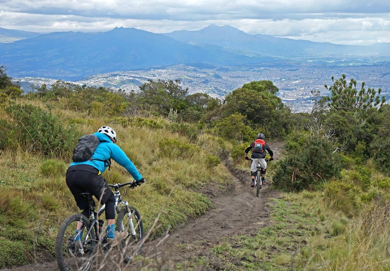
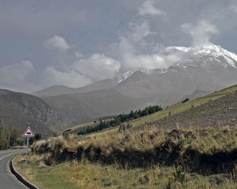
Chimborazo - The Big Volcano
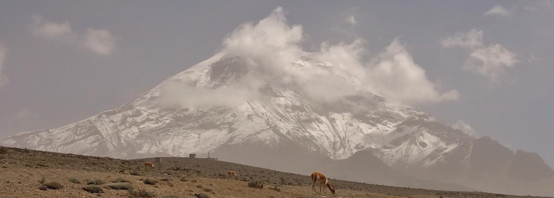
After Quilotoa, we hit the literal highest point of our trip following days of acclimatization to altitude. Chimborazo was the landmark of the day. Its last known activity was in 550AD and it is believed to be dormant. Chimbo tops out at 6280m and is the tallest peak in Ecuador. If you were to measure the height of Chimborazo from the center of the earth it would be approximately 2km taller than Everest, thus giving it the somewhat tongue-in-cheek reputation of being bigger than Everest.
The top of Chimbo is completely covered by glaciers so getting to the peak by bike would be problematic, so we contented ourselves by starting the day by scrambling to 5020m to the high refugio of Chimborazo just short of snowline. We then descended to the Panamerican Highway at 4360m.
Following Chimborazo's descent mainly on access roads, we dropped onto the Ruta Los Hieleros/Ice Route. As on other glaciated Ecuadorian mountains, Chimborazo’s glacial ice used to be mined by locals (the so-called Hieleros from Spanish “Hielo” for Ice) to be sold in the markets of Guaranda and Riobamba. In earlier days, the people transported ice for cooling to Incan coastal towns and were still doing so as late as the 80s (more in this BBC documentary). More mundanely the route is primarily singletrack, and if you didn’t know better the Incans rode mountain bikes; as portions of the trail have perfectly sculpted natural turns and berms as it drops 2200m to the Guaranda valleys.
Of note you must have a naturalist guide to enter the Chimborazo National Park. You cannot hire a guide on the spot but must pre-arrange for someone 24hours in advance. No exceptions are made. Be warned of this as other biking and outdoors parties have been turned back from Chimbo if they do not have a guide. You will also end many vertical km's below and a long distance away from where you started. I truly don't have a clue how you could do this route without some support either from Ride Ecuador or from locals. You could ride all of it but you'd be at it for a long grind uphill and into headwinds on gravel roads and the Panamerican.
![Day 6 and the literal highest point of our trip following days of acclimatization to altitude. We started by scrambling to 5020m to the high refugio just short of snowline then descended to the Panamerican Highway at 4360m then completed a 2200m descent to the Guaranda valle]() First glance of Chimbo from the valley floor. The entire mountain was surrounded by cloud but for our south facing window from where we approached
First glance of Chimbo from the valley floor. The entire mountain was surrounded by cloud but for our south facing window from where we approached
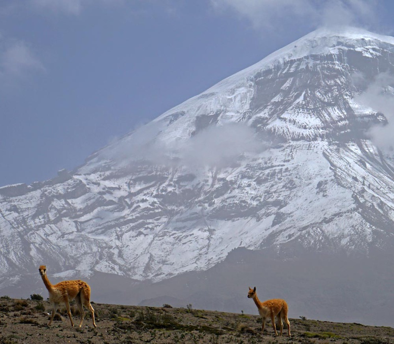
![Day 6 and the literal highest point of our trip following days of acclimatization to altitude. We started by scrambling to 5020m to the high refugio just short of snowline then descended to the Panamerican Highway at 4360m then completed a 2200m descent to the Guaranda valle]() Vcuna are native to Chimborazo
Vcuna are native to Chimborazo
![Day 6 and the literal highest point of our trip following days of acclimatization to altitude. We started by scrambling to 5020m to the high refugio just short of snowline then descended to the Panamerican Highway at 4360m then completed a 2200m descent to the Guaranda valle]() More National Geographic moments
More National Geographic moments
![Day 6 and the literal highest point of our trip following days of acclimatization to altitude. We started by scrambling to 5020m to the high refugio just short of snowline then descended to the Panamerican Highway at 4360m then completed a 2200m descent to the Guaranda valle]() 5020m and our high point. Highest we've ever been.
5020m and our high point. Highest we've ever been.
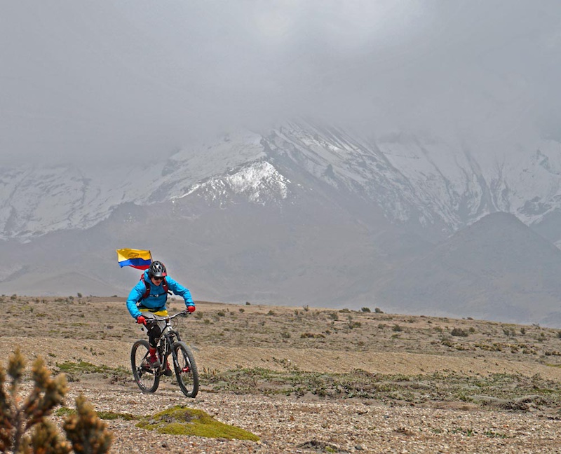
![Day 6 and the literal highest point of our trip following days of acclimatization to altitude. We started by scrambling to 5020m to the high refugio just short of snowline then descended to the Panamerican Highway at 4360m then completed a 2200m descent to the Guaranda valle]() And we descend with Mateo flying the flag.
And we descend with Mateo flying the flag.
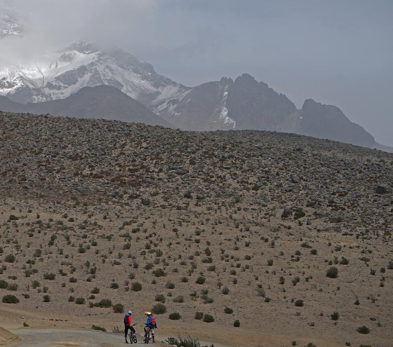
![Day 6 and the literal highest point of our trip following days of acclimatization to altitude. We started by scrambling to 5020m to the high refugio just short of snowline then descended to the Panamerican Highway at 4360m then completed a 2200m descent to the Guaranda valle]() Taking a breather as the trail crosses the approach access road.
Taking a breather as the trail crosses the approach access road.
![Day 6 and the literal highest point of our trip following days of acclimatization to altitude. We started by scrambling to 5020m to the high refugio just short of snowline then descended to the Panamerican Highway at 4360m then completed a 2200m descent to the Guaranda valle]() Cross the highway and up another access road to get to the trailhead of Ruta Hieleros.
Cross the highway and up another access road to get to the trailhead of Ruta Hieleros.
![Day 6 and the literal highest point of our trip following days of acclimatization to altitude. We started by scrambling to 5020m to the high refugio just short of snowline then descended to the Panamerican Highway at 4360m then completed a 2200m descent to the Guaranda valle]() Ruta Hieleros winds on for a long long way.
Ruta Hieleros winds on for a long long way.
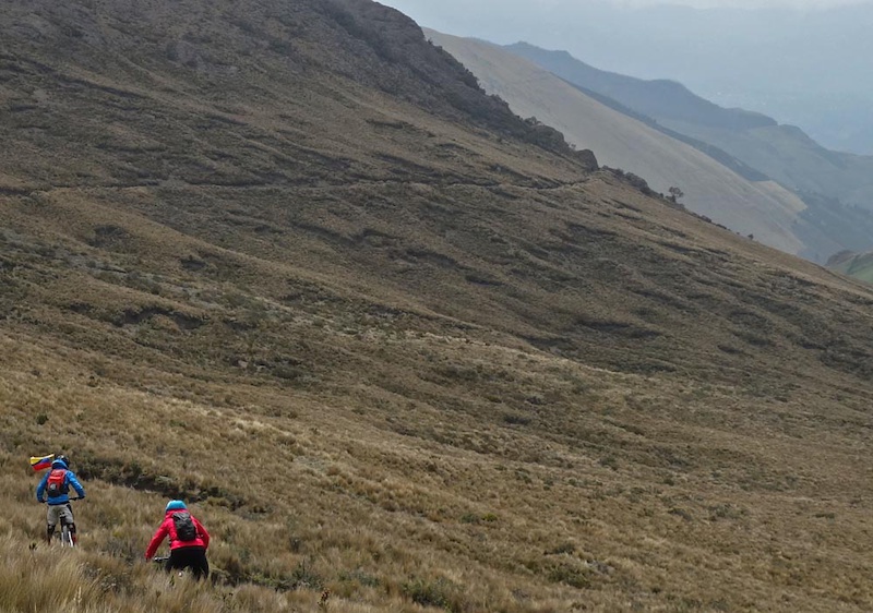
![Day 6 and the literal highest point of our trip following days of acclimatization to altitude. We started by scrambling to 5020m to the high refugio just short of snowline then descended to the Panamerican Highway at 4360m then completed a 2200m descent to the Guaranda valle]() As the short little trees indicate we're still a long way up there. The upper part of the trail is rocky and technical. Don't want a mechanical out here as it'd be a long and serious walk back.
As the short little trees indicate we're still a long way up there. The upper part of the trail is rocky and technical. Don't want a mechanical out here as it'd be a long and serious walk back.
![Day 6 and the literal highest point of our trip following days of acclimatization to altitude. We started by scrambling to 5020m to the high refugio just short of snowline then descended to the Panamerican Highway at 4360m then completed a 2200m descent to the Guaranda valle]() As you drop down-valley the lowlands surrounding Guaranda come into view. Lowlands being just 3000m elevation.
As you drop down-valley the lowlands surrounding Guaranda come into view. Lowlands being just 3000m elevation.
![Day 6 and the literal highest point of our trip following days of acclimatization to altitude. We started by scrambling to 5020m to the high refugio just short of snowline then descended to the Panamerican Highway at 4360m then completed a 2200m descent to the Guaranda valle]() In the pine forest.
In the pine forest.
![Day 6 and the literal highest point of our trip following days of acclimatization to altitude. We started by scrambling to 5020m to the high refugio just short of snowline then descended to the Panamerican Highway at 4360m then completed a 2200m descent to the Guaranda valle]() More local knowledge. Mateo knows this beer spot at the town of Cochas at the end of the trail
More local knowledge. Mateo knows this beer spot at the town of Cochas at the end of the trail
Our trailforks ridelog is here
Where to stay - Quilotoa
The Hosteria Alpaka was the first hotel in Quilotoa and was set up by an indigenous couple who are doing incredibly well in this small town. The food is simple and good. Accommodations are clean and basic. Keep in mind where you are and how hard it is to get amenities to a relatively geographically isolated place like this and you will better appreciate the warmth of the wood-fired stove in the rooms

Hosteria Alpaka
Chimborazo
We stayed at the Posada La Estacion in Urbina. This small Refugio is housed in the old station building in Urbina and has been run by Rodrigo Donoso for over 20 years. Rodrigo is an accomplished climber who owns and runs the Refugio. He also guides climbers who want to climb Chimborazo, Tungurahua & Cotopaxi, mountains which he has climbed probably hundreds of times. Rodrigo also runs Alta Montana which runs guided trips and arranges accommodations and acclimatization in the area.
 Posada la Estacion
Other parts
Part One, Quito and Baby Volcanoes.
More pictures, maps and details on Sharon and Lee's site are below:
Volcan Rucu Pichincha
Volcan Quilotoa
Volcan Chimborazo
MENTIONS: @leelau /@mateo5
Ecuador has an 8,000-year-old history with Europeans as a recent entrant. Its history is dominated largely by indigenous communities which goes a long way to explaining why Ecuadorian trails came to be. Incas came into the picture in the late 15th century swooping in from what is now Peru. The Incas conquered and then were conquered. Their operational method was to move conquered populations wholesale from one part of their empire to another; sometimes thousands of kilometers. This resulted in some native languages and cultures (Quechua most noticeably) being widespread over many geographies. Their large built-up transportation network of roads and trails also made it easy to move populations en masse. These roads and trails now can connect singletrack.
The difficulty can be in connecting the various disparate trail networks and making sense of the local communities who lay claim to and/or own the trails. With an area of 248,000km2 Ecuador is small compared to Canada at 9,985,000 km2 and comparable in size to the state of Oregon or the entire United Kingdom. The country is 714 km (444 mi) long and 658 km (409 mi) wide. Compounding its compact nature is the fact that a good chunk of the country is in the Amazon jungle basin; sparsely populated and difficult to navigate. Although Ecuador is small there is a lot going on in the land as even our first few days showed us. The high uplands of the Cordillera where we were biking is densely populated and the land extensively worked. You do need either a lot of research or a good chunk of local knowledge to make sense of how best to connect the trails together. Luckily we were with Mateo Cuesta of Ride Ecuador to help with this.
In the first part of our trip we rode some of the more minor volcanoes. In the next part of our trip we were a bit more acclimatized to elevation and tackled higher and bigger objectives. It bears repeating that there are no less than 31 volcanoes over 3800m within a 100km radius of Quito. Many of these volcanos, including the well-known Cotopaxi and Tungurahua are active. These two were rumbling during our time here disgorging ash and displacing people. The highest peak in Ecuador is the dormant Volcano Chimborazo with its massively glaciated peak and summit block standing at 6,310m. Another mind-blowing factoid; the Equator runs through the glaciated Volcano Cayambe (5790m) so you can always bike, hike or ski on glaciers at the equator if that’s your fancy.
Rucu Pichincha - Quito's Twin Terrors

Today we’re off to one of the two Pichincha volcanos – signature mountains of Quito. Rucu Pichincha is the non-active twin to Guagua aka Baby (which is burping out smoke). Because we are soft and because we had many days of riding to do we used the Teleferico to get to 4000m. Then we climbed further to approx 4400m, 400m shy of the summit then rode down trails towards Quito. Despite the volcanic activity, tourism in Ecuador is still alive and well as is the mountain biking.
These two volcanos are popular acclimation climbs; used to prep for climbs for higher mountains. It’s a signature of Ride Ecuador’s preparation that we started with smaller mountains (recall that Ilalo was 'only' a little over 3000m) and then slowly but surely built up to higher elevations. Today we topped out at elevations that was oxygen-depriving for sea-level dwellers but were still able to pedal. We would have fared far worse if we had tried to ride this on our first day off the plane to Ecuador.
Of note, we chose to ride Rucu because one can get there easily from Quito and make it a more relaxed outing. You can ride Guagua but it entails a longish drive a fair bit west of the city of Quito and then up a jeep road to then hike/push bikes to the summit. Either ride is worthwhile and makes for incredible views.
Today we rode with Suca and Julia who run the company WIP – they make customized bike clothing both for men and women. Their clothing is designed and made in Ecuador – rather a nice touch!
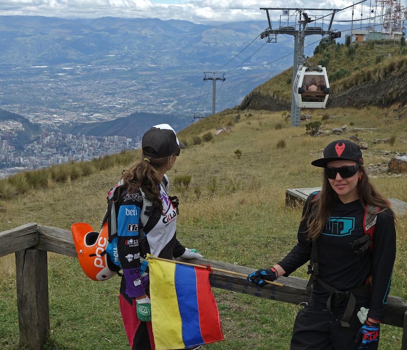
Julia and Suca waiting for the teleferico to drop off Mateo and Sharon
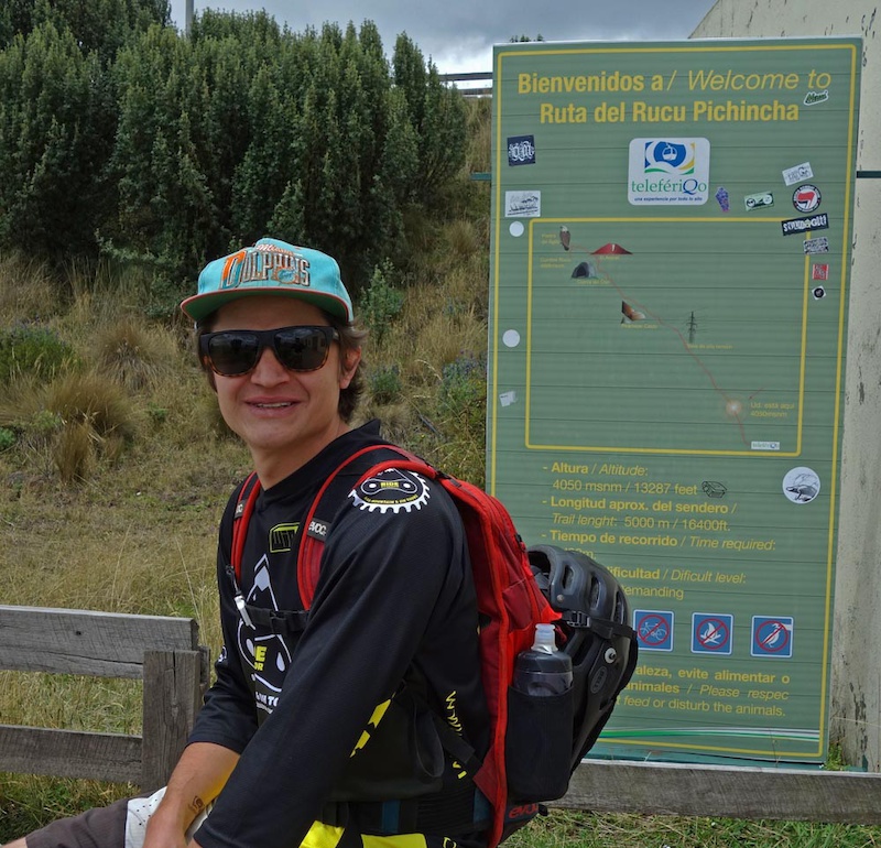
The sign says that bikes are verboten which is not true and characteristic of sometimes outdated Ecuadorian signs. Biking is allowed in the area
Quito views
Rucu Pichincha views
and now we go down
No shortage of views
These trails show the wear of wildlife and feet; farmers graze here
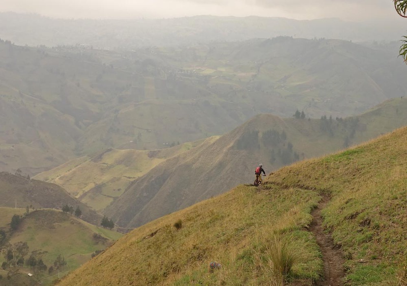
Dropping lower to Ruta Humboldt now in the treed part of the highlands
Spot the biker
Well that was a blast!
Our trailforks ridelog is here
Volcan Quilotoa - Now we get High
Day five of our Ecuador mountain biking trip was supposed to be a rest day and had us further acclimatizing to altitude by sleeping at 3914m and then riding a short loop close to Volcan Quilotoa. Quilotoa is both the name of the water-filled caldera (old crater) of the now-extinct volcano and the small town closest to the volcano. You get there by way of a two-three hour drive southwest from Quito towards higher points in the Ecuadorian Andean cordillera passing some larger and many smaller towns. The area is deep in the heart of land inhabited mainly by indigenous people; tourism is a major contributor to their well-being and one can see that tourism dollars go a long way here.
The ride is part of the Quilotoa Loop, an exceptionally beautifully scenic and well-known hiking/biking loop towards the center of Ecuador. Sharon and Mateo went for a short ride sampling part of the loop while Lee recovered from drinking the Agua Ibarra.
The Quilotoa loop itself is in an area where you pay a small fee to enter the area where you can view the Caldera. The pay-for area is surrounded by the small indigenous name-saked community that has taken full advantage of its prime location by establishing hostels, some restaurants and small markets. The section of ride on the loop is fairly flat being high on the alpine plateau and that’s a good thing since at 4000m you probably won’t be charging too hard. Generally speaking it’s almost always cool and breezy (daytime temps of 10 to 15 C) here so dress accordingly.


Our trailforks ridelog is here
Chimborazo - The Big Volcano
After Quilotoa, we hit the literal highest point of our trip following days of acclimatization to altitude. Chimborazo was the landmark of the day. Its last known activity was in 550AD and it is believed to be dormant. Chimbo tops out at 6280m and is the tallest peak in Ecuador. If you were to measure the height of Chimborazo from the center of the earth it would be approximately 2km taller than Everest, thus giving it the somewhat tongue-in-cheek reputation of being bigger than Everest.
The top of Chimbo is completely covered by glaciers so getting to the peak by bike would be problematic, so we contented ourselves by starting the day by scrambling to 5020m to the high refugio of Chimborazo just short of snowline. We then descended to the Panamerican Highway at 4360m.
Following Chimborazo's descent mainly on access roads, we dropped onto the Ruta Los Hieleros/Ice Route. As on other glaciated Ecuadorian mountains, Chimborazo’s glacial ice used to be mined by locals (the so-called Hieleros from Spanish “Hielo” for Ice) to be sold in the markets of Guaranda and Riobamba. In earlier days, the people transported ice for cooling to Incan coastal towns and were still doing so as late as the 80s (more in this BBC documentary). More mundanely the route is primarily singletrack, and if you didn’t know better the Incans rode mountain bikes; as portions of the trail have perfectly sculpted natural turns and berms as it drops 2200m to the Guaranda valleys.
Of note you must have a naturalist guide to enter the Chimborazo National Park. You cannot hire a guide on the spot but must pre-arrange for someone 24hours in advance. No exceptions are made. Be warned of this as other biking and outdoors parties have been turned back from Chimbo if they do not have a guide. You will also end many vertical km's below and a long distance away from where you started. I truly don't have a clue how you could do this route without some support either from Ride Ecuador or from locals. You could ride all of it but you'd be at it for a long grind uphill and into headwinds on gravel roads and the Panamerican.


Our trailforks ridelog is here
Where to stay - Quilotoa
The Hosteria Alpaka was the first hotel in Quilotoa and was set up by an indigenous couple who are doing incredibly well in this small town. The food is simple and good. Accommodations are clean and basic. Keep in mind where you are and how hard it is to get amenities to a relatively geographically isolated place like this and you will better appreciate the warmth of the wood-fired stove in the rooms
Hosteria Alpaka
Chimborazo
We stayed at the Posada La Estacion in Urbina. This small Refugio is housed in the old station building in Urbina and has been run by Rodrigo Donoso for over 20 years. Rodrigo is an accomplished climber who owns and runs the Refugio. He also guides climbers who want to climb Chimborazo, Tungurahua & Cotopaxi, mountains which he has climbed probably hundreds of times. Rodrigo also runs Alta Montana which runs guided trips and arranges accommodations and acclimatization in the area.
Posada la Estacion Other parts
Part One, Quito and Baby Volcanoes.
More pictures, maps and details on Sharon and Lee's site are below:
Volcan Rucu Pichincha
Volcan Quilotoa
Volcan Chimborazo
MENTIONS: @leelau /@mateo5
Author Info:

Must Read This Week
Sign Up for the Pinkbike Newsletter - All the Biggest, Most Interesting Stories in your Inbox
PB Newsletter Signup
Is it actually okay to ride wherever you want up on those big volcanos or is it protected in some way? There's an awful lot of potential up there!!!