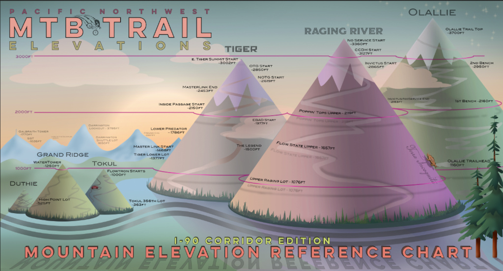
I designed this graphic to show the elevations of some popular areas and trails along the I-90/Seattle Corridor. If you know the current snow-level, you can reference this handy chart to see if your favorite trail might be snow-free. Or maybe you just want to see the comparative elevations of these trail systems. Or maybe you just want to cover up a hole you smashed in the wall of your garage because you were so frustrated that you couldn’t go riding because you didn’t know the starting elevation of your favorite trail. For instance.

187
Views
0
Comments
0
Favs
Photo info
- Album
- PNW-Trail-Elevation-Chart
- Category
- Bike Drawings/Art
- Date Posted
- Feb 22, 2021 at 17:36Feb 22, 2021
- Location
-
Seattle, Washington, United States

- Articles
- PNW Trail Elevation Chart - Seattle/I-90 Corridor
Photo details