Trailforks App Big Spring Update

Apr 18, 2017 at 9:47
by Trevor May  


We had intended to release a small update during the winter to add winter trail support, but it grew into a much larger update and was delayed. So, sorry to those that were waiting for the winter trails. The good news is there is a ton of other new features and refinements!

Get the Trailforks app here.


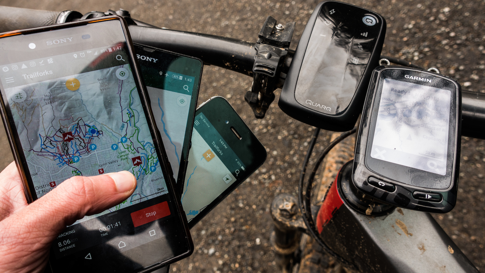
Experimental GPS Tracking!
This has long been our number one requested feature. We aren't ready to roll it out 100%, but this update contains an option within the app's GPS settings to enable experimental GPS tracking, so you can start using and testing it!

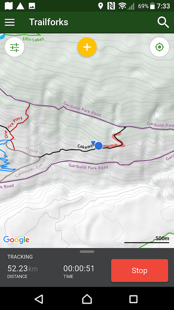
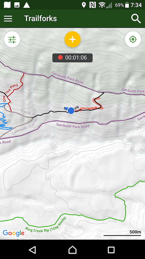
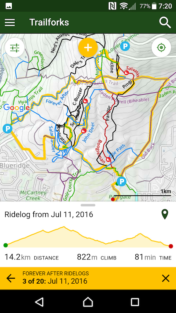
As a navigation app, it is really valuable being able to see where you've been on the trail map because it makes it easier to orientate yourself and find your route. The tracking feature is pretty simple, if you are a rider that likes to record all their fitness data with various devices, your best to stick with something like Strava. But if you just want to record your ride with a simple start/stop interface and provide trail usage data to the local trail associations, then this is for you. You can save your ride when you're done and upload it to Trailforks as a ridelog. If you have your Stava account connected to Trailforks you can sync this to your Strava account.

The tracking works in the background, so it will use more battery to get your location constantly when your screen is off or the Trailforks app is not the active app. Being super nerds we have taken extreme measures to make sure that Trailforks tracking is power efficient.

Please let us know how the tracking works or if you encounter issues.

gps tracking
gps recording with tracking bar hidden


save ridelog


Strava

You can now connect your Stava account to Trailforks from within the Trailforks app. So you can start syncing your Strava rides with Trailforks.

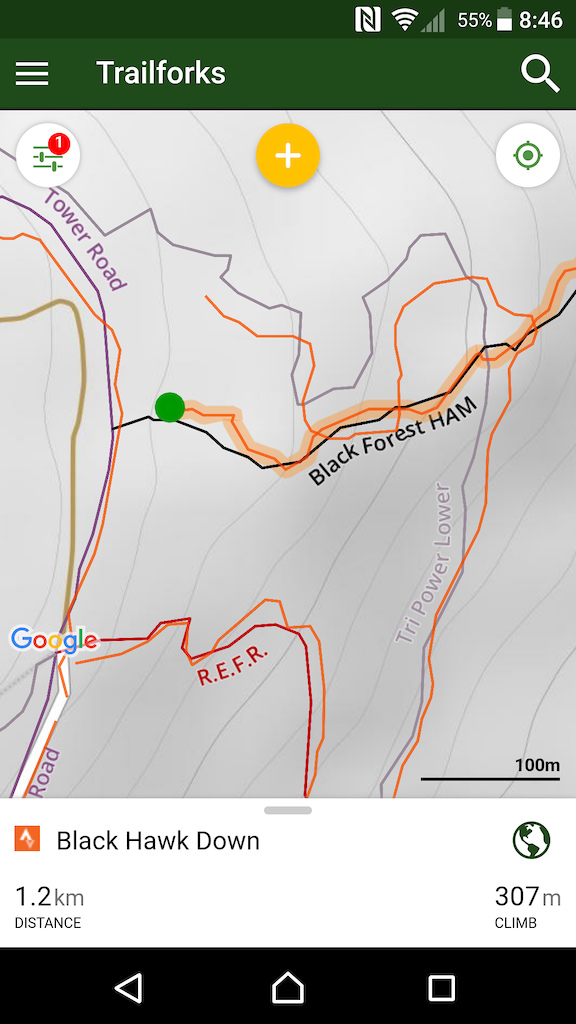
For those competitive Strava users, we have a super cool new feature for you! You can toggle on Strava segments to show on the map. Segments are often not right at the start and end of a trail, so being able to see the segment in relation to the overal trail network map can help you know where to start and end a run. You can click the segment on the map to load its details in the Strava app.

Please note you must zoom in close to the trails before the Strava segments load.

toggle viewing Strava segments on the map
click a strava segment for details


Events Section
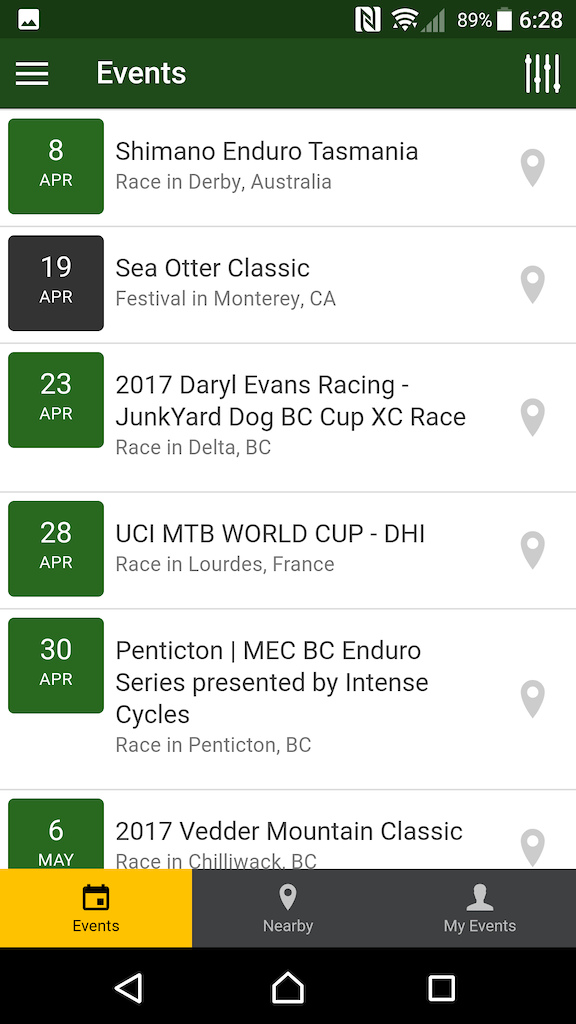
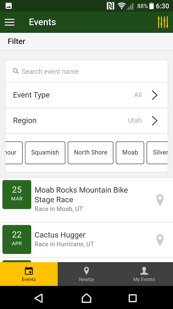
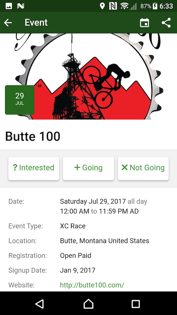
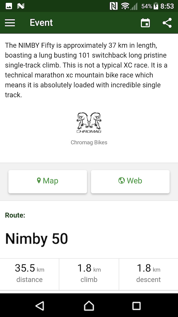
The Trailforks website has been collecting mountain biking events such as races for several months now. We are building a global calendar of race events customized for your location. In this app update you can view the listing of events customized for your user, view nearby events or your personal events calendar. Routes can be attached to events, making it easier to find & follow the route for an upcoming race you want to get some practice riding on.

events
event filters

view event details
route attached to event


Popular Routes
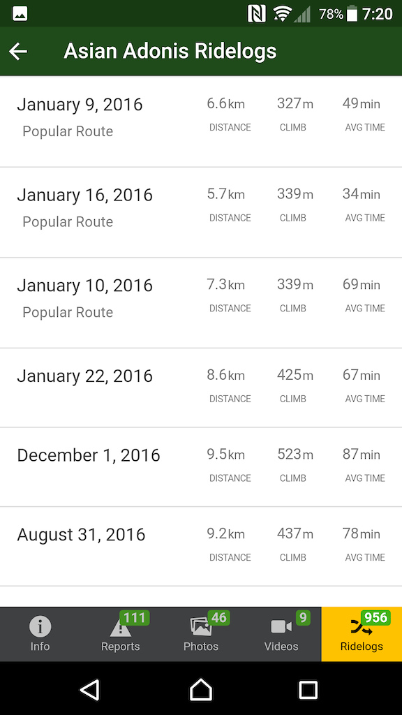
Want to find out in what order to ride trails in a new riding area? When viewing a trail's ridelogs tab, we now sort the most popular routes to the top of the list. We recently scanned over 1 million user ridelogs to programmatically determine the most popular routes people ride in each riding area. You can simply look at any trail and in this way see what the most popular route/ride is that includes this trail. This is the best way to figure out how and what to ride when you are in a new area.

popular routes sorted to top
view popular trail route


New Contribute Button
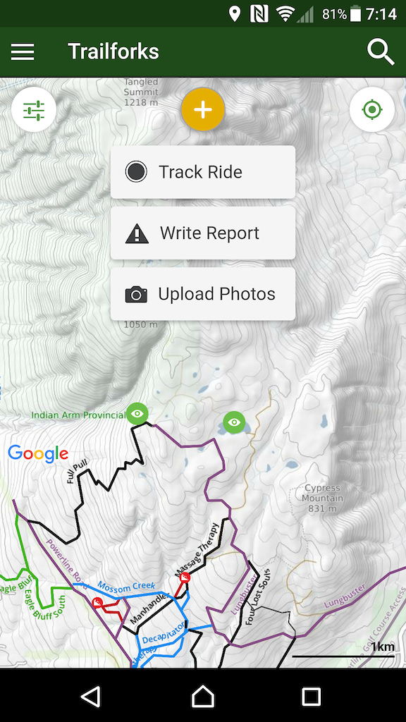
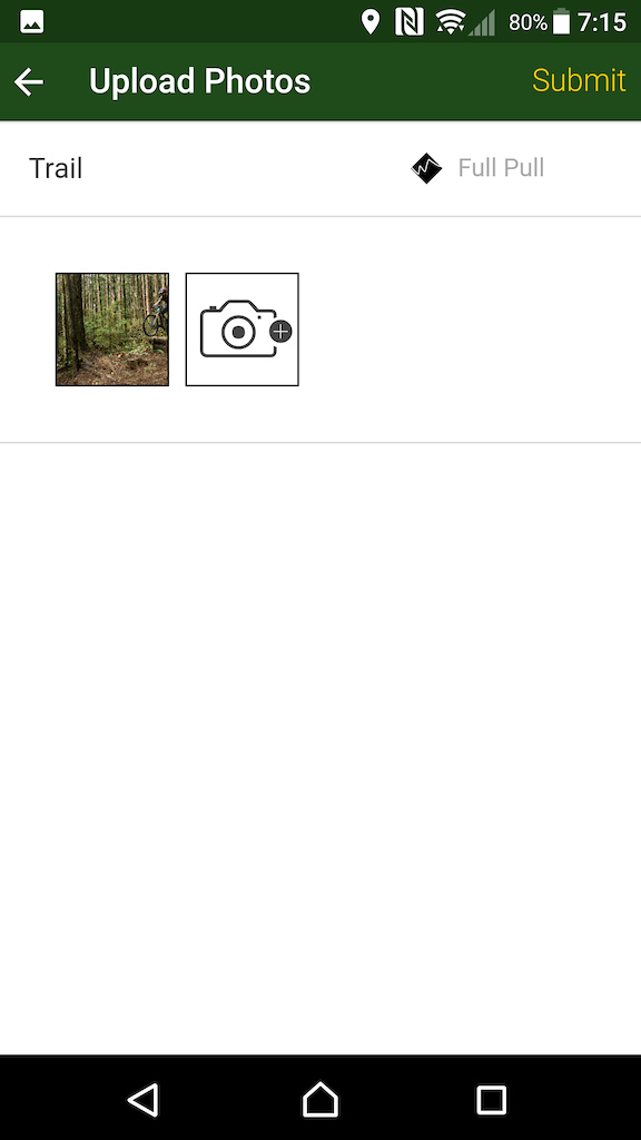
We've moved where you go to submit a trail report from the main menu to the new yellow contribute button at the top of the map. This button will host links to all the types of content you can "contribute" to Trailforks. We've had the option to upload photos to a trail without being tied to a report for awhile, but this feature was hard to find, it's easy to find in the new contribute menu.

This button has a handy time saving feature, if you first select a trail on the map so it's highlighted, then open the contribute menu to submit a report or a photo, it will pre-populate the trail with the one you had selected on the map!

contribute button
upload photos to a trail


New Reports Section
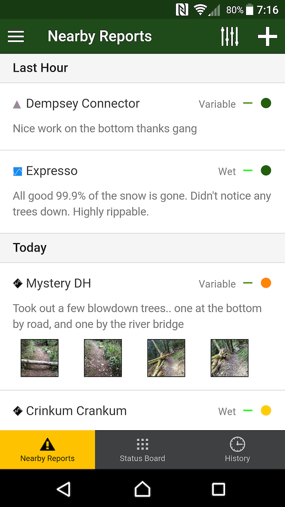
Since the report form is now accessed via the Contribute button mentioned above, we've changed the functionality of the "Trail Reports" section accessed via the main menu. This section is now focusing on viewing reports, rather than creating them. The nearby reports is now front and center with a better design to show you all the info at a glance.

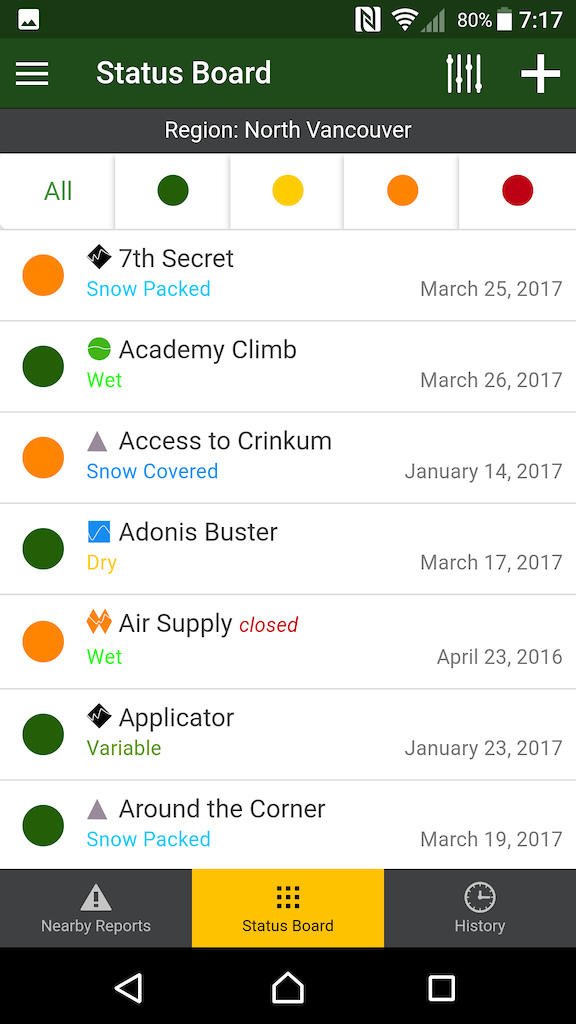
There is a new page called "Status Board" think of this like a status board at a ski mountain. It will list all the trails alphabetically listing each trails current status. You can quickly filter the list with the status buttons at the top.

Both these pages can be filtered, if you rather have them show reports & status for only a specific region you can do so. The region you select will also be saved each time you visit.

nearby reports
status board


US Land Owner Map Layer
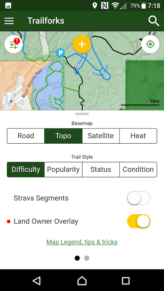
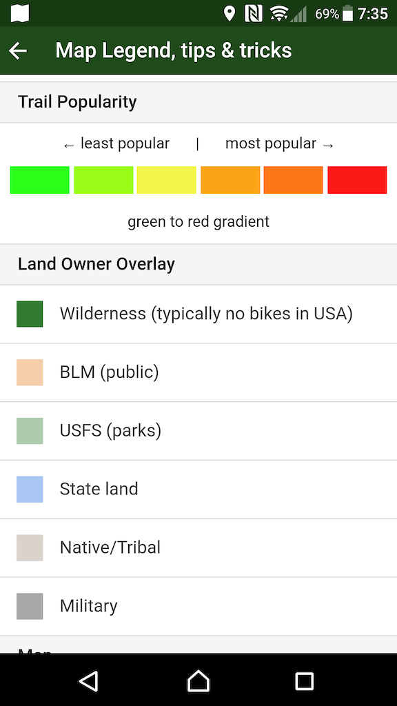
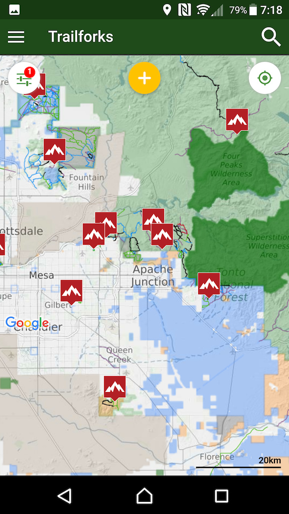
The landowner map overlay we created for the website is now available in the app!

Related to this the app will also show "planned trails" now. They will be thinner lines on the map. So region admins adding hidden planned trails can use the app in the field.

enable land owner overlay
map legend land owner overlay
land owner overlay


Comments
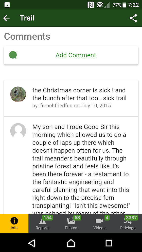
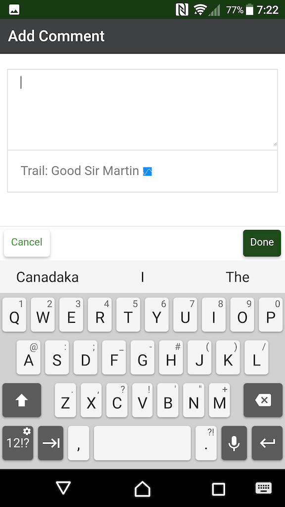
Comments can now be viewed and posted in the app for trails, routes, reports & events.

view comments
add comment


Sharing
Ridelog & rideplans now have a detail page in the app. When viewing a detail page for a route, ridelog or rideplan there is a share icon in the top right. Allowing you to share this route with a friend. This sharing will include a link when clicked, and if that friend has the Trailforks app installed it will open that route in the app. If they don't have the region installed where the route resides, no worries, the route will download in the background and be available to view.

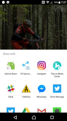
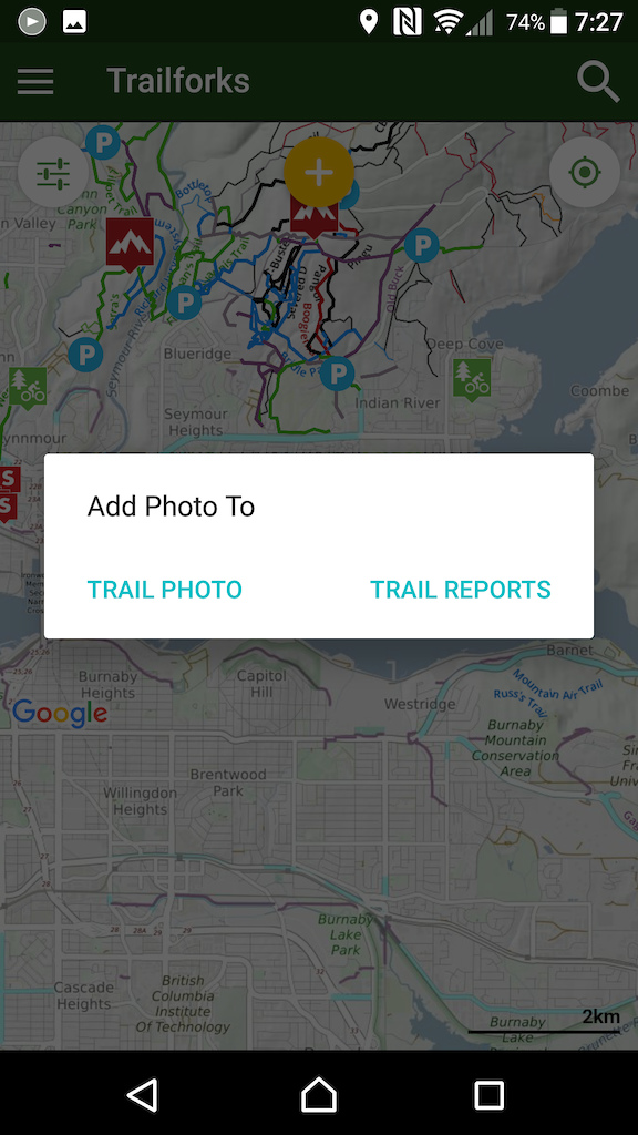
Android users can now share photos to the Trailforks app. Select a photo or photos with your favourite photo viewing app and Trailforks will be listed among the apps to share the photo with. When Trailforks launches it will prompt what you want to do with this photo.

share photo with Trailforks


Map Trail Filtering
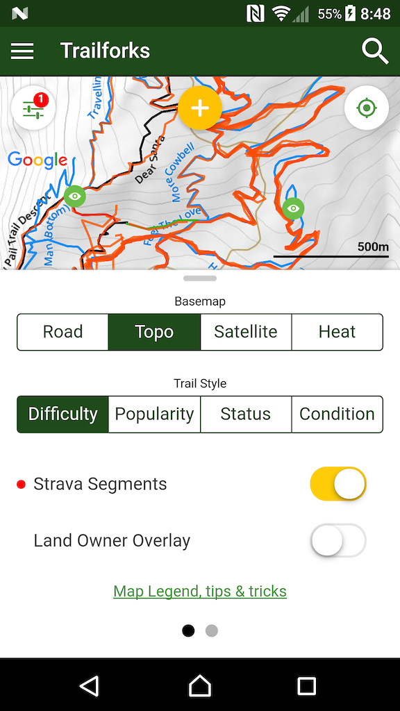
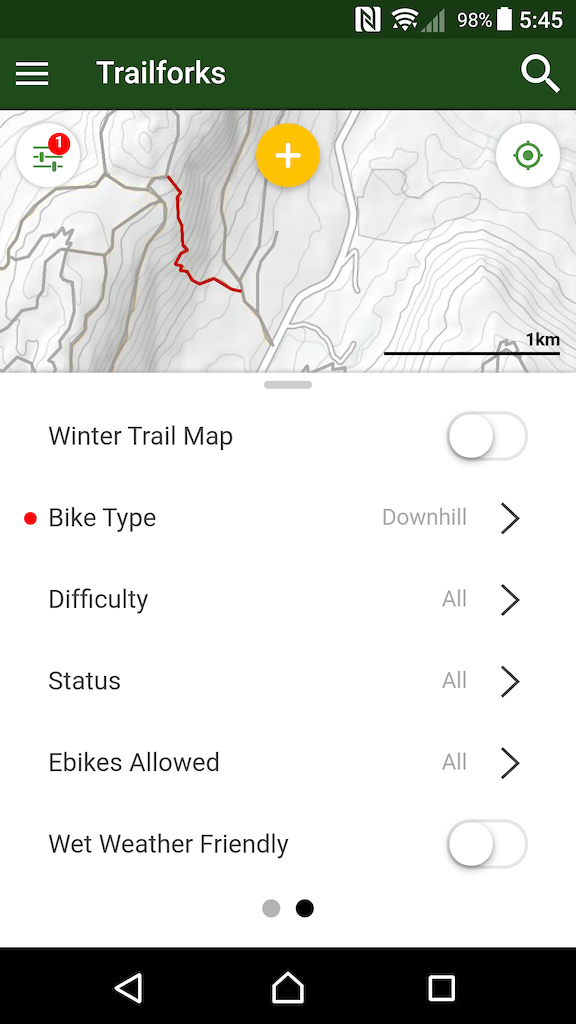
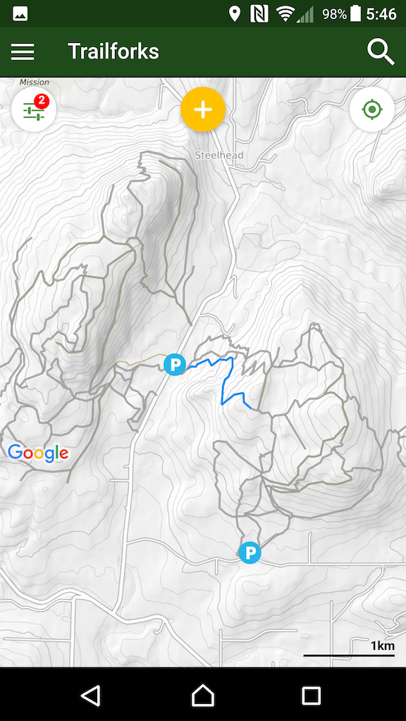
We've added the ability to filter the trails shown on the map using a new UI in the map settings panel. Trails matching the selected filters will be shown as normal, all other trails will be greyed out. This is especially useful for adaptive mountain bikers or eBike owners to see what trails they can or are allowed to ride on.

Trails can also be tagged as "wet weather friendly" to better educate riders which trails are suitable to be ridden in wet conditions.

The map settings panel is now paged, to accommodate these new map filters. Swipe left/right to switch panels. The map settings button will show a small red number indicating how many filters are enabled.

Many other sections of the app have more filtering as well, for example the trails wishlist can now be filtered to only show trails in a specific region.

map trail filters
filtered trails on map


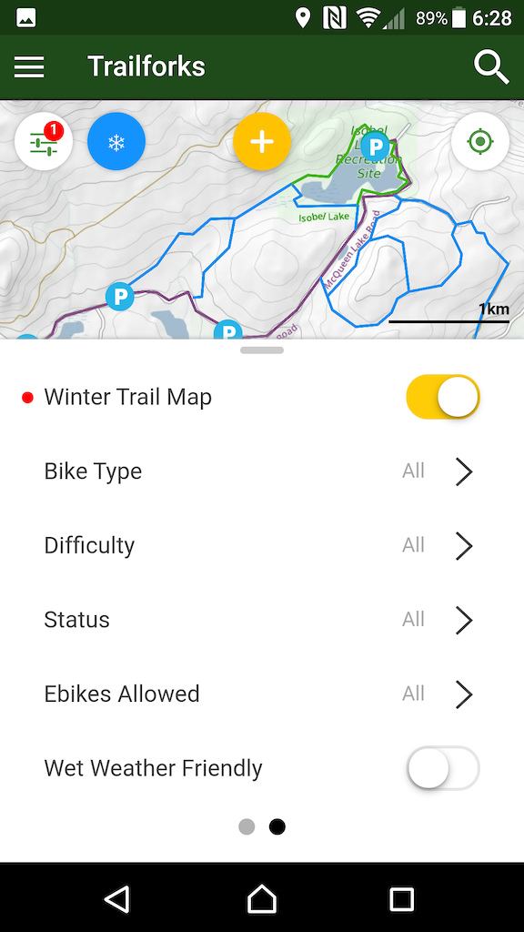
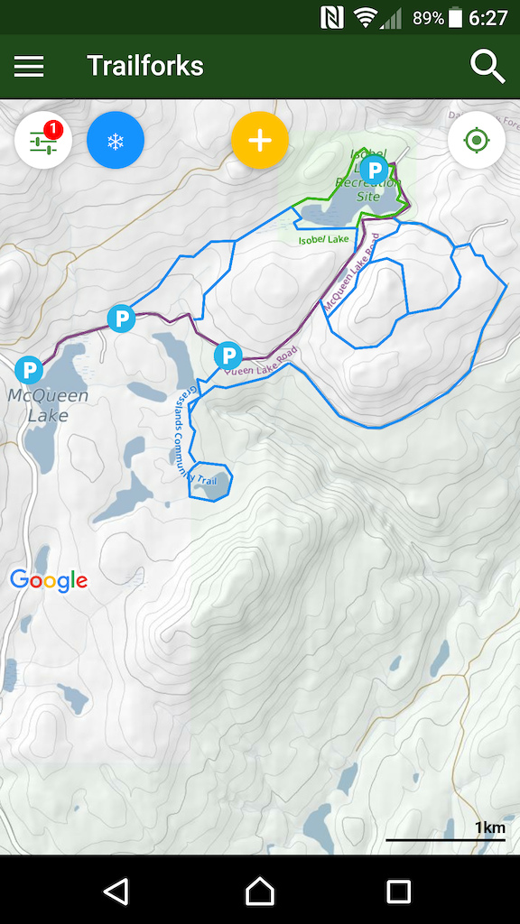
Winter Trail Map
Many riding areas around the world have separate trail networks in the winter, these winter trails often only exist in the winter and overlap summer trails. So a separate winter only map is needed.

The Trailforks website has been mapping winter trails for over a year now. So now you can toggle the app to show the winter trail map, to view these winter trail networks.

winter trail map
winter trail network


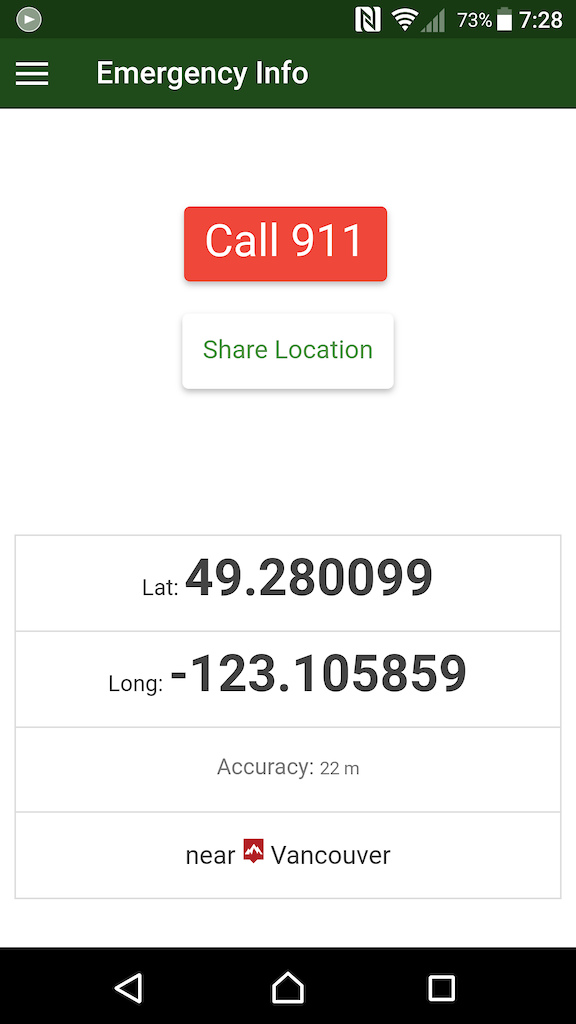
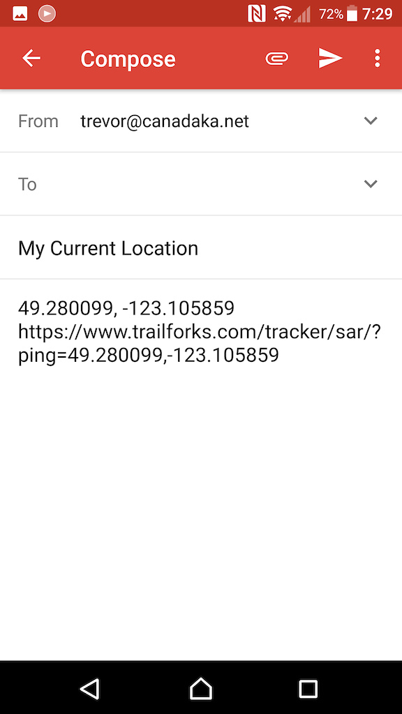
Share Location Link
The emergency page now has an additional button, which will share a message with the app of your choosing; for example, a TXT message. This message will include a link to a map showing your current location. You can use this to aid search & rescue or simply to let a friend know where you are on the trails.

share location button
share location text


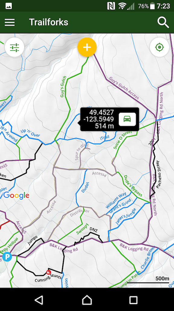
Map Longpress Elevation
map longpress elevation
A small handy new feature, when you longpress on the map, a small bubble pops up like before with your lat/long. But now the elevation of that point is also included.

This feature only works if you have a data connection.


Other Changes

There are hundreds of other small refinements and fixes that we continue to make based on user feedback and our own usage. Here are a few.

- Users karma regions sycned in background
- Trail & region content counters synced in background
- Reports and photo uploads now have a background task
- When trail is selected on report form, the most recent report for that trail is shown at bottom for reference
- Clicking a report or event from a list and going back, will return you to that scroll spot on the list
- Region filter on routes page
- Fix iOS users reporting invisible text in report description field
- Fix photos are not rotated when taken vertically
- Improved legend page layout
- Improve list scroll speed
- iOS users can now copy and paste
- iOS users can choose Waze as directions app
- better handling of opening driving directions app
- More directory listing types shown on map, tour guides, shuttle companies,
- Allow bike park regions to have a custom emergency contact number
- Quick filter list of your faved regions
- List your faved regions in account page
- wishlist & faved buttons on regions
- 5-star rating for routes
- wishlist & ridden buttons on routes
- directions link on skillpark POI
- change trail & route start & end markers to be different shape for color blind users


If you’re enjoying the app, please take the time to leave us a review, it really helps us out!


MENTIONS: @trailforks
Follow Trailforks on Facebook & Instagram

Author Info:
canadaka avatar

Member since Jun 8, 2010
29 articles

118 Comments
  • 112 0
 Just need a brewery overlay on the map and it's dialed!

Seriously, one of the best and most helpful apps out there. Let's be honest, it's not Boost, fat tires, oval rings, or carbon wheels that get people out riding; it's an easy way to see and get to the trails they want to ride. This app is the ideal tool for that, and now it's even better.
  • 17 4
 Umm.. You do realize that if you zoom in on the map it shows you the location of things in town with symbols, right?
That includes Pubs with a beer mug symbol. (So the feature you asked for already exists!)

Other things it shows you is Parking Lots, Bike Shops & Hospitals... All the things a growing mountain biker needs basically.
  • 4 0
 Agree, this is the thing that actually makes a difference to your riding pleasure - not some new wheel that is 13.8% stiffer than your old one!
  • 2 1
 @HpSauce: yeah but a giant beer icon over each brewery would be better.
  • 1 0
 In Asheville, you wouldn't see anything on your map except a houndstooth overlay of beer mugs. Crap, weve got too many breweries. Hah
  • 1 0
 @bizutch: 1st world problems!
  • 1 0
 @HpSauce: Nah, it's actually nuts here. We currently own the title Beer City USA and it's gotten out of hand.

Out of hand to the point where there is a train caboose down the road from me that is a "brewery". We quite literally have almost triple digit "breweries" along with home base for several national ones.
Oscar Blues, Sierra Nevada & New Belgium. Those big 3 will eventually wipe all the mid size ones, but right now we are swimming in them. Wink
  • 25 0
 Trailforks has really expanded my riding. It has made researching new areas much easier and gotten me to ride further away from my local spots. Their road trip planner is cool too. It highlights your driving route and emphasizes popular riding spots on the way. I have even found a few gems in my area I had never ridden. The trail status feature is awesome as well. No more driving to a trail-head only to find it is too wet and having to turn around. I love scouting out a trail's photos and videos if I'm new to an area. Pinkbike was fun before, but since Trailforks has been added, I will keep coming back for life.
  • 12 1
 Wish there was an offline base map we could download for an area we are going to ride. Most places don't have internet connectivity, and having a saved map would make the trails more navigable.
  • 20 1
 Normally if you zoom/pan around the area where you are going, the caching works fairly well.
At the same time, we do have on the list to integrate full offline tiles.
  • 4 1
 Just load it before hand and keep the app running and your phone on. The basemap will be stored dynamically
  • 3 1
 That's exactly what TF does (browsing trails and locate you without Internet connectivity).

That being said you might need to load the area you are interested with an Internet connection first if you want the background to be cached (i.e. will be shown offline).
  • 6 1
 You can already do this via Downloaded Regions? I have pre-downloaded all of BC, Washington and Alberta for example. Doesn't that include the base map and all trail detail?
  • 3 0
 @radek: This would be great. IMO offline terrain and road maps would be extremely helpful thing in trailforks. Somehow caching didn't work that good (or at all) for me last year, and had bit of problem to find a way in Squamish. And yeah, I viewed the whole area before, so it probably should be cached, but could see only lowest resolution tile, that didn't even had all roads needed. But on my friend's smartphone it worked well, so we were good. And most important - thanks for the Trailforks guys - it's a game changer :]
  • 1 0
 @radek: On my Andriod phone, caching doesn't work at all. Meaning, topo backgrounds that were once loaded with internet, disappear each time i turn on the app without data. This app is a data muncher and really inconvenient in areas without data. MTB project has good caching. I guess i'll use that in the meantime.
  • 1 0
 @slayerdegnar: The background map tile caching is the same in both apps, it's just using the Google Maps SDK built in tile caching. The Google road map will cache the best compared to the topo or satellite.
  • 8 0
 This is awesome. Trailforks just keeps getting better. I log all my fitness/stats and stuff on Strava but their map function is literally worthless. It's just a blank grey screen with random segments on it. And if you move it even slightly, everything vanishes or changes. So I am always toggling back and fourth between Strava to see how long/far I've ridden and Trailforks to determine where I'm going. Great that segments can pop up on Trailforks now.
  • 8 0
 Yeah, if you are competitive, the killer part of the segment integration is that you can really see where the segment starts/ends on a trailforks map so you can determine when to ride hard.
  • 2 1
 Yes, maps in Strava are next to useless if you are exploring some area or trying to even get to some segment. Glad I'm not the only one who noticed this.

I only had strava running to see the segment times, but with this new trailforks version I can use only one program (TFWink
  • 2 1
 @Archimonde: sorry meant to + you. Small buttons!
  • 15 3
 Is there a 26" version?
  • 4 2
 It's 26+. You can use 26, but it looks funny when installed. Lots of clearance though...
  • 9 0
 Love it - thanks for the excellent work!
  • 8 0
 Trailforks, thanks for being an 11/10
  • 8 0
 That photo zoom when i scroll down had me fucked up
  • 2 0
 Me too I spent like 15 seconds scrolling up and down
  • 1 2
 welcome to the internet. first time?
  • 2 0
 No, I've been welcomed to lots of things before. /tedstryker
  • 4 0
 You made the go-to mountain biking app into The Mountain Biking GO-TO App. You folks keep coming up with improvements that just keeps both the flow and the gnar at my gloved fingertips. Thanks!
  • 3 0
 Excellent work on this update!
Love the new work for both submitting trail reports (it was a PITA to wait for strava sync), and also the browsing trail reports view. Excellent for a quick scan to see whats running well or not.
  • 7 1
 Still have never used trail forks. Is it really all that great? maybe i don't travel enough.
  • 11 2
 Yes it really is that great Salute
  • 1 0
 Pretty sure my local trails only have been synced into Strava Frown
  • 13 0
 That is an awesome opportunity for you then! You can add trails with your Strava GPS.

www.trailforks.com/contribute/trail
  • 2 1
 @saskparkrider: fyi, no illegal trails on t.forks
  • 2 0
 Downloaded trailforks last week and absolutely loving it! Ridden 3 new locations I never would have otherwise. Makes it so easy to find new trails, expand your boundaries and improve your riding. Best contribution to mountain biking since the invention of front suspension!
  • 7 0
 Awesome work. Thank you.
  • 5 0
 Why in my day we used paper maps and you had to find your own trail. Getting lost was half the fun. You damn kids.
  • 17 2
 In your day half your family died of dysentery on the way to Oregon. Get with the times gramps.
  • 8 0
 Paper maps is what the rescuers use to find and rescue those who run out of battery on their phone.
  • 7 0
 The mistake is thinking you have to choose one or the other. Choose the right tool for the job. You can take both, or take just one, depending on the situation. Yes, paper maps are a very useful tool and I use them all the time (I love maps!), but (and maybe I'm biased as one of the developers of the Trailforks app) it also is a very useful tool, and I think you're missing out by not adding it to your arsenal.
  • 1 2
 @employee7: comment of the year.
  • 4 0
 @bentomas: Trailforks is indeed a very useful tool, you have done a great job developing the app, well done!
  • 3 1
 I would REALLY like a "Route builder" feature, in which you can connect trails and see them clearly while riding. (Maybe have a voice that tells you left, right, straight on forks so you don't have to stop to use the phone.

Perhaps you guys could opensource this project, lot's of riders are software engineers and we will like to make our contribution to this amazing tool.
  • 4 0
 There is a "Route Builder" feature. You can create your own routes, load them up on the phone, and see a big yellow line highlighting your route. Building the route can be down with a drag and drop, or by simply selecting each trail segment until you have a connected list.

www.trailforks.com/ridelog/planner

Or are you talking about something else?
  • 2 0
 Yeah, we do have that feature as todd said, just not in the app. you have to go to the website to do it!
  • 3 0
 @bentomas: This is awesome! Will try asap
  • 1 0
 @todd: Thats the one, but It'll be nice to see it implemented on phones. Something really easy to use like:

Open the map, press the route builder button and start tapping on the trails to connect them. After that, save the route and highlight it in the map just like the web counter part.
  • 1 0
 @bentomas: BTW the app it's amazing, it totally transform the way I ride and go for new adventures. Keep up the good job guys, you're killing it!
  • 1 0
 Great update, love the direction this is going! Out of curiosity, is there a way to make the emails I get after Strava syncs with Trailforks about "adding a ride report" to open the trailforks app when I click the link, instead of opening a browser and asking I login? I'm on Android 6.0.1.
  • 1 0
 Maybe someday, but that email link opens to a special form that lists all the trails you rode. Where as the report form in the app only allows 1 trail at a time. So it's a time saving feature the "ridelog reports", but a complex form that doesn't exist in the app at this time.
  • 3 0
 Excellent! Finally tracking in Trailforks! You guys are killing it with the new features too- Love the events section! Can't wait to track my ride tonight
  • 6 0
 best. app. ever.
  • 5 0
 Thanks ... this is excellent! Trailforks is invaluable.
  • 2 0
 ummm @radek you seem to be answering questions, so just going to suggest you immediately get the "share location" button away from the "call 911" button. maybe a standard share icon in the upper right?
  • 2 0
 Perhaps move it farther away, or your share icon is also a great suggestion.
  • 4 0
 I don't know which is more bat $#!t insane a) How awesome this app is or b)that it's completely free.

THIS APP RULES!
  • 2 0
 This is freakin awesome @radek you guys are killing it on this and it'll just be a matter of time before folk get on this. I'm going to get a GPS here in a bit to take advantage of everything you all have created.
  • 1 0
 Trevor and the pinkbike / Trailforks team, well done! Couple of quick observations. The photo uploading works better now, but it is still a little confusing as there is a submit button still visible after selecting an image and telling it to upload. It may give users mixed messages.

Also, users should know that it's easier if you first click a trail in the app to highlight and select it, prior to hitting the contribute app / upload photo. This way you don't have to enter in the trail name using the search function.

49.280099, -123.105859 Trevor, you work in Shanghai Alley? Behind the green or red dumpster buddy?
  • 2 0
 We're going to work on the photo upload flow even more for the next update, we'll take that suggestion into consideration! But that submit button after uploading is definitely on my list.
  • 2 0
 Yup! Well live in the apartment tower right beside the alley Wink
The photo page upload button state was an overlook on our part, the report submit button indicates its uploading.
  • 1 0
 Auto trail selection based on GPS tagged photos would also be a really efficient and slick way for users to upload photos from their phones. Might not sure in dense trail networks, but most of the time I bet it would! Note how Strava will even note where the photo (roughly) was taken at, within the ride. Pretty cool way to begin to create some real useful content image and navigation wise.

Cheers!
  • 1 0
 Seeing the send location feature is awesome. I just got a Garmin Vivoactive and have been trying to find a garmin connect iq app that would send my location and a pre programmed message to a pre programmed phone by text in an emergency. There are plenty that show your location, and one or two that can send canned texts, but none that combine these services. Any chance you guys could somehow bundle your emergency text feature into a connect iq app?! Ive no idea how difficult that is so sorry if it's a ridiculous request!
  • 1 0
 i can't understand why there is the layer with opencycles map or similar map with trail.....on Trailfork there aren't a lots of trail and if you ride or hike on a unknow land it's impossible to use only Trailforks because the maps are not completes! pleaser add multilayers with other topo maps!
  • 3 0
 Hopefully the trail forks comment section will be as enlightening as the pb article comments are.
  • 2 0
 Now I just need a way to hide a user's rides, but not anything else, from my dash... cause I'm tired of @bigworm520 poluting my dashboard with his morning commute.
  • 2 0
 You can do that in the PB dashboardsettings. The gear icon on the dashboard page.
  • 1 0
 @canadaka: Thanks, though that is a global setting. I actually enjoyed, for instance, seeing when Ryan Leech put up a ride, it's just I don't need to see my buddies morning ride on the road every day.
  • 1 0
 Ha yeh its a problem on strava too. You can label a ride a commute but there is virtually no point as there is no way to filter commutes at all. So annoying. I think there is a chrome plugin for it, but that's only for the end user to block seeing them, I would still like to record and label my commutes but not be that guy ha, at the moment I cant...
  • 3 0
 Massive thanks to the developers and improvers at TF. You guys rock, and we appreciate it!
  • 2 0
 Love you guys for bringing this app to life. And, you're not sitting still, always looking to improve. Love it. Thank you so much.
  • 3 0
 I used the internal ride tracker this morning and it was flawless. Thanks for the update!
  • 1 0
 Awesome! Thanks for the info.
  • 1 0
 Hi Guys, Still waiting for the app to be compatible with Fenix 5x. Went to Sedona and you have no idea how bad I missed it. Best regards,
  • 2 0
 excellent to see a couple of things I've thought about make it into the app!
  • 3 0
 Nice, can't wait to test it in BC during my next vacation!
  • 3 1
 You guys are killing it. Trailforks is really, really good - the new features are fantastic!
  • 1 0
 Great work guys!

Comment of the article!

" Being super nerds we have taken extreme measures to make sure that Trailforks tracking is power efficient."
  • 1 0
 Strava segments don't show for me - have synced account and toggled "strava segments" filter on the map and fiddled with zoom, but none are showing. What am I doing wrong?
  • 1 0
 You may have to zoom in farther? Maybe try looking at a very popular area.
What is the region you are looking at?
  • 1 0
 Without wifi or cellular connection the "share location" will not work is that correct?
  • 3 0
 NO, but you can send as a TXT, so you might not have data but might still have phone signal for a TXT.
  • 1 1
 @canadaka: Isn't that a SMS? Wink
  • 1 0
 I tried to use it in Sedona last week, and it kept crashing... hope it is more stable
  • 4 0
 We have fixed stability that some OS versions had. I'll message you to verify and make sure your issue is corrected.
  • 2 0
 Hell yes, this app is the shit
  • 2 0
 oh man. that's a SWEET upgrade!!!
  • 2 0
 Killed it, no need to have strava open anymore.
  • 1 0
 how about a way to connect straight to Garmin connect to bypass strava completely.
  • 5 0
 Garmin charges $5,000 for access to their API, insanity! They should want people using it to sell more devices.
  • 1 0
 @canadaka: They'll come around, but expect them to hold out as long as possible to leverage their platform
  • 1 0
 @canadaka: Agreed. I'd buy a garmin if i could interface directly to TF....
  • 1 1
 @canadaka: $5k doesnt seem that much when you think of that much more people using the app. think about the "old timers" crushing not so known back country trails that dont use strava. trailforks is THE app for locating and navigating on remote trails.
  • 3 0
 @eightysixways: it is when Trailforks is free and we help sell Garmin units with our custom trail basemaps. Some users connect there Garmin to Strava then to TF. Hopefully something can be worked out in future, but you can now start tracking in the TF app aswell, removing any middlemen. Has to be enabled in app settings atm, but we'll enable it on by default soon.
  • 2 0
 What a comprehensive update. Great work guys!
  • 1 0
 It's easy to spot the Strava segments. Just look where all the corners have been trashed by cutting them
  • 1 0
 thanks so much for this, trailforks is one of the best apps ever and just keeps getting better!
  • 2 0
 Holy s**t
  • 1 3
 Are you guys still using Cordova/Phonegap? I know it makes ios/android faster to develop but you are killing the gps tracking capability, one of the best features from the devices, in exchange of nothing really.
  • 2 0
 How are we killing it? We just announced it is available
  • 1 1
 @radek: curious also if you are using a hybrid mobile or are these native apps?
  • 2 0
 @mrniceguy42: its a hybrid app.
  • 1 0
 Many of the features of the app are in native code via plugins. Such as the map and the background gps tracking.
  • 1 0
 @radek: yeah I was talking about the hybrid app instead of native, I know you just announced it but as a native app it would work even better, my two cents.
  • 1 0
 @baldemarch: the parts that require performance and efficiency are native and the parts that do basic ui and logic are not for consistency and cleaner development. You get the best of both worlds.
  • 1 0
 @baldemarch: except then its 2 apps to maintain, a java app and a objective C/swift app
  • 2 0
 Awesome work guys!
  • 2 0
 Neat!
  • 1 2
 Have taken a look here a couple of times. According to Trailforks, Europe is a wasteland. May take a look to see if Germany is listed as native/tribal land ownership Smile
  • 2 0
 While i'm sure there is a long ways to go in mapping large parts of europe, but there is over 10,000 trails added in europe.
www.trailforks.com/regions/directory/?r=europe
  • 3 4
 Trailforks is a great app but is a mistake to blend it with Strava. "competitive Strava users" are what we need less of...
  • 1 1
 Can't get it to work with Strava, no syncing.
  • 3 0
 I see your rides being synced. www.trailforks.com/profile/Kootbiker/ridelog
  • 1 0
 @canadaka: I got it to work, thanks
  • 1 1
 more ride less apps
  • 1 0
 what if you don't know where the trails are and you are in town for one day?
Below threshold threads are hidden


Copyright © 2000 - 2024. Pinkbike.com. All rights reserved.
dv65 0.052516
Mobile Version of Website