Trailforks Introduces New 'Traildar' Feature

Mar 19, 2024 at 12:36
by Holly Duncan  
photo

Ever wish you could get a heads-up before that key intersection, that prime photo spot, or that beverage you stashed trailside without stopping to check the map?

Picture this: you're cruising down your local trail, fully immersed in the flow of the ride. Suddenly, you hear a buzz, alerting you that you're closing in on that epic viewpoint you marked earlier. No need to slow down or stop to check the map - Traildar keeps you in the know without interrupting your ride.

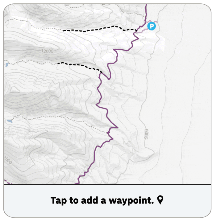
You're not limited to just one waypoint and they are synced to your online profile between devices. Add as many as you like along your ride or hike, whether it's a trail entrance, a buzz for that lookout spot (bonus points if you're on a date), or a ding to speed check as you head toward that intimidating feature. Think of Traildar as your personal guide, giving you the freedom to explore more while staying connected to the trail... and your handlebars.

photo

As you continue along the trail, Traildar keeps you engaged with its unique alerts that adapt to your chosen activity, whether that's downhill skiing, mountain biking or dirt biking - you'll have a different alert distance. Whether you're flying down a descent or climbing up a technical incline, Traildar knows just when to give you a heads-up about the next waypoint. With haptic feedback, visual cues, or sound notifications, you've got nothing to lose.

Traildar gives you 3 different alerts as you get closer, each increasing in intensity of the audio and haptic feedback. From subtle audio and haptic feedback when you are near a waypoint, to more noticeable feedback as you get closer and intense feedback when you are closest. The Traildar points are synced to your online profile between devices, and you can create waypoints on the website and have it sync to your app.

photo

But perhaps the best part of Traildar is its versatility. Whether you're a mountain biker, trail runner, hiker, or skier, Traildar adapts to your needs. So go ahead, set those waypoints, let it guide you on your next adventure and let us know how your experience goes!

*It's worth highlighting that this is only the first version, with future updates coming later this year. Additionally, Traildar sends notifications, meaning if you use a device capable of receiving phone notifications, you'll receive Traildar alerts there.

DOWNLOAD THE TRAILFORKS APP

Author Info:
thespeedykiwi avatar

Member since Sep 4, 2018
9 articles
Must Read This Week
Sign Up for the Pinkbike Newsletter - All the Biggest, Most Interesting Stories in your Inbox
PB Newsletter Signup

114 Comments
  • 181 4
 Jeez I never would have seen this epic view if I wasn't looking down at my computer to tell me there is a good view.
  • 54 11
 How about a troll-dar so we know when you're going to post
  • 8 4
 Man, I knew you were in Utah (or somewhere similar). Of course you aren't going to miss an epic view when you're not surrounded by dense forest.
  • 7 1
 @philneuve: just between business hours Wink
  • 1 1
 @jayacheess: You've clearly never been to Utah (or never outside of Moab)
  • 69 2
 I’d like to see a jumpDAR feature, telling you if the jump up ahead is a simple booter or a gap jump with a deep pit full of sharp sticks..
  • 11 2
 Couldn't you just use this to mark the jumps yourself?
  • 25 0
 Yes!! And call it out rally car style.
  • 7 1
 @ryan77777: I need this.
  • 18 1
 @ryan77777: THIS^^^^
Forty, left five minus over crest opens over 40, tightens four plus, into triple caution right four over big jump off camber.!!!
  • 10 1
 Yes and it also should tell you if you have not enough speed like: "3 cranks more, jump ahead"
  • 2 0
 something wrong with your eyeballs?
  • 2 1
 @justinfoil: hmm I generally can't see what is behind a take off.
  • 1 2
 @fabwizard: can't see it ever? you have some kind of "landing-blindness"? Like face-blindness, you just instantly forget everything past the take-off after you look away from scoping it out? And you think an app will help with that?
  • 2 0
 Haha that'll never happen. Way too much liability. Plus, pre-ride, re-ride, free-ride mantra works. Can't/shouldn't skip it.
  • 31 0
 “Shrine Nearby”
  • 2 0
 Underrated comment Smile
  • 2 0
 @BroDozer69 this, but unironically
  • 17 3
 NOW! If we can do that, can we get a audio alert for a turn? Say, we've loaded a route and it beeps once for left and twice for right as we approach the intersection. Been dying for this to become a thing for years.
  • 3 1
 Yes. Turn by Turn directions via Trailforks has been the goal for me for years. Even better, it shouts LEFT and RIGHT.
  • 28 3
 This is coming later in future updates to Traildar feature. We have the data already synced to the app to do it. But for a lot of mountain bikers, we often don't follow a specific route when going for a ride. It's often an ad-hoc communal process of deciding a route to ride while on the go. But there may be a few specific spots or intersections one wants to remember, without constantly checking their phone.
  • 9 0
 @canadaka: That's great to hear. I've been on trails that are marked horribly (OK, not marked at all) and have had to be constantly stopping and checking my phone to find where we went off trail. It would be great to have this available.
  • 16 2
 Pair it with e-steering and you don’t even have to ride!
  • 7 0
 @canadaka: Nice. Yes anything that allows me to not pull my phone out of my pocket at every intersection would be ideal.
  • 6 1
 If you use a Garmin cycling computer and upload your routes from Trailforks you can have it so it does notify you of things like off course, upcoming turn, etc.
  • 3 0
 @canadaka: I'm curious if that statement about how mountain bikers ride is validated with user research? It rings true to my personal experience in BC, but I'm not sure if that's applicable to a wider context (whether that's geographic or social). Just anecdotally I've ridden with some less experienced groups here that pre-plan rides in a lot of detail, and wouldn't be at all surprised if there are very different norms internationally.
  • 3 1
 @danprisk: For sure different areas or segments of the sport are more likely to plan and follow a route. This is why Traildar will automatically do Traildar points on route turn-directions in the future. We are already generating the turn directions and its synced to the app for future use!
  • 2 1
 We were just talking about this yesterday but need ‘roll’ and ‘huck’ (and even more important would be ‘check’, but spelled ‘HUCK’ because it’s bigger than I can safely huck) as I roll up to the 100th ledge in Moab.
  • 3 0
 This reminds me of an old Daewoo car ad, where a blind man was driving and asked his dog to bark just like that. Then the dog barked 3 times.
  • 3 1
 @colemanb: would be better if it used waterfowl noises and only worked for riders using a bluetooth speaker. Quacks left, honks right, sustained whistles for strait, and a little jon "yeah!" for jumps.
  • 1 0
 @canadaka: What about a function to build a route like Strava has? I use Trailforks heavily while traveling and usually just load a route from someone else's ride and follow it because I have no clue where I am.
  • 1 0
 @pizzaiolo: You can create a route on the TF website, which then syncs to your app: www.trailforks.com/ridelog/planner
  • 1 0
 Mapmyride already does that. "Turn left on (trail name) in 300 feet" in your earbuds
  • 1 0
 @azastrowBBLV: I only see road and running rides on that, are there actual mountain bike trails and rides on there?
  • 1 0
 @colemanb: Its actually Ride with GPS with a paid membership. I knew MMR didnt sound right as I typed it. Sorry for the confusion
  • 15 0
 Rally car pacenotes would be amazing
  • 5 0
 Would be amazing to get something like this:
youtu.be/D9-voINFkCg?si=Po6pKaSs2hzZ3284
  • 11 0
 Samir, you are breaking the bike.
  • 10 0
 My Garmin GPS unit has a sharp turn warning for use on the road, the problem with it was that it'd distract me and I'd take my eyes off the road rather than slowing down before the turn. I ended up turning off the warning as I felt less safe with it on...
  • 2 0
 That's because it beeps and you need to look down at the device to see what the fuss is about. Connect a Shokz headphone and it potentially becomes very useful.
  • 5 0
 Actually seems like a good idea in my opinion. I do a fair bit of exploring this time of year and it kinda ruins my flow when I keep pulling out my phone to double check that I haven't missed any turnoffs. For those Squamish locals, maybe we will finally get to ride Valleycliffe for more than 10sec before getting lost... not keeping my hopes up though
  • 1 0
 If exploring, why do you need to keep checking if you've missed something? Just keep exploring.

The beeping & buzzing won't ruin your flow? It'll probably annoy the flow out of people around you if you keep it audible. And you may find you have to keep it audible since it's often tough to notice a phone buzzing in your pocket or especially in your bag, and double especially when you're shredding and flowing.
  • 3 0
 I always kick myself whenever I see the rad stuff Trailforks is doing. I prototyped something similar for a school project in 2014 but never bothered to pursue it. It would have used a AR piece inside your goggles more so than looking at the phone. dribbble.com/shots/1383757-Animated-Map
  • 2 1
 The Trailforks app has had location sharing for awhile now, we just have never announced it. It's not real-time like that, too much battery usage. But it does show the persons avatar you are following.
  • 1 0
 @canadaka: Hire that man!
  • 2 0
 Can the app for Garmin Fenix watches please be improved?
The interface is clunky and difficult to use - it would be so much more useful to see where I need to go with a glance at my watch rather than having to look at my phone.
  • 1 0
 You can now get Trailforks routes and trails to your Garmin devices a different method, by connecting your Garmin account to Trailforks. Then there is a "Send to Garmin" button when on route & trail save popup screens.
  • 5 0
 Rolls off the toung - dar
  • 6 0
 Throwing some shadar.
  • 3 0
 This is a cool idea. I appreciate the trailforks dev team and how they add these very specific little features fairly frequently
  • 1 0
 Hmm... interesting feature. But curious about a few thigns.

Customizable sounds for different things? Having different sounds/sensations for a "notable feature that I need to look at before I send" than for "remember to look around at the beauty you idiot" and "you took the wrong fork at the last crossing, turn around" could be nice.

On the other hand... do people really think they'd be able to feel haptics while riding a trail? Audio would work better... but I don't know about you, I feel even having my phone in my pocket, it would be super, super muffled and hard to hear when actually on the trail.
  • 2 0
 If it syncs to a watch. I get haptic notifications on my garmin watch for text or calls & I can feel them. Pretty useful with kids or meeting up with people on the trail.
  • 5 1
 We wanted to make the UI for adding a Traildar as simple and fast as possible. But we are open to adding some more optional customization in the future after users feedback and use. The alerts can sync with a device or watch as well.
  • 1 0
 You need a reminder to look at a new feature before hucking it? Or to look up at the surrounding nature at all? An app ain't gonna help you.
  • 1 0
 @canadaka: it would be really nice if Trailforks supported Garmin’s flagship watch, the Epix Pro gen 2.
  • 5 0
 does this include pvp areas
  • 3 1
 hidden path ahead, try jumping
  • 3 0
 liar ahead
  • 1 0
 Happy to be classed as thick, but I still can't work out how to plot a ride using Trailforks...on the website or app...I just seem to get stuck. Unsure what I've done but it only seemed to allow me to select trails, but then didn't join them up, so I had an attempted plotted route with 8 trails but nothing to get me from the end of one to the start of the next. Clearly doing something wrong, but I've not tried for over 6 months as I couldn't get it to work.
That being the case, how would you place these POI items for your device to register them? Do you somehow plot your route and whilst plotting it, you add these poi items?
  • 1 0
 They are primarily used in the app, long press the map and then there is an Add Traildar icon. You can add them on the website and they will sync to your app. Right click any map and "Add Waypoint" then in the waypoint options is a "Traildar" option.
  • 1 0
 that may be an issue with how the trails have been logged on trailforks by the person uploading them in the first instance. if they don't connect (digitally speaking) close enough on the map then, yes they are visible to know there's trails there but the routing function will not snap the junction of two different trails together properly/efficently to create a route- as digitially speaking the function treats the 2 trails as unconnectable.

ideally, all the official roads/bridle ways etc should already be on the map. Then we as users upload the trail from a gpx file or manually add it point by point. if done right each added trail should snap to the existing roads/bridleways mtb trails already there. the system allows for a small degree of sloppiness, but if the trail is very poorly placed in its start or end point then the game of route plotting is bust. there should be a moderator for every area but as to their fastidiousness in making sure its all tickety boo will differ for each person moderating it.
  • 1 0
 Is there some way this app can emit and slather rasberry/huckleberry perfume all over the rider while navigating? The smell is so delightful when visiting the mountains. I enjoy huckleberry body balm, rasberry shampoo, and a fine romp through yonder woods amongst the grizzlies. Occasionally I will stop for lunch and munch salmon caviar whilst checking my battery status and updated trail map. I do get lost in the kom data and specifics about go left/ or go right, but picture taking rapture and mountain revelry is my feed focus these days.
  • 2 1
 "Ever wish you could get a heads-up before that key intersection, that prime photo spot, or that beverage you stashed trailside without stopping to check the map?"

No. The last thing I want when I'm out deep in the countryside surrounded by beautiful views and awesome trails is some electronic device f*cking bleating at me
  • 2 2
 Need to be able to tag friends with one of these so they get notified... you know.. that corner- you know the one with the tree; cheeky line you rode once and they didn't see; the spot where they fell off last time- endless possibilities for shenanigans!
  • 4 0
 TrailDar - for Trail Derps.
  • 2 0
 Awesome! Now we'll know when the Grammers are approaching the chill spots to take self-aggrandizing selfies because their phones will be beeping at them as they approach!
  • 1 0
 Biggest negative I see is it requires a cell signal - I ride almost exclusively where there is no cell. I'd like to see/hear notifications in the app when I near a marked point on my route. Otherwise, it's useless.
  • 3 0
 It does not require a cell signal, just GPS signal.
  • 1 0
 A beerdar would be more useful. Think of how many times you've been riding in a new location and wondered where the best post mountain bike tap room is. Google maps does not know!
  • 1 0
 C'mon Trailforks dev, how about a really cool/useful feature like being able to see my friends' live GPS locations on the Trailforks map.
  • 1 0
 It already exists, record your ride and there is a share button. Send the link to a friend and when they open, if on a phone, will open in their app showing your location on their app.
  • 3 1
 Must be some stealth technology being deployed. Traildar failed to detect how bad of a portmanteau it is.
  • 2 1
 Maybe it's already there, but is there a "Treedar" feature that'll let me know I'm about to plow into a downed tree around the corner.
  • 1 0
 Tree-mendous idea - don't forget to submit a trail report of the downed tree so fellow riders (and trail crew) are made aware Big Grin
  • 2 0
 @thespeedykiwi: Thanks. Always do...usually with a pic or two. Two pics is usually if I clear it myself so they know not to send the guy with a chainsaw on a wild goose chase.
  • 2 0
 Dang, now that's kinda cool. I keep my phone in my pocket, so that could actually work.
  • 1 0
 It would be more helpful if they put back the dot on the trail info elevation map while recording. The dot was helpful to know how much a trail you’ve completed.
  • 2 0
 we all know this is really to mark the rock//bush you can hide behind for your mid-ride whizz
  • 1 1
 Did somebody accidently click the post button on this 12 days early? Dear Trailforks: stop adding annoying features to try and justify price increases. We need our map to be just a map.
  • 1 0
 Then just use OpenStreetMap, OpenCycleMap for more bike/trail specific rendering, or OSMAnd for great integration of all OSM features, plus more, on Android devices.

Doesn't have the "difficulty" ratings and "trail areas" that are the really useful parts of Trailforks, but if you really want just a map, OSM is the best choice.
  • 2 1
 Still crazy that there's no Apple Watch version yet. Would really prefer to leave the phone at home sometimes. What gives?! @canadaka @thespeedykiwi
  • 2 0
 Trust me, we've been hearing the growing requests! So the team is working on it - 'watch' this space..
  • 1 0
 Can we use this feature to share tool stash locations between different users?
  • 1 0
 We need to improve the share function in the app. You can share the URL and it can open in the app.
But you can share the waypoint web URL, and there is a "copy to my waypoints" button on the web.
  • 1 0
 I’d like a Wi-Fi radio peer to peer / internet + gps / signal accessory rider approach alert - digital trail bell
  • 3 1
 Cool now I can keep track of good places to poop
  • 2 0
 Missed opportunity to name it “Gnardar”
  • 1 0
 Could I use this to remind me to remember my grocery bags when I arrive at the grocery store?
  • 2 0
 I guess this move is just to help justify the price increase?
  • 3 0
 Great another alert!
  • 1 0
 When is the Weedar feature rolling out?
Notifications of nearby safety meetings would be great.
  • 1 0
 That's called "your nose".
  • 2 1
 The software development Path to Success:

Step 1: add a random feature that nobody asked for
Step 2: increase price 5x
  • 1 0
 Can this interface with an Oura ring for directions?

Seriously.

Bahahahahah.
  • 1 0
 maybe? if that device can receive notifications from the phone.
  • 3 2
 Can I configure it to make fart sounds when I'm riding a segment too slow?
  • 2 1
 Is there a way of stopping people tracking you to your house?
  • 4 1
 You can setup privacy zones on the Trailforks website profile settings.
  • 1 0
 @canadaka: nice one, thanks!
  • 1 2
 Why would you need a trail mapping app to show you how to get to your house?
  • 5 0
 @VtVolk: Read it again.
  • 1 1
 Make an update so I know when a dog is sideways on the trail with hiker from out of town around a blind corner
  • 2 0
 If you know it's a blind corner, on a multi-use trail... slow the fuck down!
  • 2 3
 I'm pretty sure Trailforks just invented waypoints. An innovative feature I first encountered on *checks notes* my Garmin eTrex from the year 2004.
  • 2 1
 Trailforks already has personal waypoints. Traildar is actually tied to waypoints in the backend. The main difference is the proximity alerts and their temporary nature. Can automatically disappear after use.
  • 4 3
 No. Just no. I go to viewpoints to avoid looking at screens.
  • 1 0
 wow, is it April 1st already?
  • 1 0
 not yet Wink
  • 2 0
 Trailtard
  • 1 0
 DAR DAR JUICE
  • 1 2
 Holy shit.


Copyright © 2000 - 2024. Pinkbike.com. All rights reserved.
dv65 0.044686
Mobile Version of Website